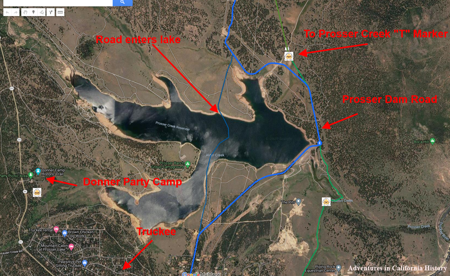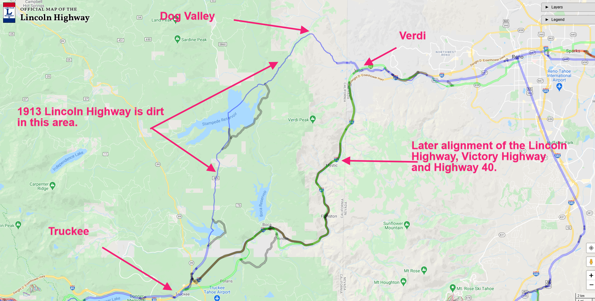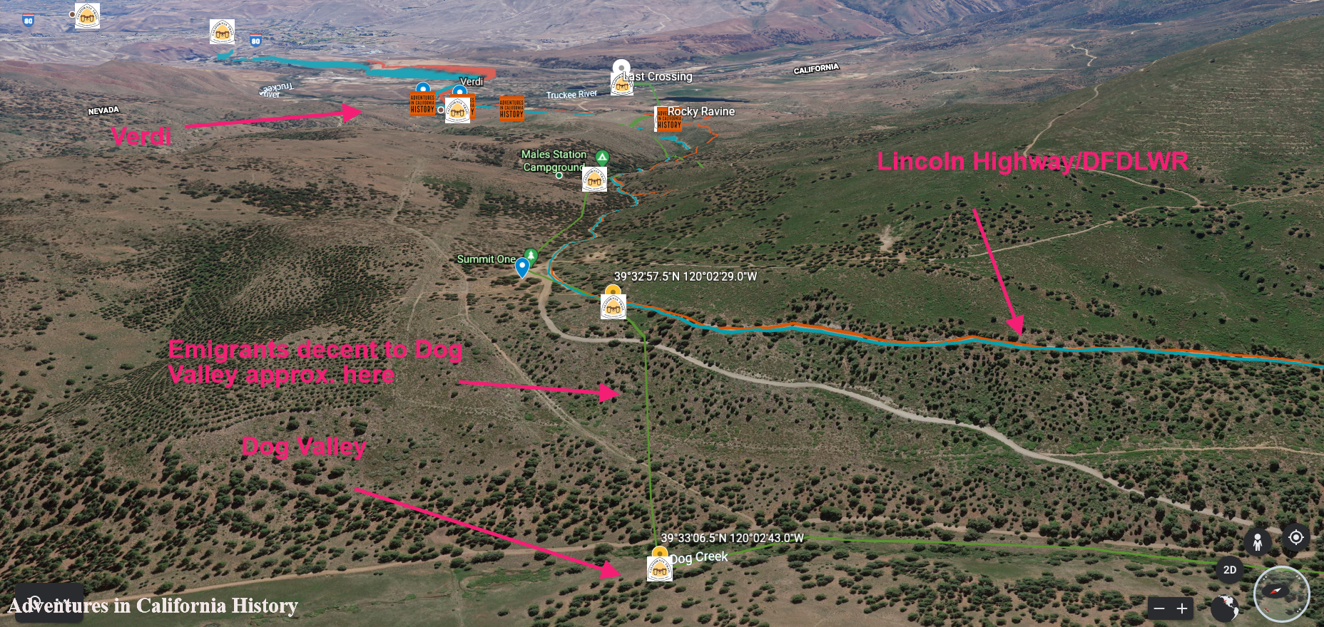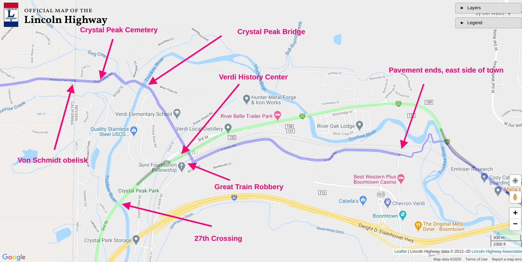
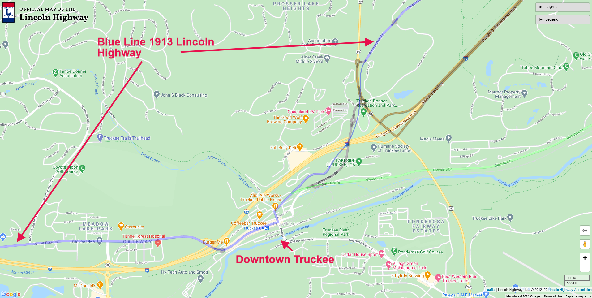
Map of Truckee showing the route of the Lincoln Highway. Click map for larger view.
The early eastbound Lincoln Highway traveler would have entered Truckee via the present-day Prosser Dam Road, which today crosses Highway 89, which has obliterated any old road traces. You can pick up the road by heading down E. Jibboom Street, which runs into Bridge Street. E. Jibboom Street was before the Lincoln Highway, a county road, and before that, the Dutch Flat Donner Lake Wagon Road (DFDLWR), built by the Central Pacific Railroad.
In the photo below, taken around the 1920s, we are looking north at Truckee and the Lincoln Highway, which is quite visible heading up the mountains. The early Lincoln Highway in this area followed the DFDLWR.

1920s view of Truckee and the Lincoln Highway.
Heading down The Lincoln Highway on East Jibboom, we come to Bridge Street and the Stone Garage, a landmark today. There is a plaque outside installed by the California Lincoln Highway Association and E Clampus Vitus, which describes this place's history.
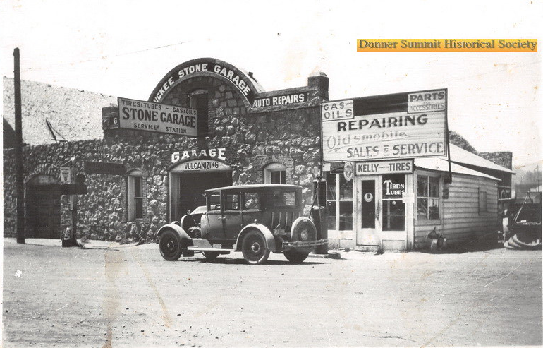
Truckee Stone Garage on Bridge and E Jibboom Streets.
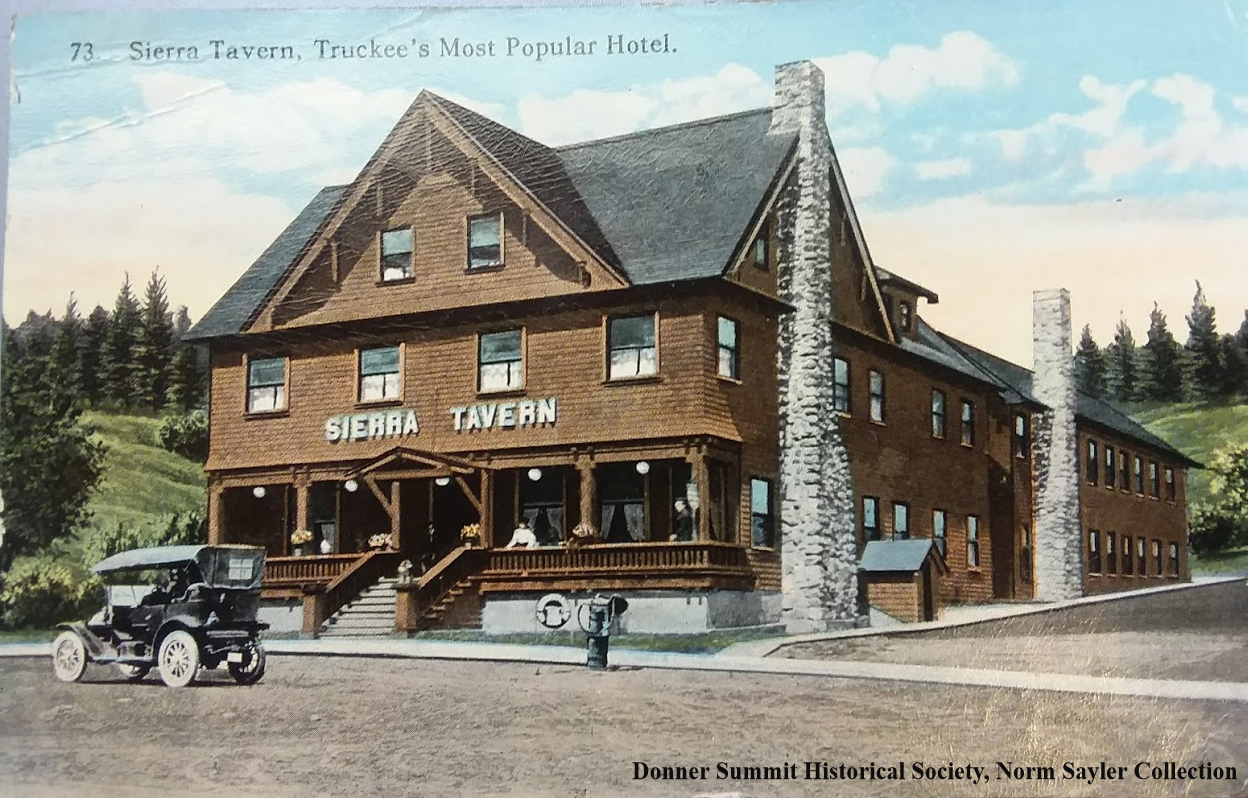
Once past the Truckee Stone Garage we turn right on Donner Pass Road and head down one block to Spring Street and the site of the Sierra Tavern, a popular stopping place along the old road. The first photo at the top of the blog shows the magnificent structure, which burned down in 1927, the year the Lincoln Highway became Highway 40.

Plaque on the wall of the Stone Garage.

Sierra Tavern in 1908 with Charles Fayette McGlashan’s home at the top left. Mc Glasahan was a prominent citizen of Truckee.
In the photo above, we can see the Sierra Tavern in 1908, five years before the Lincoln Highway. A lone automobile sits on Spring Street. The building at the top left was the home of CF McGlashan, a prominent Truckee Citizen. That building is long gone and was replaced by a Quonset hut shaped building for Truckee Veterans. To the Sierra Tavern's right, across Spring Street, we can see the Chance Saloon and OK Bar where the photo below was taken.
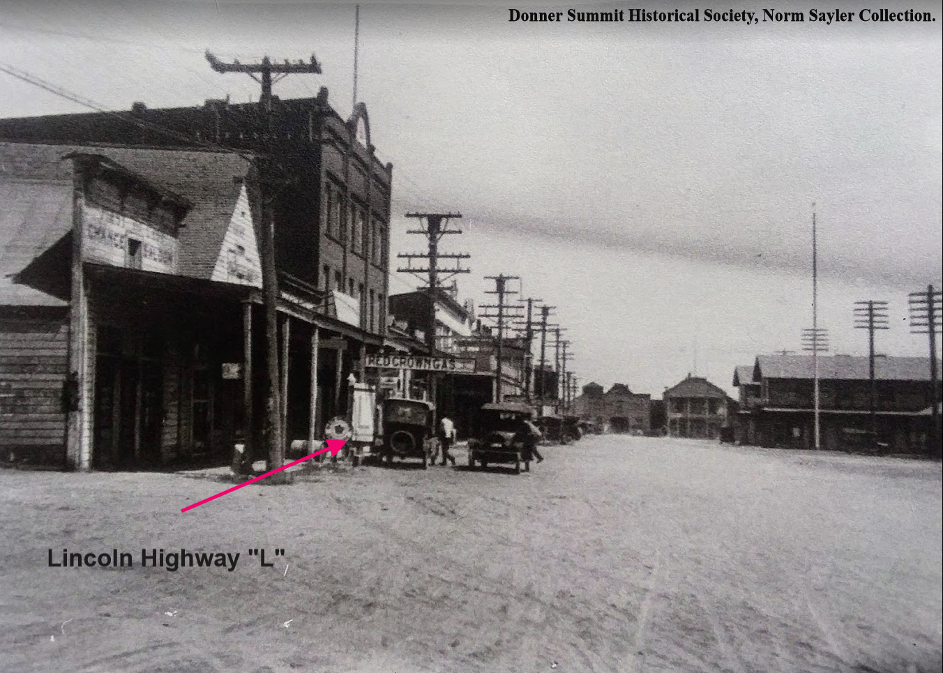
Rare photo of a Lincoln Highway “L” sign on Donner Pass Road, Truckee, sometime in the late 1910s, early 1920s.
In our next installment of the Lincoln Highway’s northern route, we will continue our trip towards the summit but will first stop to check out the Donner Party’s encampment site, now known as Donner Memorial State Park.
Photographs from Donner Summit Historical Society, Norm Sayler Collection, and Adventures in California History.