
Leaving Echo Summit on the old Lincoln Highway we continue our adventure west. Johnson Pass Road was the old highway, passing by the road to Echo Lake on the right. It was here that the American House roadhouse once stood during the 1800s. Later during the 1920s and 30s Echo Portals stood here. This was a resort with food and lodging as well as Echo Summits first rope tow for skiing. This resort went out of business with the arrival of the Great Depression in the early 1930s.
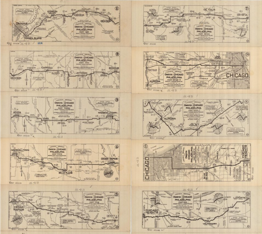
The early transcontinental driver making their way across the country might have used “strip maps” to guide them on their journey. In the above photo, we see one such “strip” of maps, which were originally produced by the Southern California Auto Association and is currently housed in the Library of Congress.
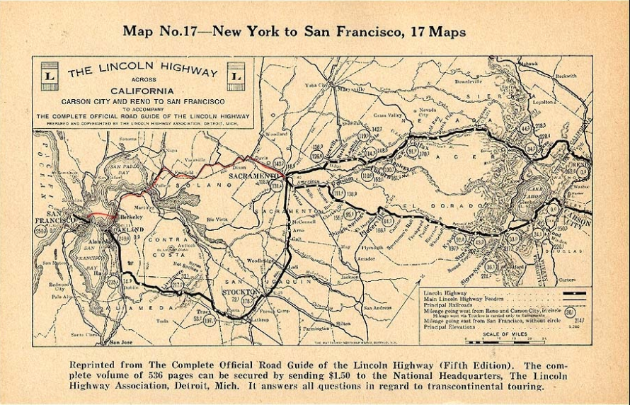
The California section from a strip map of the Lincoln Highway, 5th edition. Click map for a larger view.
In the above photo, we can see the California map that was part of the “strip maps” series showing the entire country. The above map is the California section of the maps. This map showed the 1913 Lincoln Highway route heading south from Sacramento towards Stockton and the Altamont Pass. In 1928 the Carquinez Bridge near Martinez was opened, and the newer, faster route was drawing in red by someone on the above map. You still would need to take a ferry from Berkely to San Francisco.

Phillips Station, just before it burned down around in 2019.
After passing the site of Phillips Station, and old stage stop and roadhouse, we come to Sierra Springs Road off to the right. As we can see in our Lincoln Highway interactive map, that road was the Lincoln Highway! Keep your eyes open for California “C” monuments, indicating this was a state highway. We have yet to find any, so maybe you’ll be the first! Go here to find out about “C” Monuments. Let us know if you find one, or two.

Edelweiss Ski Hill along Highway 50.
Just beyond the Sierra Springs alignment, we come to Sayle’s Flat, home of Camp Sacramento. The City of Sacramento has leased this land since the 1920s for recreation. Across from Camp Sacramento once stood Edelweiss, a small ski resort that once was the home of Spyder Sabich, a world-class skier. The above photo shows the ski resort in the 1950s. Eventually, low snow years and changing habits of skiers forced the closure of this place.

Looking towards Sayles Flat from the old Edelweiss Ski Resort Hill. Camp Sacramento is just out of view at left. You can see me lower left looking at the Trails West “T” Marker.
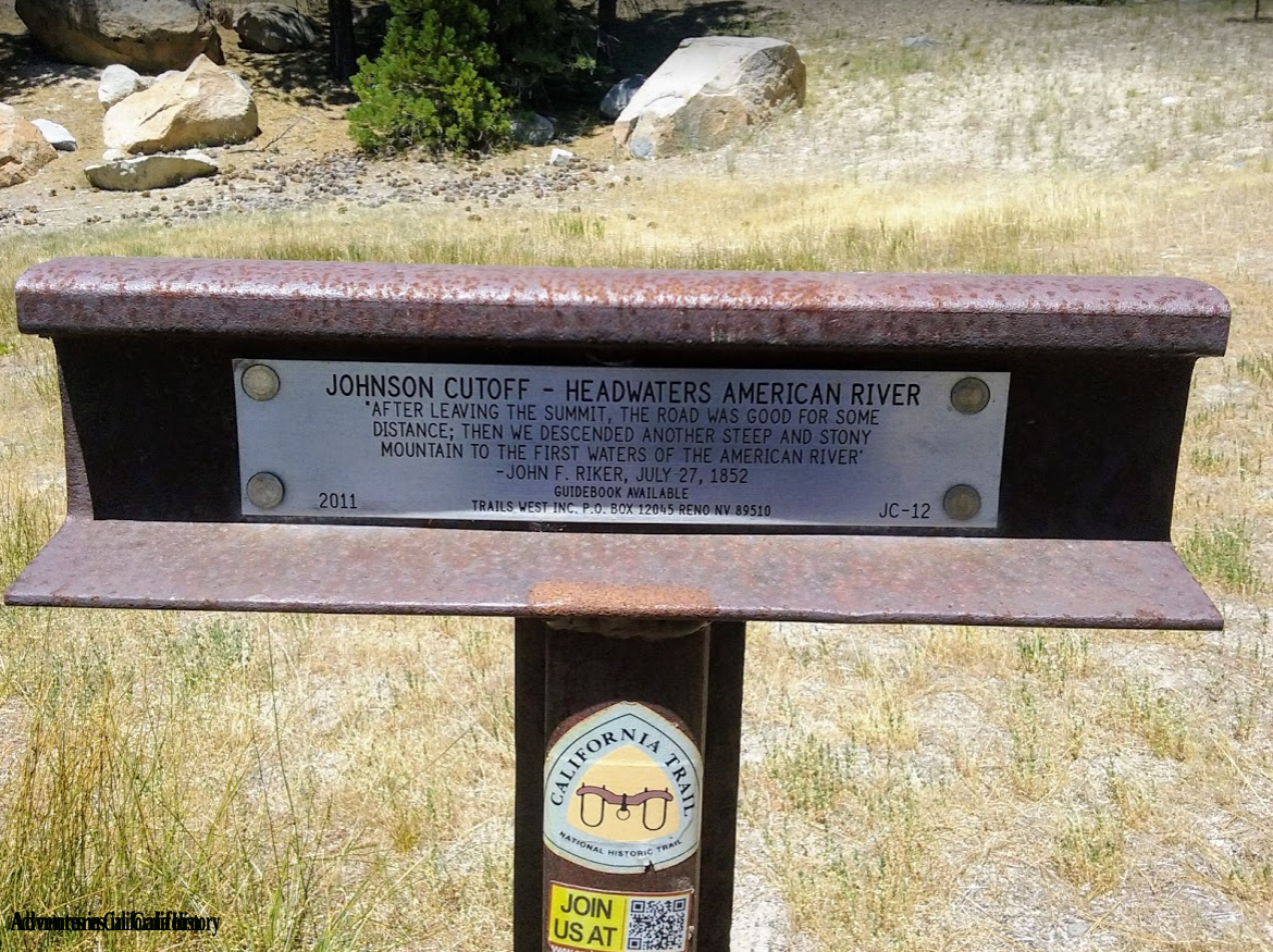
The original 1913 alignment of the Lincoln Highway often followed the old emigrant trails in these parts. As witnessed by the Trails West Association “T” marker just downhill from the Edelweiss site, this is no exception. This is the course of Johnson’s Cut-Off trail, which guided early travelers of the 1950s and 60’s down the mountain and across the American River at a place called “Slippery Ford.” We will discuss that extraordinary place in our next blog post following the southern route (Pioneer) of the Lincoln Highway.
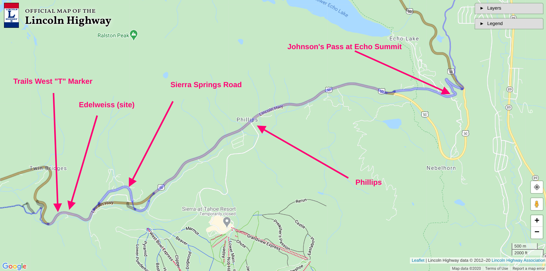
Map showing location and features. Click map to see larger version.