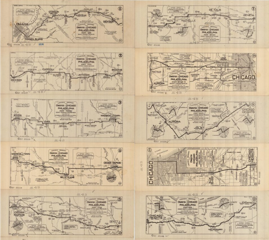
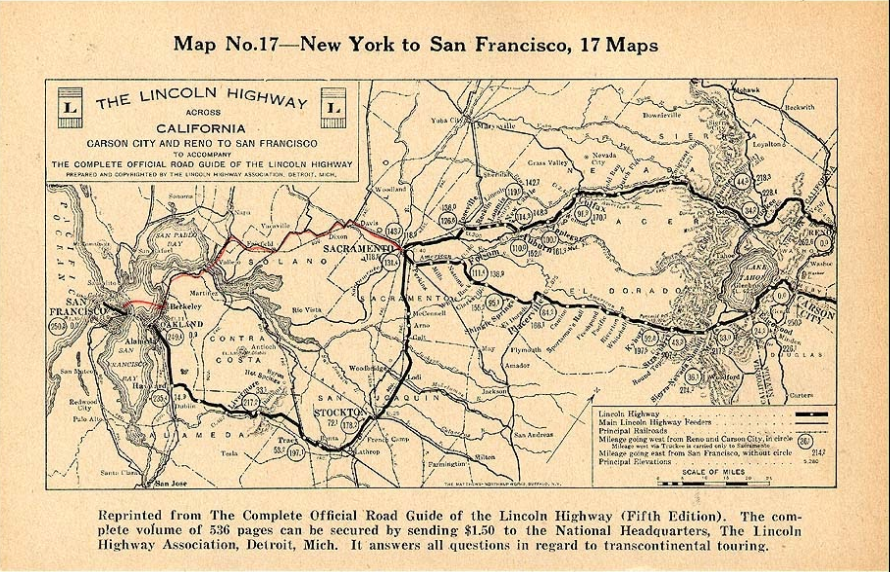
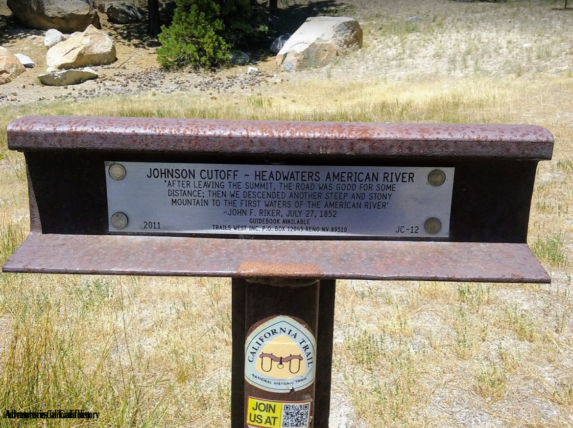
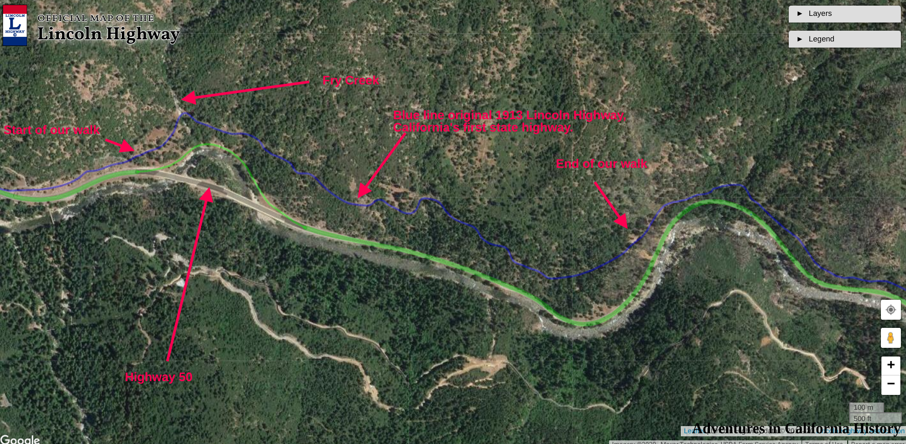
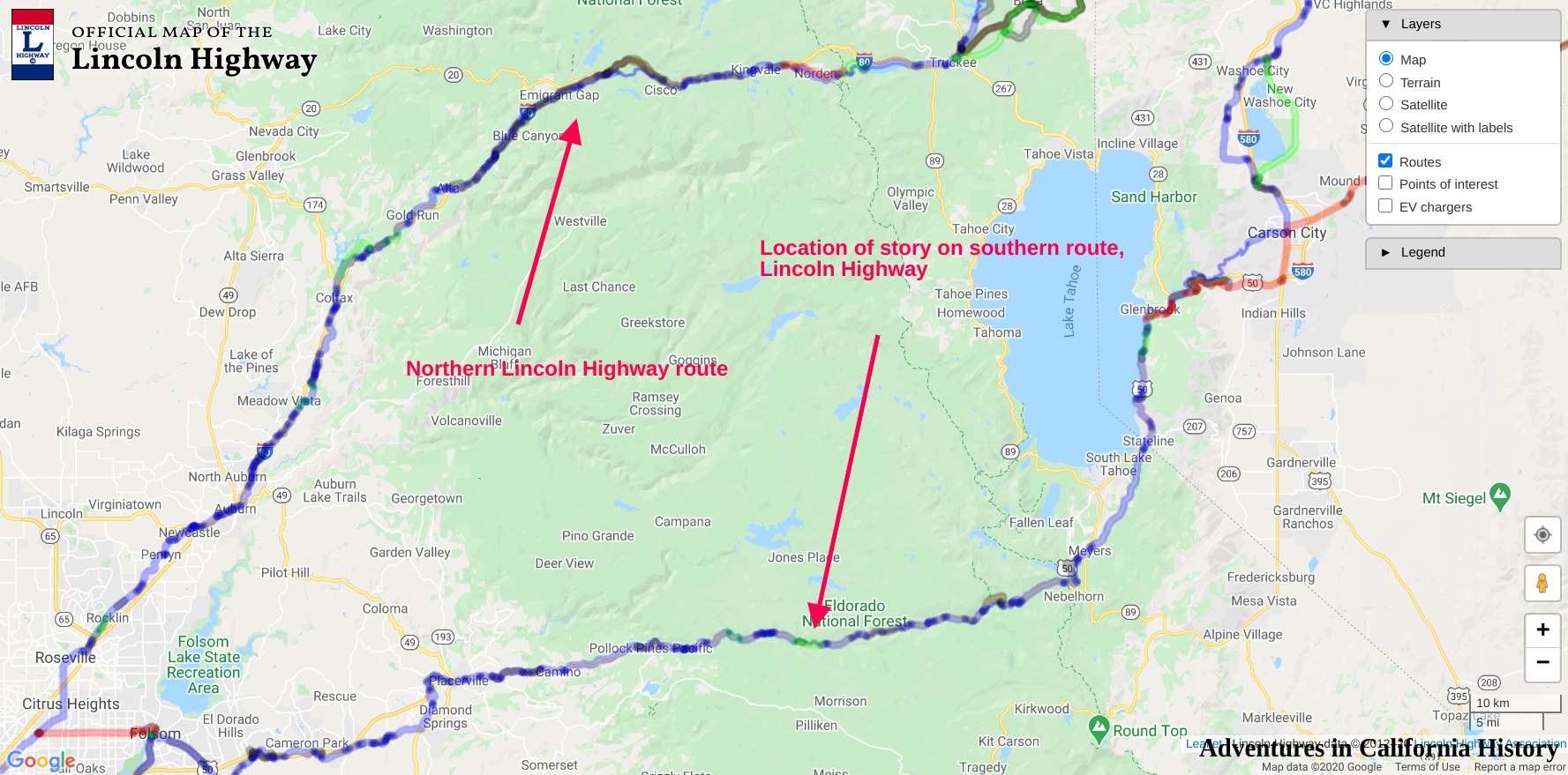
We have explored the Slippery Ford area on our eastward journey on the Lincoln Highway from Stateline to Placerville in part 4 of our El Dorado County Lincoln Highway adventure here. The Slippery Ford area is rich in history, and if you like hiking, it’s a great trip from Lover’s Leap campground to the Slippery Ford parking lot. If you are going to walk in both directions, we recommend starting at Lovers Leap campground and heading uphill first, then returning with the downhill, making it a bit easier to finish. The other option would be two cars with one parked at your destination. The walk is medium difficulty, though in the summer it can become scorching. The gravel roadbed has eroded in some areas making it difficult to walk over the small loose gravel.

Swan-Henry Toll Road and Lincoln Highway looking east.
The photo above shows a boulder that has fallen into the roadbed. We are a few hundred yards from the Slippery Ford Trail parking lot at Twin Bridges. This part of the old roadbed is easy to walk as it is not very steep. A forested area behind the photographer, a hundred yards or so, provides some welcome relief from the summer sun.
Pretty soon, we come to a wonderful rock which has been marked by old-time travelers. What era did they write this? We don’t know, but the Pony Express, Swan-Henry Toll Road, and the 1913 Lincoln Highway passed by this very rock. Someone wanted to record their passage through this historic route.

Register Rock on the Pony Express Trail, Swan-Henry Toll Road, and Lincoln Highway.
Heading down the old road a bit, we can see off to our right and below a rock building lacking a roof. At some point in the 1930s, the CCC (Civilian Conservation Corps) built this as a ski hut. Apparently, it was never finished or used. You can head down and check it out from the trail.

Ski Hut built by the CCC in the 1930s. Never used. We are looking north.
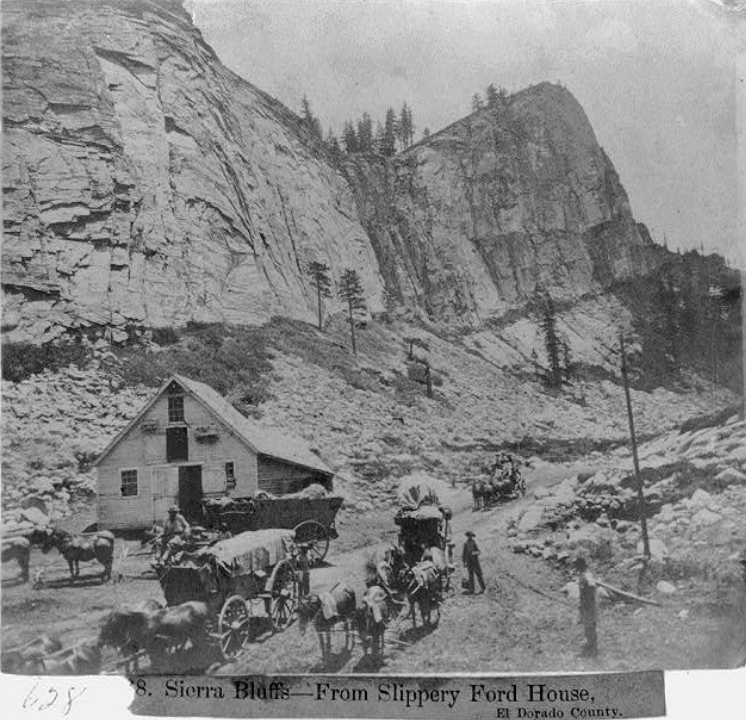
A bit further on, we come to the Slippery Ford House site, a boarding house and supply stop for travelers in the 1860’s. This spot is amazing as there is literally nothing left of this old place other than debris, which should be left in place as archeological evidence. It’s great fun to take the photo below and compare it to the site today.

1866 photo shows Slippery Ford House with teams outside. The team is headed up-hill, east, towards Slippery Ford. . Library of congress photo.
Below you will find a short video we made in 2018 at the Slippery Ford House site.
These historic photographs come to us from the Library of Congress, Lawrence & Houseworth Collection, made in 1866. Slippery Ford was famous enough they took many photographers of the area, including the Slippery Ford House. The photo below is interesting as it appears to shows the third building on site. We assumed from previous photos there were just two buildings.
From Slippery Ford House looking east on the old Swan-Henry Toll Road.
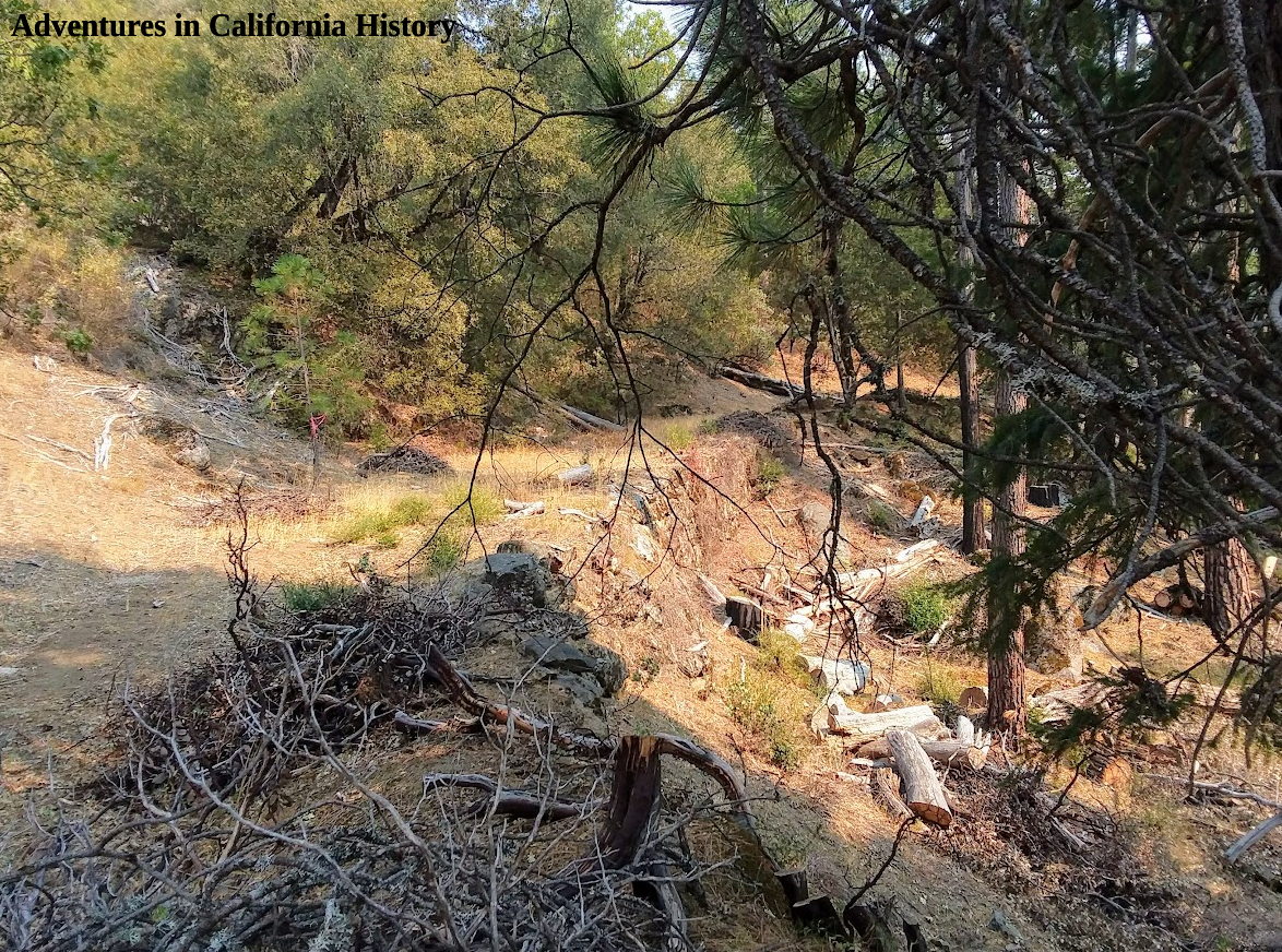
Looking at these old photos of Slippery Ford House, the first thing I notice is the roadbed's great condition. Today this road is often a jumble of rocks resembling a stream bed more than a road. This is due to erosion over the years, with water etching deeper into the ruts each year. In addition there is no road maintenance anymore, so nature is left to it’s own creation along this trail.

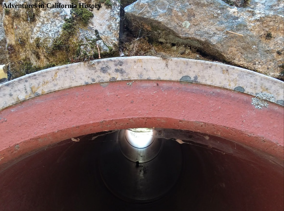
Monica standing in the middle of the badly eroded roadbed. You can see a old culverts sticking out of the ground. That is likely Lincoln Highway era pipe.
Monica's photo above shows how the roadbed has been eroded over the years, exposing the base, which consists of softball size and larger sized rocks. These sections of the road can be difficult to walk as every time you step the rocks move. You can see a Lincoln Highway era culvert sticking out of the ground.
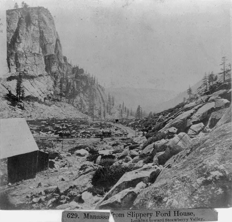
Looking west towards Strawberry Valley from the Slippery Ford House, 1866. Look closely and you can see the wagons coming up the hill towards the house. Click photo for larger view. Photo from Library of Congress.

Monica and a blasted rock.
As we travel these 19th Century roads in the Sierra Nevada, we often come across these rocks with a star-shaped pattern. These rocks were just too big to move, so the road builders blasted them, making the roadbed level. Dirt would then be graded on top of the rocks to make a smooth surface for travel. That’s why many of these roads were toll roads, to pay for the ongoing maintenance.

A rock showing the star shaped pattern from blasting.
We are approaching our destination near Strawberry, and there is one more historic obejct to enjoy, Monks Rock. Hank Monk was quite famous in his day for being a devil may care stage driver, who held records for his speed of travel. It’s said that one night, when stage traffic would travel the less crowded roads, he hit his head on this rock while speeding to his destination.

Monk’ Rock, on which the famous stage drive Hank Monk hit his head while driving his stagecoach team up the Slippery Ford Trail. Photo from the Library of Congress. Click the photo for a closer version.
We have looked at Monk’s Rock trying to envision how he managed to get close enough to actually hit it. Still can’t figure it out, but it’s a great story about a big old rock, of which this area abounds.

Monks Rock.
Just past Monk’s Rock, headed west towards Strawberry, the end of the hike is the Lovers Leap Campground. This campground is usually filled with rock climbers who find it thrilling to climb up the sheer side of Lovers Leap. Lover’s Leap Campground is only a short 1/4 mile from Strawberry. There is day-use parking at the campground.

Lover’s Leap Campground at Strawberry.
Now that we’re done hiking down the Slippery Ford Trail we’ll take a look around the Strawberry area in our next episode of our Lincoln Highway Adventure in El Dorado County.
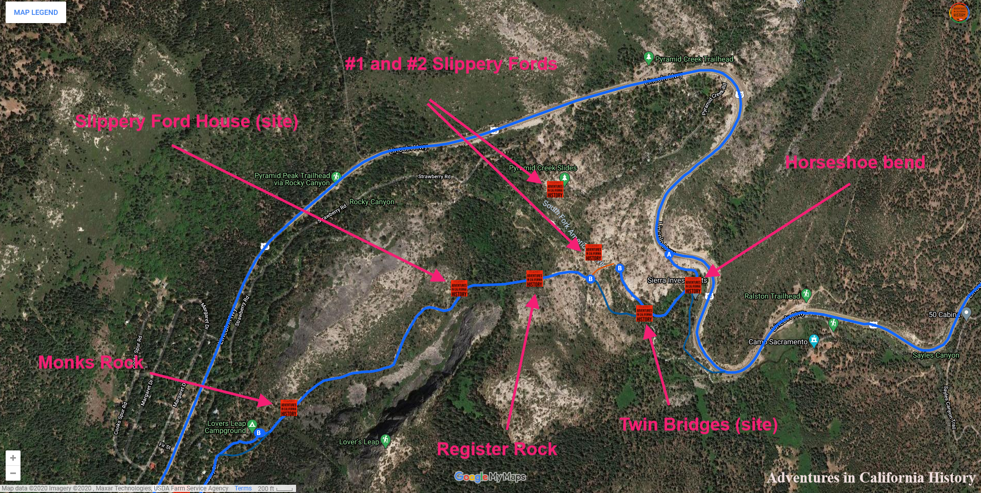
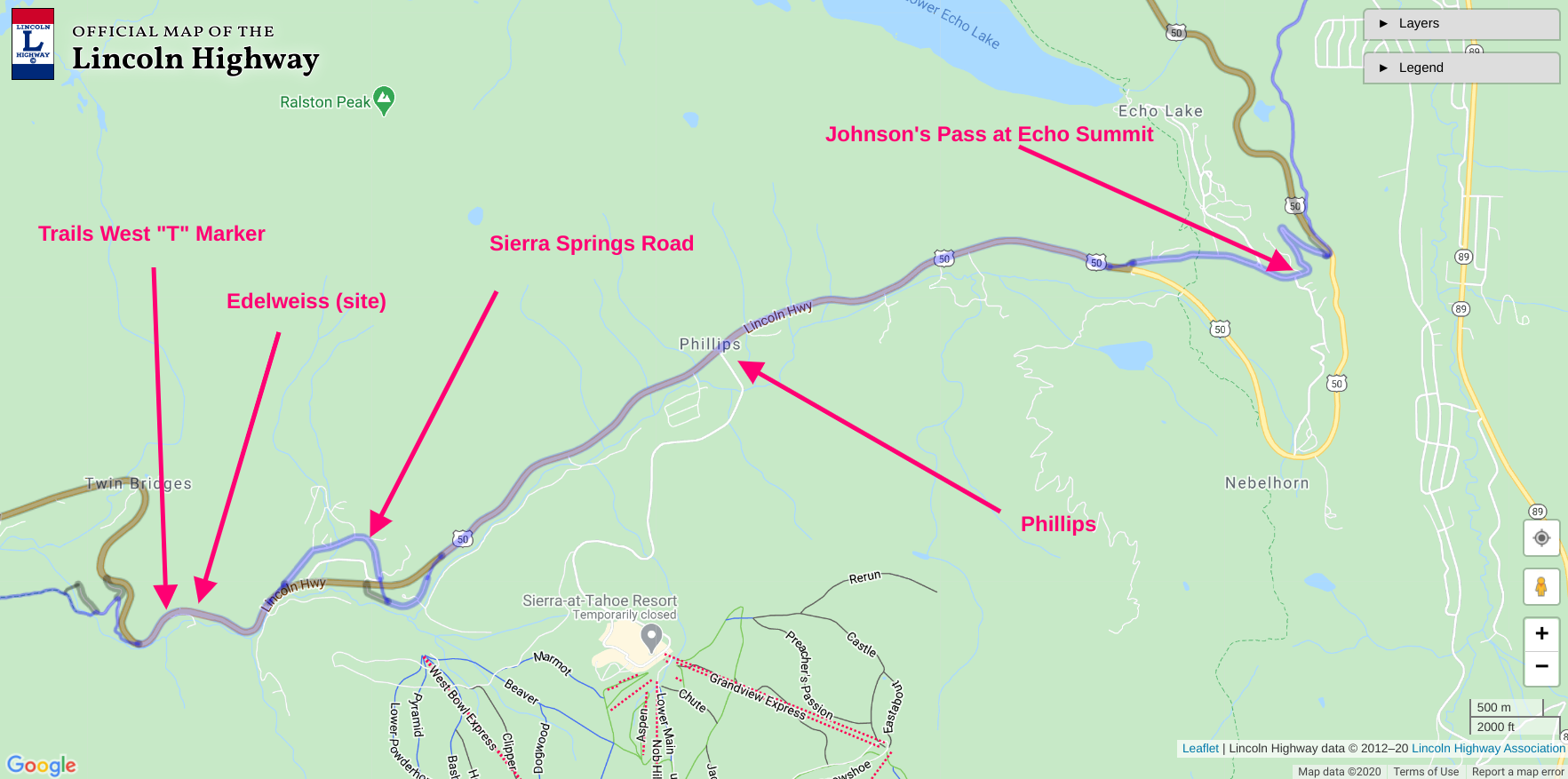
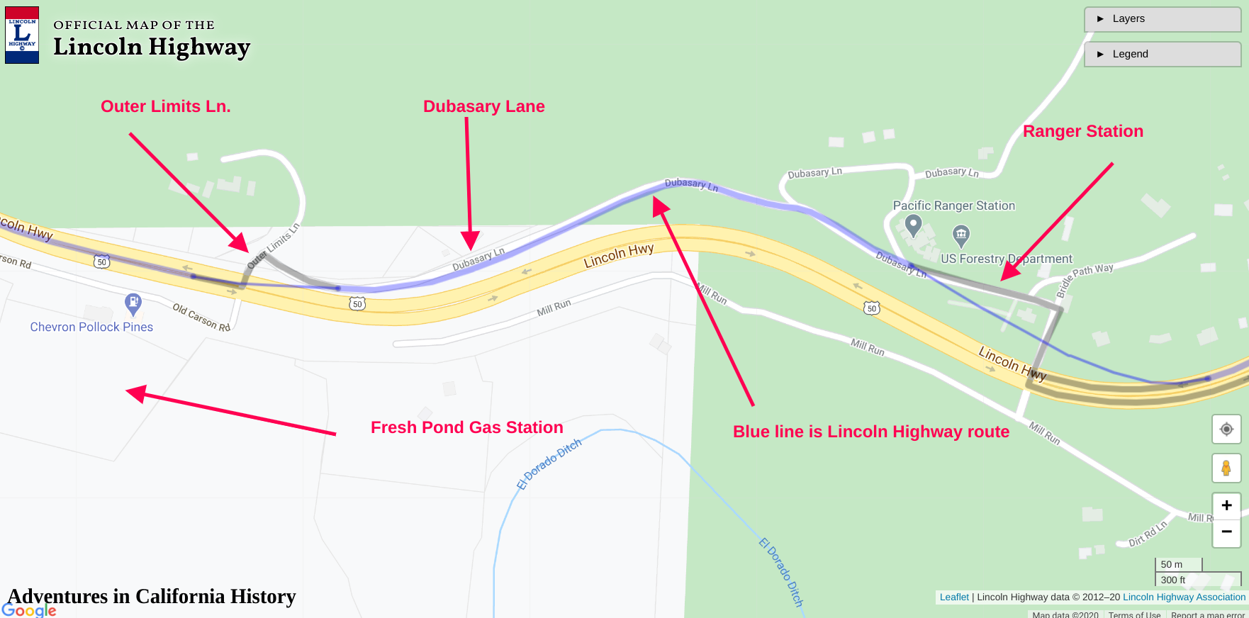
Map of area showing key features. Click map for larger view.
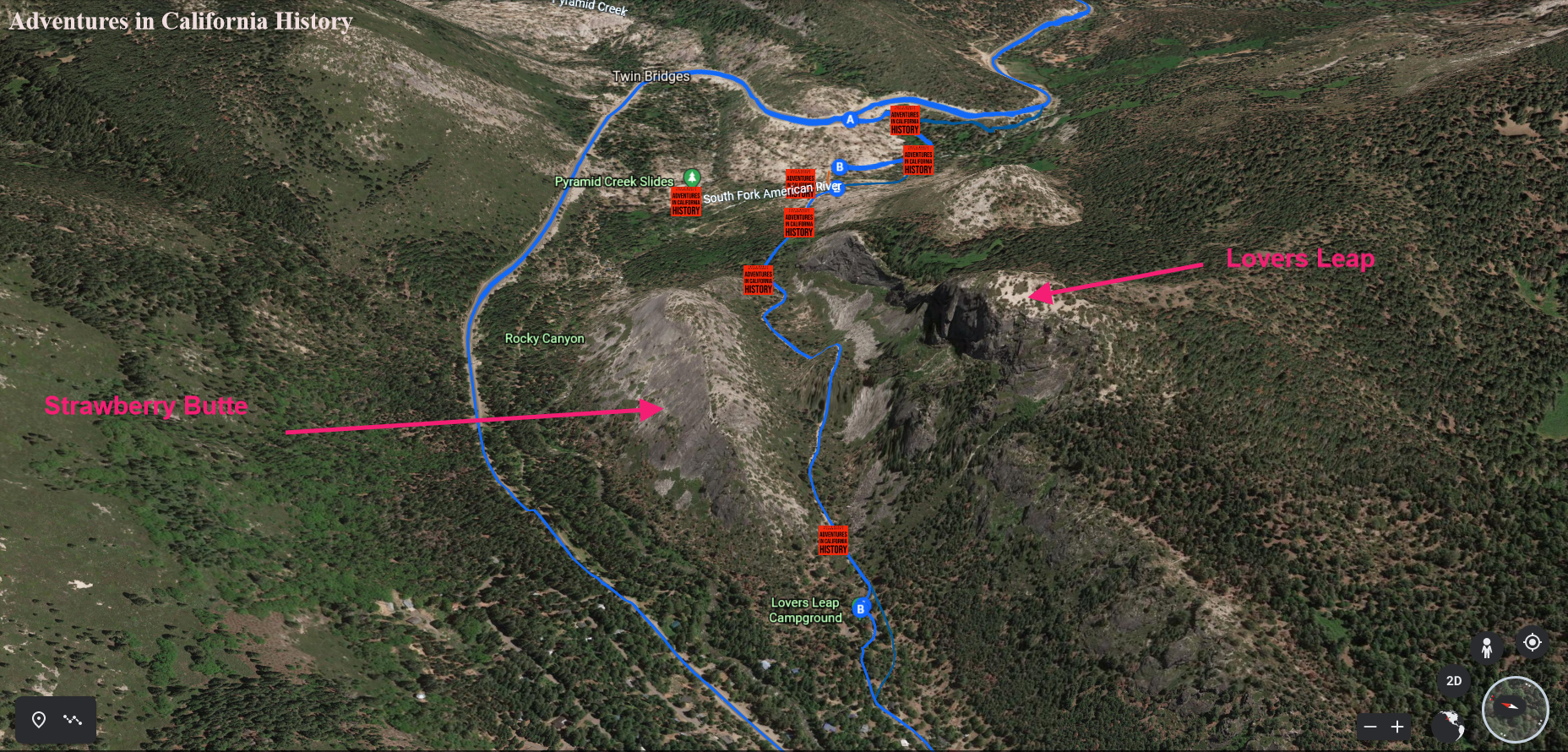
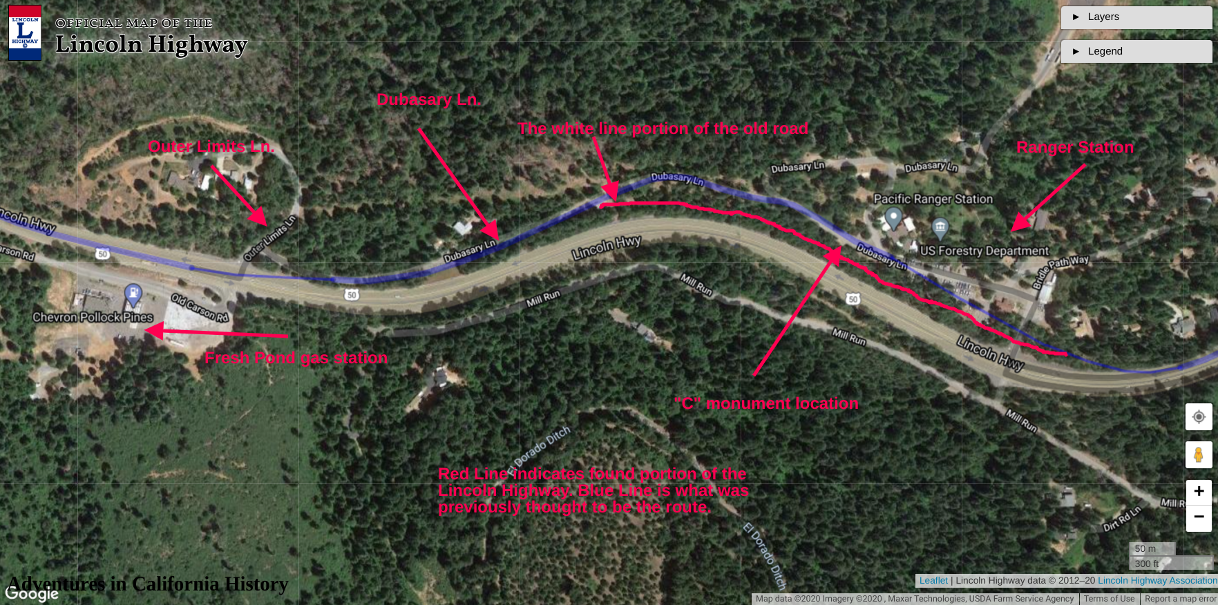
Google Earth view looking east.This 3D view shows the topography of the area well. Click map for a closer view.