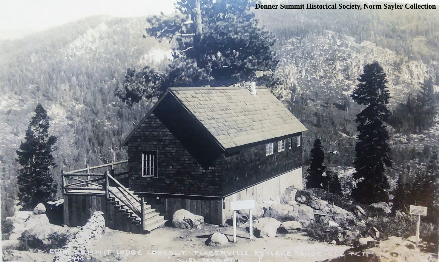
The early autoist would have finally reached Johnsons Pass after climbing up the steep Meyer’s Grade from the Tahoe Valley floor. These old autos would need supplies like water and oil once they reached the summit, as they were constantly leaking or burning up fluids. Fortunately, entrepreneur TC Wholbrick had built an early service station and food stop that he called a “Canteen.” We have talked about TC and his Canteens here. While there had been a small forest service cabin, TC added to it, creating the building we see in the above photo.

Inside of the Echo Summit Lodge and Canteen.
Above is a rare photograph of the inside of the Echo Summit Canteen. Everything seen in the photo was handmade by TC. Some of the furniture is inside the present Alpine Club Lodge, which occupies the site today.

The view from the Echo Summit Canteen, looking east.
While enjoying a break from the road, you could head to the deck in the back and check out the magnificent view, as seen above.
Once your supplies were purchased, you started back down the west slope of the Sierra Nevada. If you were a transcontinental autoist, having left New York weeks ago, this was your final mountain challenge on your way to San Francisco. The sign pictured below was just 100 yards beyond the Canteen, a popular spot to photograph your passengers and auto.

Summit of the Sierra Nevada Mountains, Johnson’s Pass, Echo Summit, El Dorado County.
In the photo below, we look back at the lodge as we head down the west slope of our journey on the Lincoln Highway. You can see a Lincoln Highway sign in the tree on the right.

Looking east at the Echo Summit Lodge and Canteen.
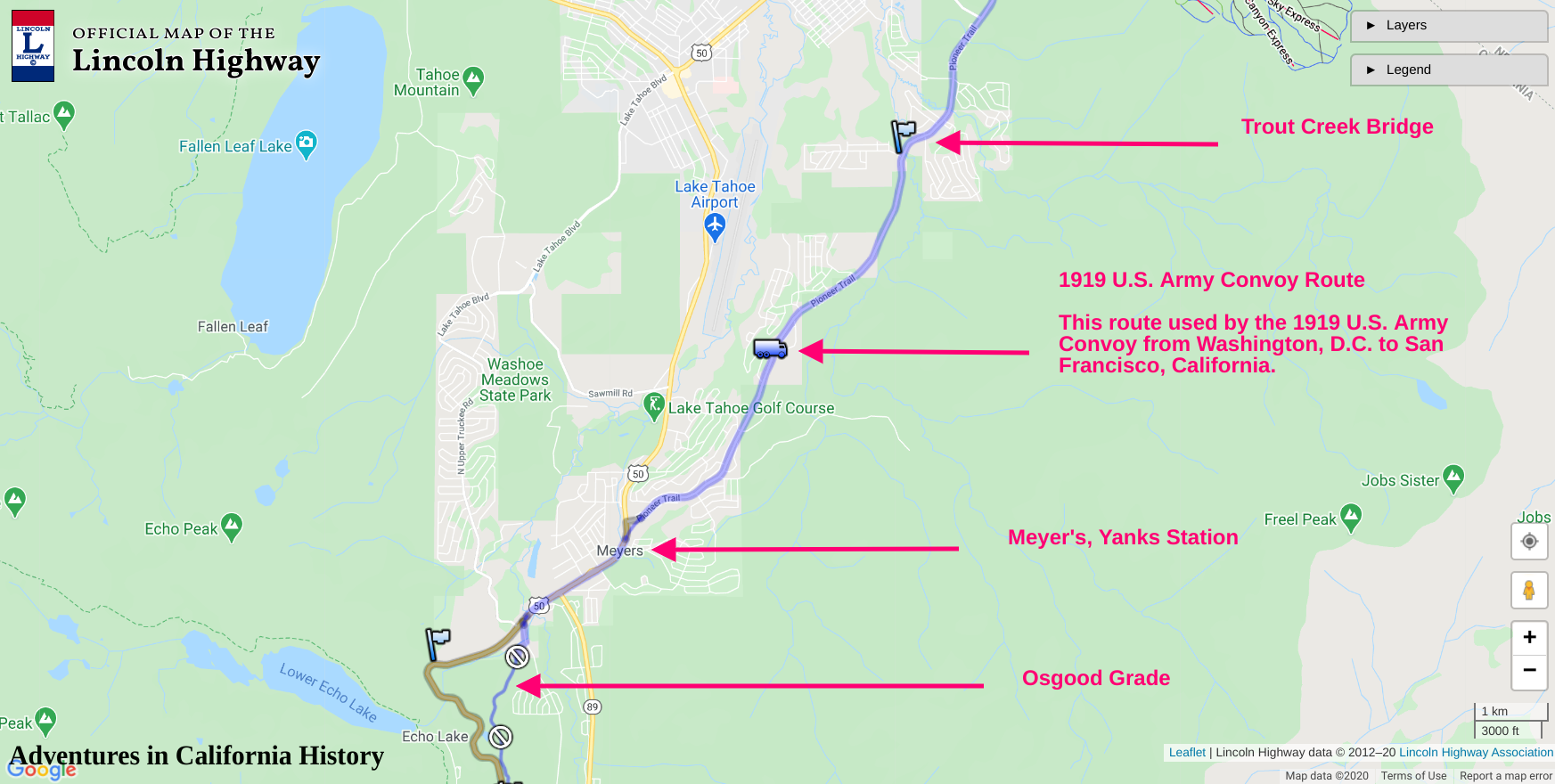
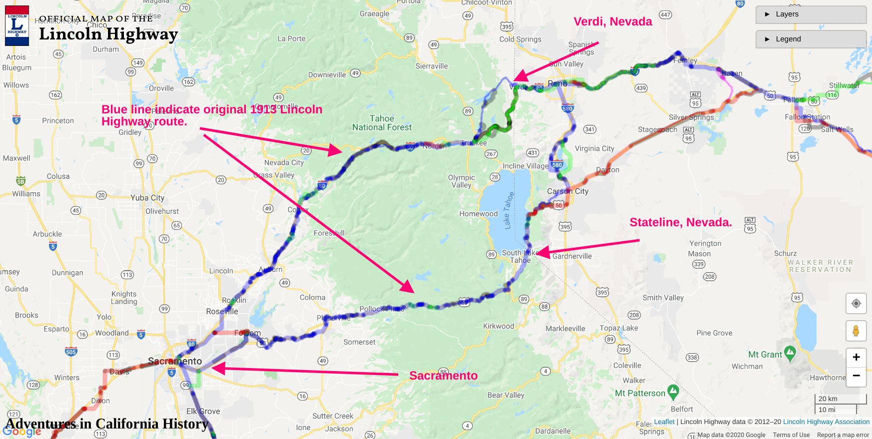
Below is the official Lincoln Highway map showing the location and features. To see the entire interactive map, go here.
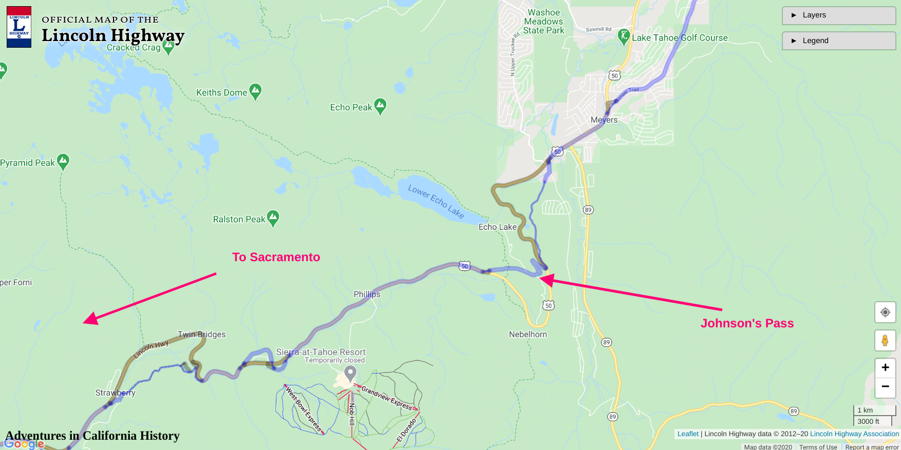
Map showing locations. Click the map for a larger view.