Johnson's Cut-Off Trail

1922 Moreland Truck at Johnson's Pass

Recently I was contacted by Greg Hull, who had worked for Cal Trans for thirty-three years as a construction engineer. His Father-in-Law was Darel Kehlet, whose family bought 640 acres on the west shore of Lake Tahoe and built Meeks Bay Resort from 1915-1969. Greg had inherited many family photos showing the resort's early development and surrounding highways and by-ways. He has kindly permitted these photos to be shared.

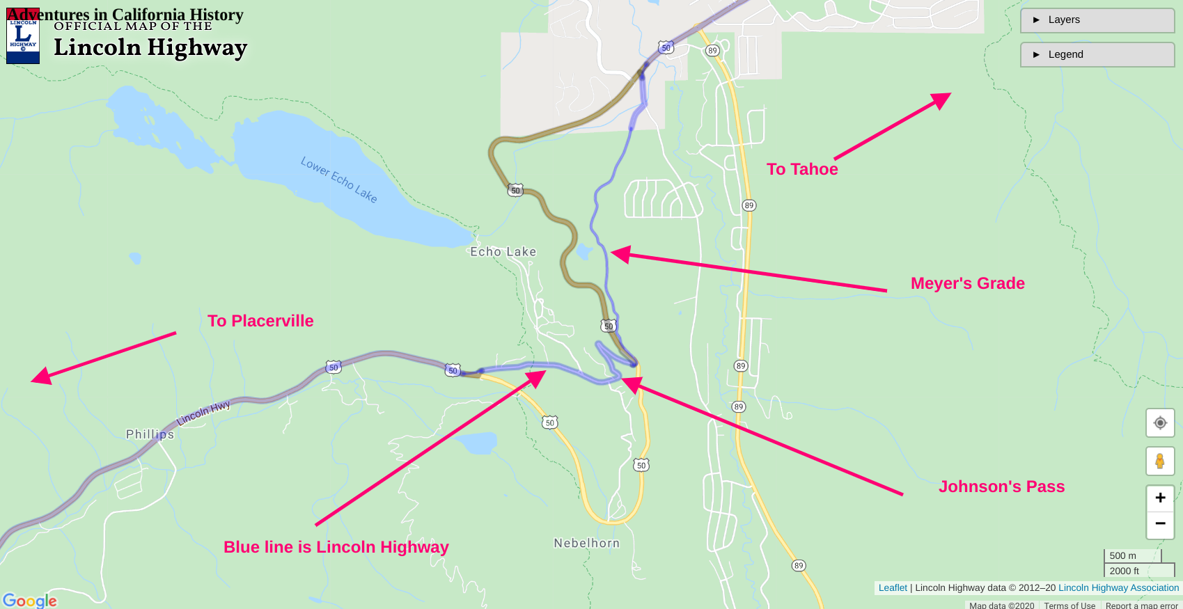
We see the Meek's Bay Resort Truck at the top of Johnson’s Pass at Echo Summit, looking east towards Lake Tahoe. The photo dates from 1922 or shortly after. It shows a man, woman, and dog, outside the truck, which has stopped at the pass. Johnson’s Pass was always a popular spot for travelers to snap photos. Just outside the frame, to the right, would be the Echo Summit Canteen Service Station owned by TC Wholbruck, whom we discussed.

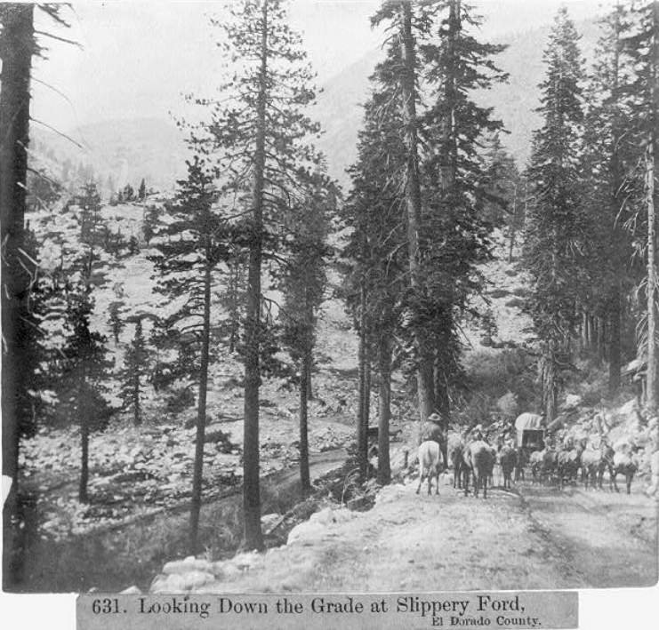
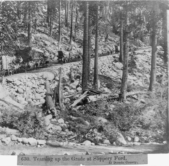
In the early days of automotive travel, trucks and cars would have to back up steep hills as these vehicles had not yet been equipped with fuel pumps. On its journey "down the hill" towards Placerville, this truck would include a drive backing up the nearby Slippery-Ford Grade on the Lincoln Highway. What an experience that must have been.

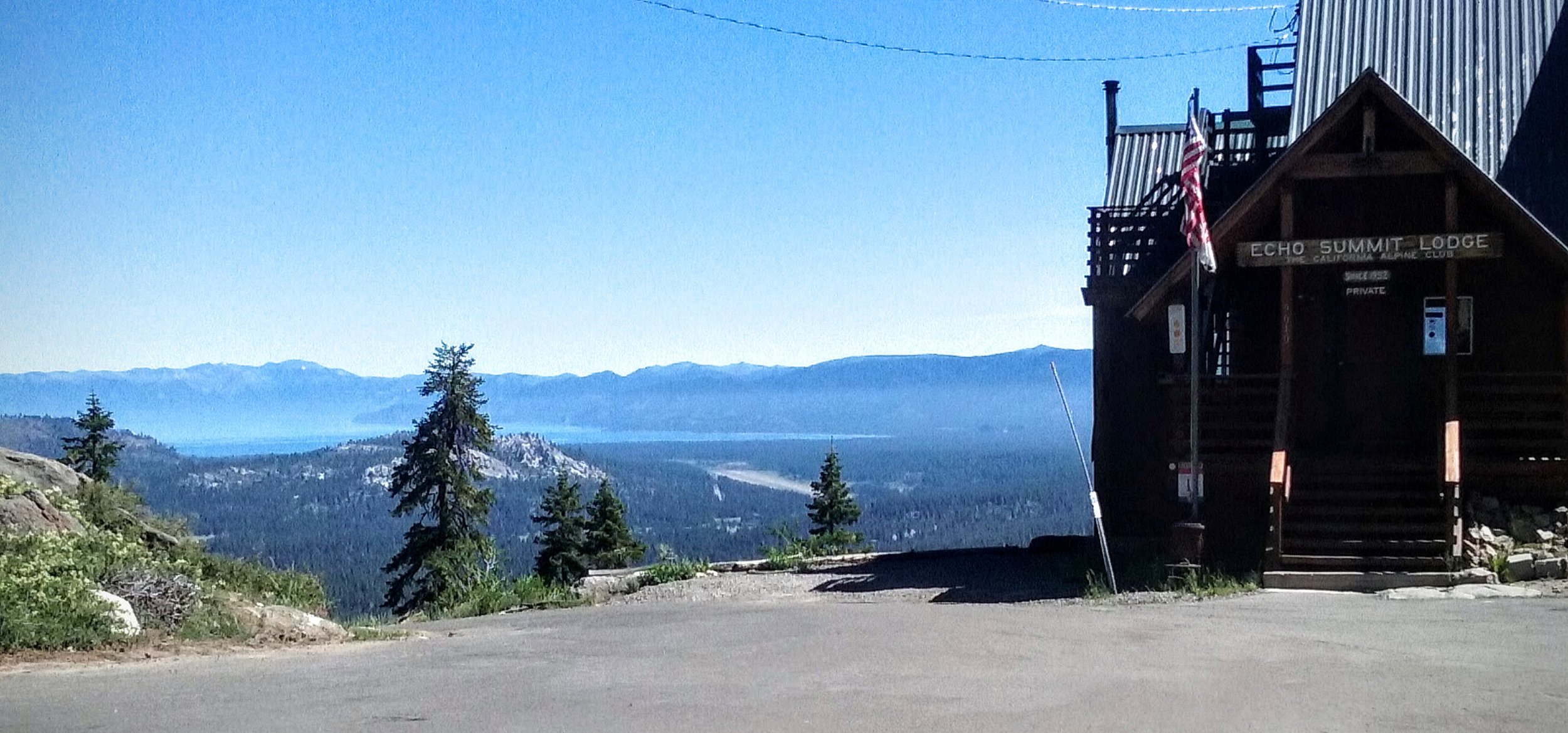
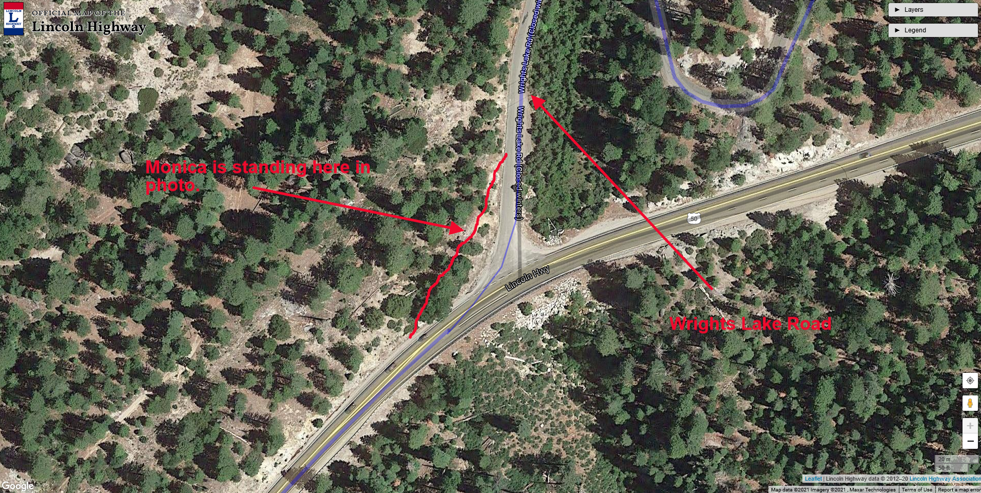
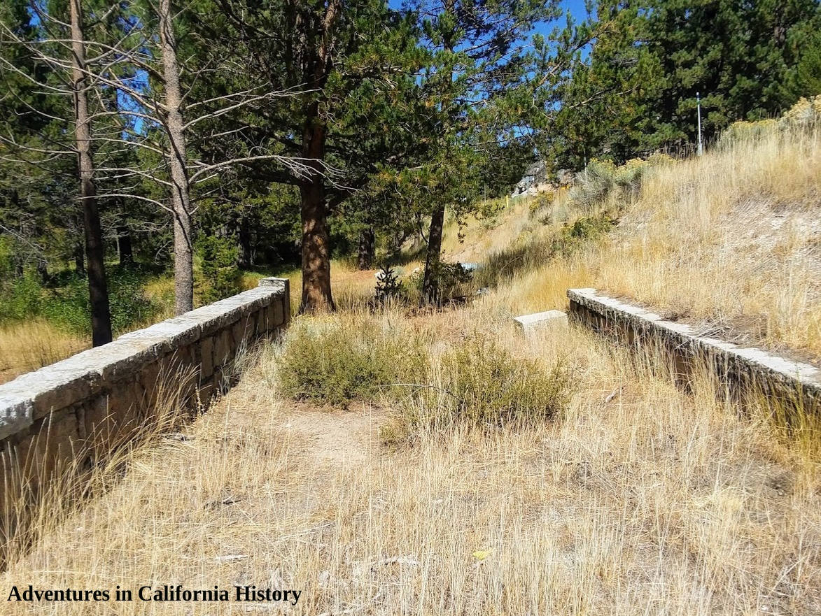
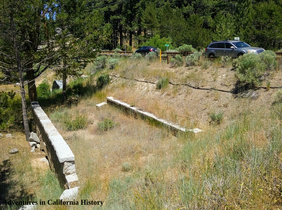
The same spot today!

Thanks to Greg Hull for sharing this and some other photos I hope to post here shortly. I have placed a comparison photo showing what the location looks like today
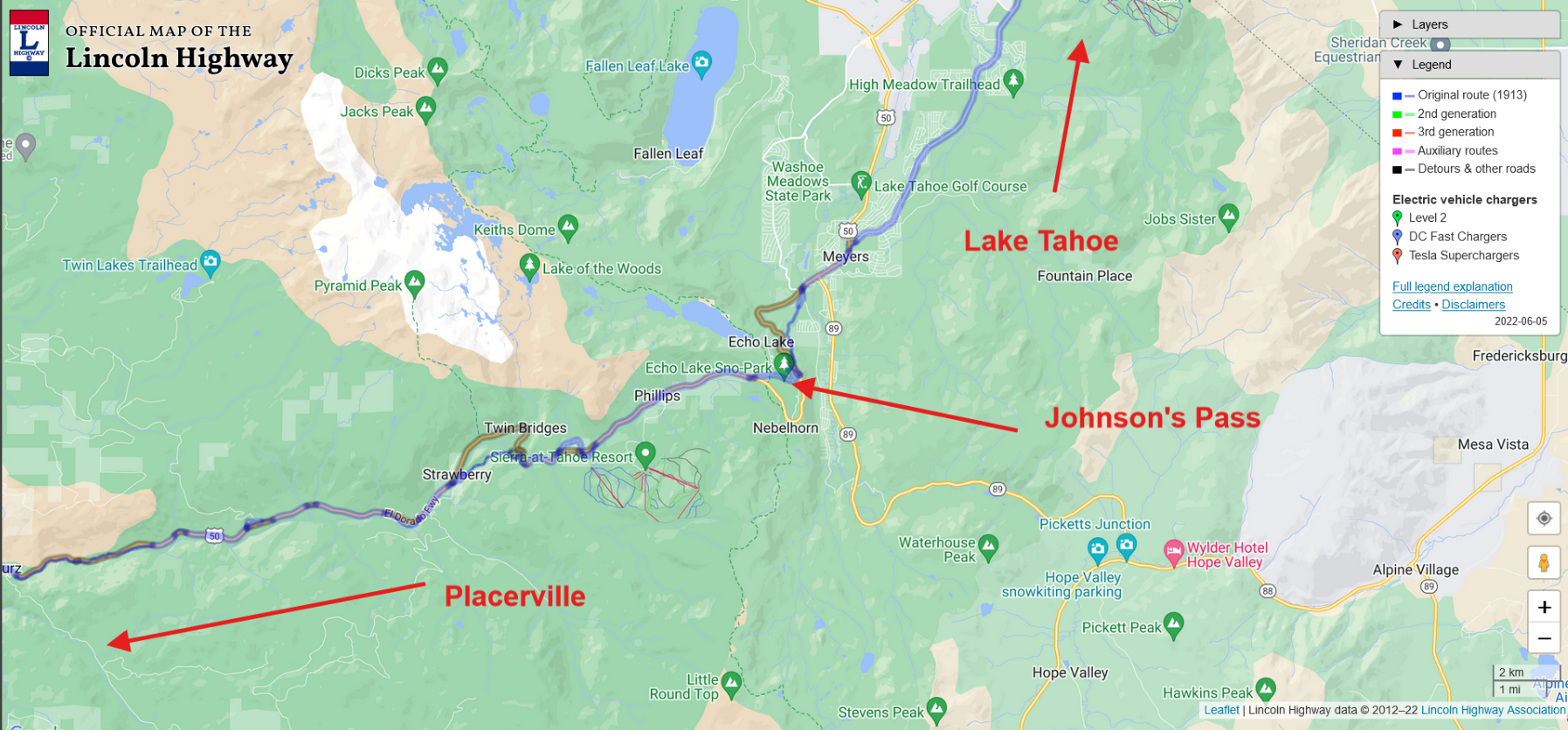
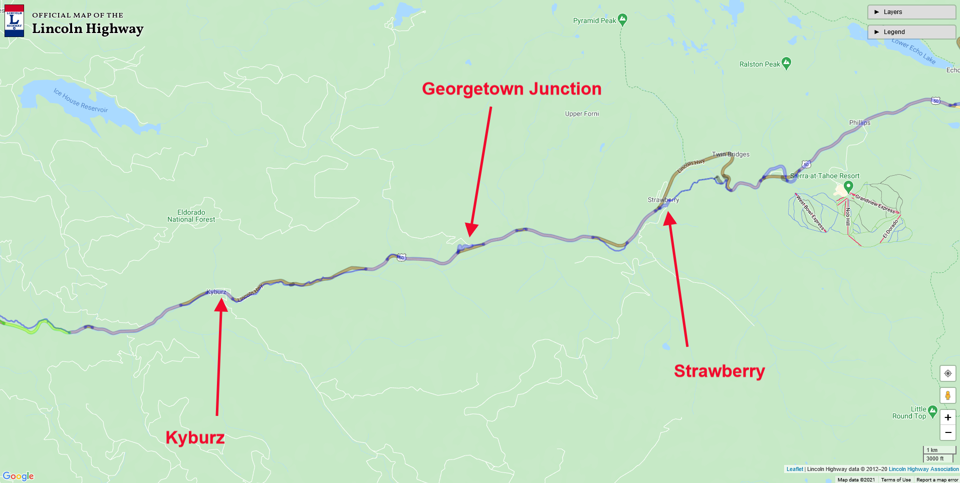
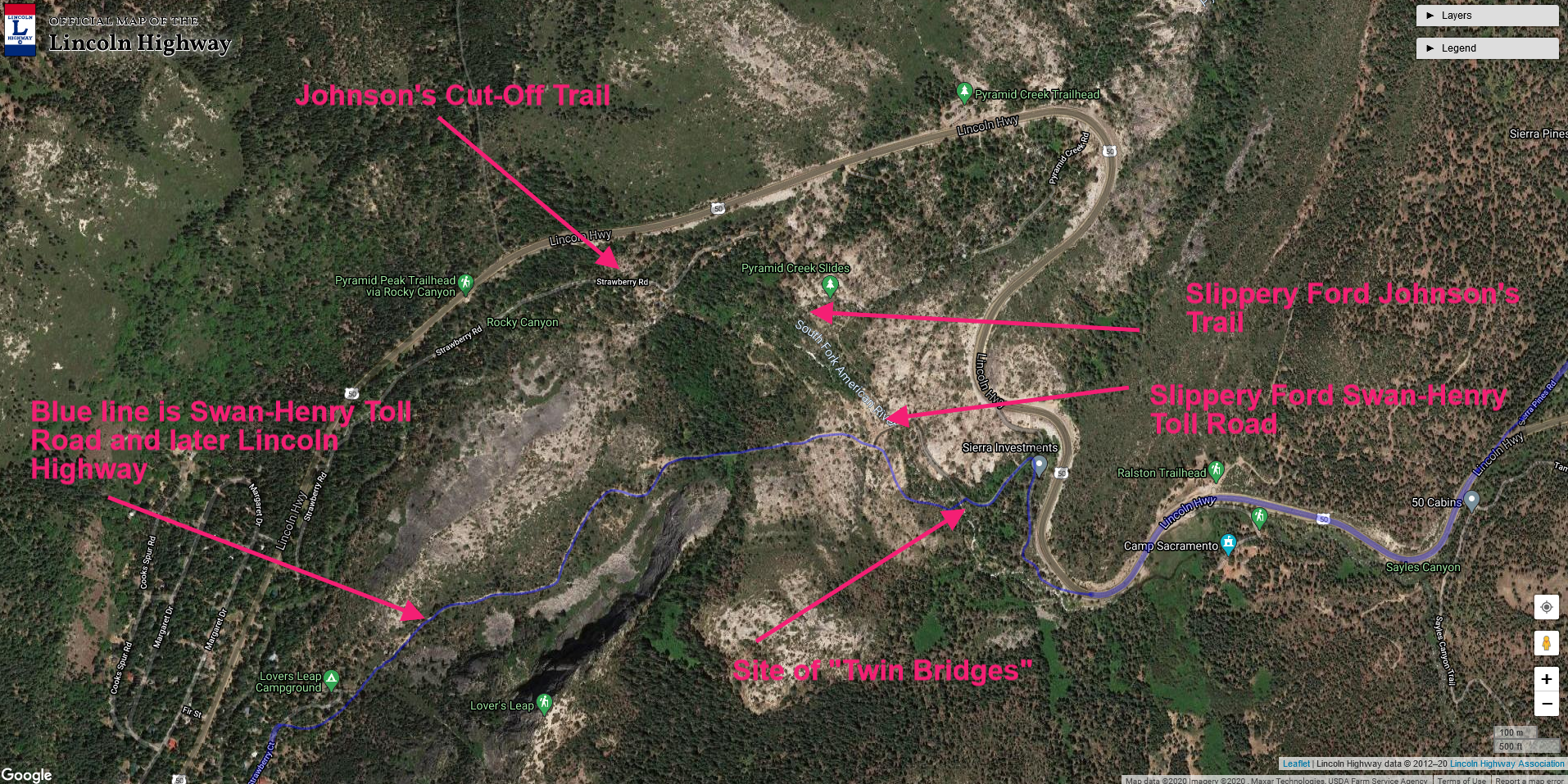
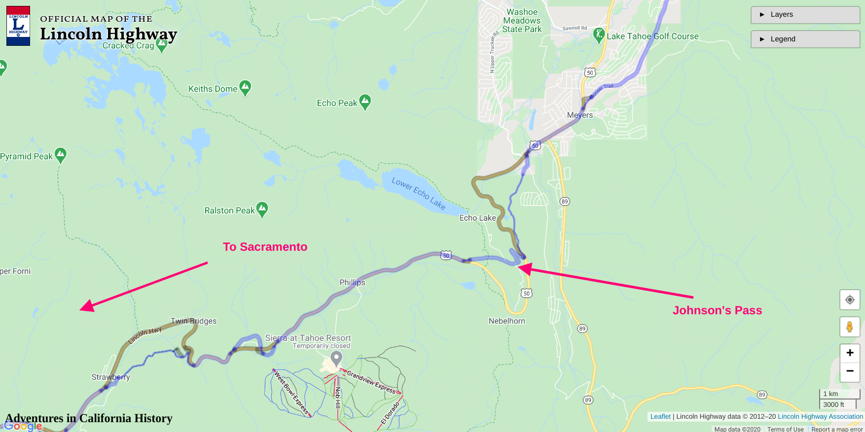
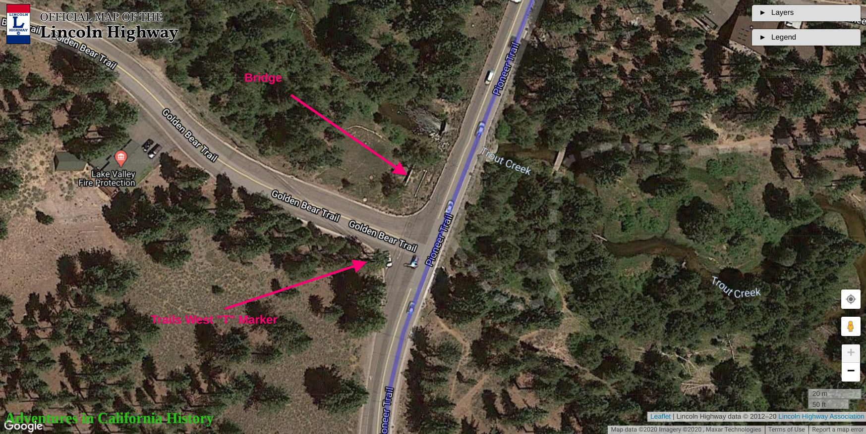
Location on map.

Slippery Ford on the Lincoln Highways southern route, Part 4

When it comes to California history, Slippery Ford is a name and place that conjures up a terrifying chapter in transportation history. The name suggests that this river “ford” or crossing was dangerous. Indeed, until a bridge was built nearby, travelers would have to cross this portion of the American River by wading through, depending on the season, a shear film or torrent of cascading water. One slip and you and your wagon would slide down the river to a doubtful, likely painful outcome.

A wagon team and riders make their way down the grade from Sayle’s Flat towards Slippery Ford, 1866. Photo from the Library of Congress.

A wagon team and riders make their way down the grade from Sayle’s Flat towards Slippery Ford, 1866. Photo from the Library of Congress.

Before the Lincoln Highway passed this way, John Calhoun Johnson built what was known as Johnson’s Cut-Off Trail in 1852, which brought emigrants over the Sierra Crest. This route soon replaced the earlier Carson River emigrant route up and over Carson Pass to the south, a more difficult climb and a higher elevation. Johnson’s Cut -Off Trail soon became the road to use.

Another 1866 photo showing the wagon train headed up the grade. The photo was taken at the horseshoe bend as located on the map at the end of the post. Photo: Library of Congress.

Another 1866 photo showing the wagon train headed up the grade. The photo was taken at the horseshoe bend as located on the map at the end of the post. Photo: Library of Congress.

Something to keep in mind when exploring Slippery Ford, is there are two Slippery Fords just a few hundred yards from each other. The original crossing was the Johnson Cut-Off Trail which crosses Pyramid Creek, not the American River as the later Slippery Ford does. I will admit, that until I learned this it was a bit confusing reading the records of this area. One crossed Pyramid Creek, the other the American River.

Perhaps a Swan-Henry toll road bridge crossing the river near Slippery Ford. Photo:Library of Congress.

Perhaps a Swan-Henry toll road bridge crossing the river near Slippery Ford. Photo:Library of Congress.

As traffic increased tolls were collected to help find a new trail with the Slippery Ford Grade down to Strawberry being rebuilt by George W. Swan. It’s Swan’s brand new 1866 grade we are seeing in the above photos. The bridge at Snow Slide Mountain could be the first bridge built here in 1858. Both Slippery Fords are shown on the map at the end of the post.

One of the twin bridges that once crossed the American River at Slippery Ford.. Photo from: Lincoln Highway Association collection.

One of the twin bridges that once crossed the American River at Slippery Ford.. Photo from: Lincoln Highway Association collection.

As we have learned, the original 1913 alignment of the Lincoln Highway followed old wagon roads, and this was the case here. The Lincoln Highway followed the Swan-Henry toll road, with the addition of two bridges, or “twin bridges” that crossed the American River. The bridges were not side by side, but rather one went to a island while the other bridge exited the island. In the photo above we see an early auto on one of those bridges.

The following two video show us the first Slippery Ford of Johnson’s Pass over Pyramid Creek. This was the original emigrant trail that was later bypassed by the Swan-Henry Toll Road.

The following video gives you a good view of the area around Slippery Ford. One correction to the video. I mention we are on the ”Scenic Route” of the Lincoln Highway, but this is actually known as the “Pioneer” or southern route of the Lincoln. The Slippery Ford in this video is the later one used after Johnson’s Cut-Off Trail ford.

Once travelers crossed the American River, the road continues down the grade past Register Rocks, Lovers Leap, and into Strawberry. We’ll cover that part of the adventure in our next post of the El Dorado County section of the Lincoln Highway, Part 4.

Map of location and features discussed, Click map for larger view.

Map of location and features discussed, Click map for larger view.

The Lincoln Highway, EL Dorado County, Johnson's Pass, Part 5

John Calhoun “Cock-eye” Johnson. Photo from the California State Archives.

John Calhoun “Cock-eye” Johnson. Photo from the California State Archives.

We continue our adventure up Meyer’s Grade near Lake Tahoe on the old Lincoln Highway. This climb was the last major difficulty for emigrants in the 1850s who had come to settle in California or gather its riches and head back home. Early automobiles would often break down under the climb's strain, and reaching Johnson’s Pass was a major relief, as it was mostly downhill to Sacramento.

Johnson’s Pass is named after John Calhoun Johnson (1822 - September 13, 1876), a native of Deersville, Ohio. Johnson was the first trans-Sierra mail carrier, who delivered mail from Carson City, Nevada, to Take Tahoe, California, and continued to Hangtown, CA (Placerville, CA). Johnson used the Truckee River Route and the Carson Emigrant Trail to deliver the mail, but these were difficult trails to travel, and he started to look for another way up and over the summit. Johnsons figured if a trail could be built starting at the north end of Carson Valley and then made to go west over the mountains to Placerville, a large chunk of the Carson River Route would be “cut-off.” Johnson built that road, and it became known as Johnson’s Cut-Off Trail, saving much time and effort for travelers. It soon became the most popular route into California for emigrants and wagon trains.

We have learned that the 1913 original alignment of the Lincoln Highway often followed these old wagon routes and emigrant trails, and this was no exception. Automobiles were still a new thing in 1913, and road construction hadn’t caught up to the new-fangled horseless carriages, so they just followed the dirt trails like this one.

T.C. Wohlbrück photo showing the building at the summit before he built onto it.

T.C. Wohlbrück photo showing the building at the summit before he built onto it.

Once you reached the top of the summit in 1918, this small forest service building would have greeted you. A visionary named Theodore Clemens Wohlbrück (1879–1936), known as "T.C." was a photographer who arrived in California in 1912. He realized that the new automobile and its passengers would need supplies. TC started what he called Canteen Service Stations in three locations of the Sierra Nevada, Donner Lake, Emigrant Pass, and here at Johnson’s Pass, Echo Summit. You can read more about TC and his Canteens here.

T.C. Wohlbrück photo showing the view of the Tahoe Valley from the Summit Lodge.

T.C. Wohlbrück photo showing the view of the Tahoe Valley from the Summit Lodge.

The view from the Summit Lodge is famous, and TC made sure to record it in the above photo. In the lower photo, we have a modern day view from the same spot.

The view from atop Johnson’s Pass at Echo Summit, CA.

The view from atop Johnson’s Pass at Echo Summit, CA.

TC Wohlbrück photo showing his Canteen Service Station at Johnson’s Pass.

TC Wohlbrück photo showing his Canteen Service Station at Johnson’s Pass.

TC Wohlbrück arranged a lease with the Forest Service to add to and develop the cabin as one of his Canteen/Service Stations. In the above photo, we can see the enlarged Canteen waiting for customers. The sign on the right mentions there is no illegal parking on the Lincoln Highway in the Eldorado National Forest. The photos of the Tahoe Basin were taken from just below the stairs, looking east.

The view from Johnson’s Pass looking east.

The view from Johnson’s Pass looking east.

Pictured below is a Trails West historical “T” Markers at Johnson’s Pass. Each marker quotes from an emigrant diary about the very spot you are standing. In the next installment of our Lincoln Highway Adventure through El Dorado County, we will look around The Johnson’s Pass area and take a rare look inside the canteen.

Trail West “T” marker at Johnson’s Pass.

Trail West “T” marker at Johnson’s Pass.

Map showing location and features at Johnson’s Pass.

Map showing location and features at Johnson’s Pass.