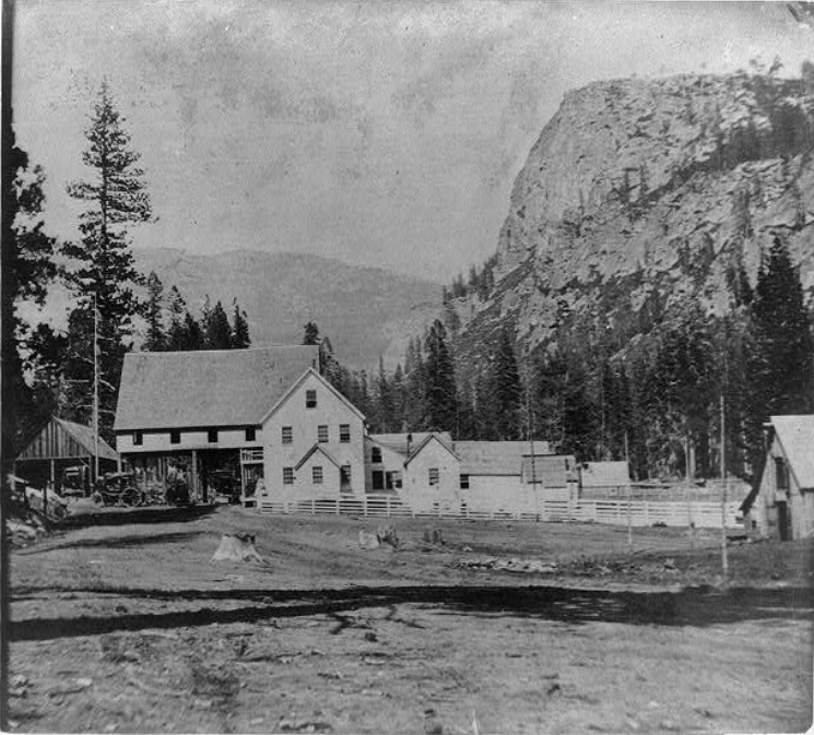
These wonderful photos show Strawberry’s two locations. The location of the Strawberry House has been a source of confusion for me. The secret is realizing there were a total of four Strawberry Houses over the years. Irad Barry built the first roadhouse in 1858 along what is now Highway 50. There is a state rock monument describing the first location just west of the gas station. It was here that a second larger lodge was built and stood until a fire destroyed it in 1867. The photo above shows the huge structure.
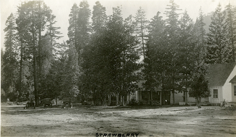
Strawberry cabins in 1920. We are facing east. Click photo for closer look. “McCarthy Album 04, Photograph 068,” California State Archives Exhibits,
After the disastrous fire of 1867, the new owner, Charlie Watson, re-built the station, but a bit up the road, just before the bridge crossing the American River. The photo above shows this new location. It was this location that would see the rise in automobile traffic after the turn of the century. This spot would be owned by the Watson and Martin Families from 1867 to 1938. While autos did pass down the old Swan-Henry Road, the Lincoln Highway in 1913 breathed new life into the old rest stop. For the next 16 years, the place was a beehive of activity as American's took to the road in their new Model T's.
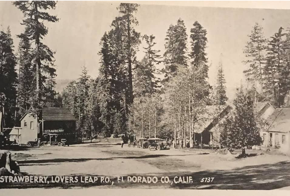
Strawberry Resort on the Lincoln Highway, The photo above is courtesy of Laura Bantz
In 1929 the Great Depression was upon us, and the acquisition of automobiles and traveling slowed down as well. Who had the money to do it? The second reason business slowed was the highway's re-routing in 1931 from the old Swan-Henry Toll Road/Lincoln Highway to today's route. This bypassed the old resort and, combined with the Depression, helped in its eventual demise in 1939, just before World War II.
In 1939 Fred Baumhoff built the structure we know today as Strawberry Lodge along the new Highway 50. This would make the third location of the famous Strawberry House/Lodge/Resort. Fred’s Resort didn’t have much time to become a success as World War II roared into the 1940s, and men and equipment were in short supply. In 1943 Fred sold the business, and it had some success in the 1950s and 1960s, but people and their driving habits changed, and no one wanted to stop and take in the fresh air and views anymore.
Today the resort sits somewhat forlorn, waiting for its next big break or its next big disaster. Until people slow down and stop to smell the flowers once again, it will likely be a place that most just speed by on their way to somewhere else.
Our next stop along the southern route of the Lincoln Highway will be the Georgetown Junction, a wide spot along the road today, but back in the 1800s a major crossroads.
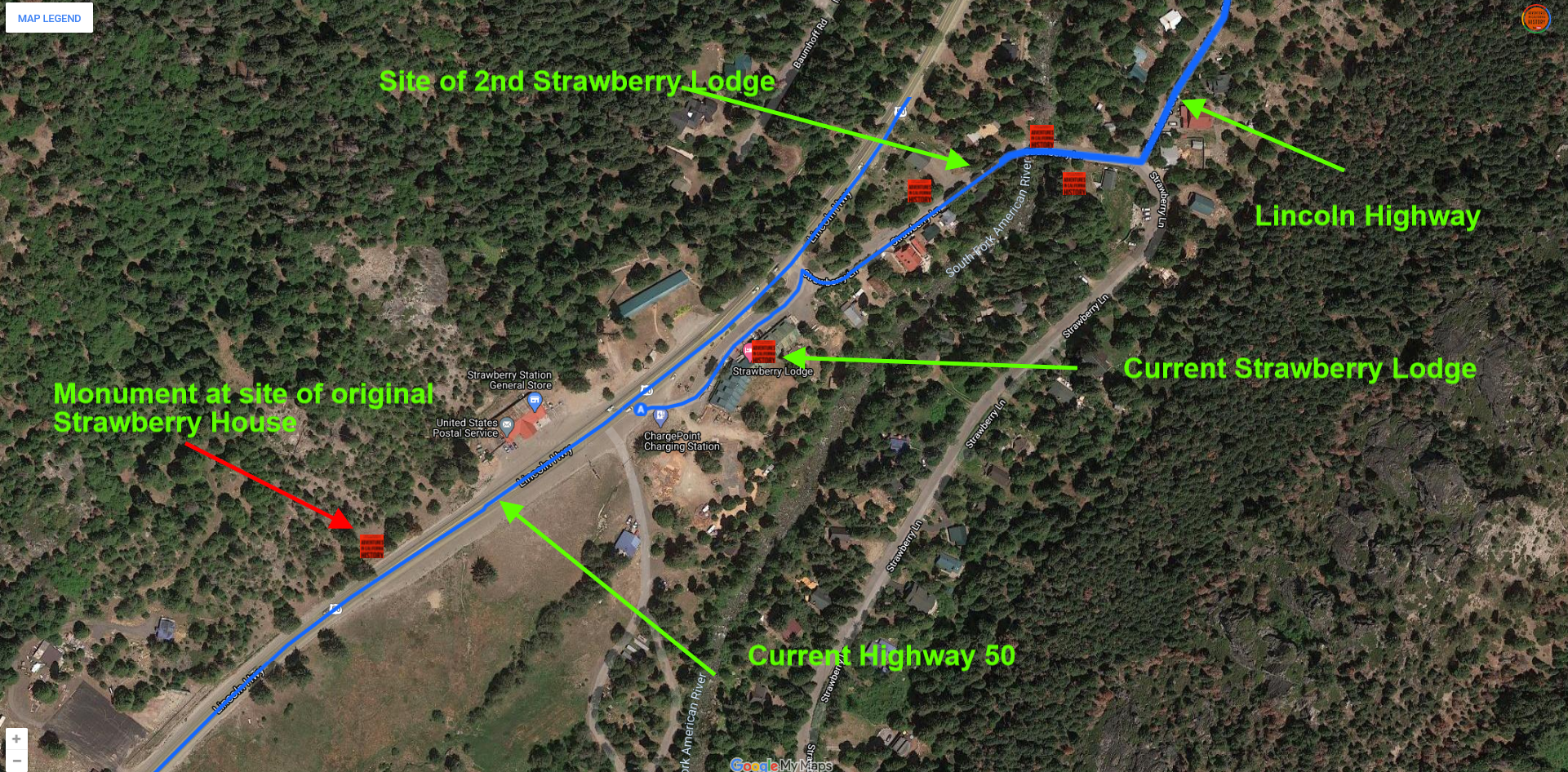
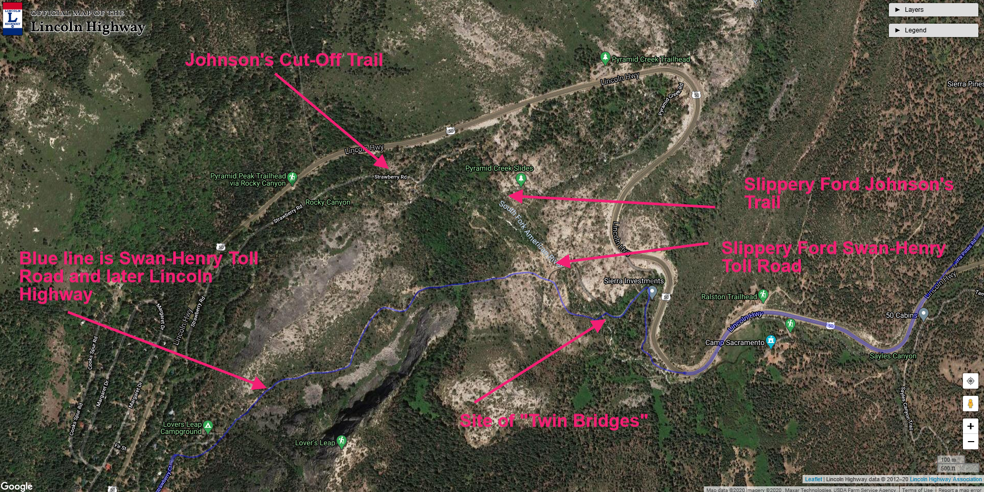
Map showing the sites of the three Strawberry buildings. Click map for a larger view.