
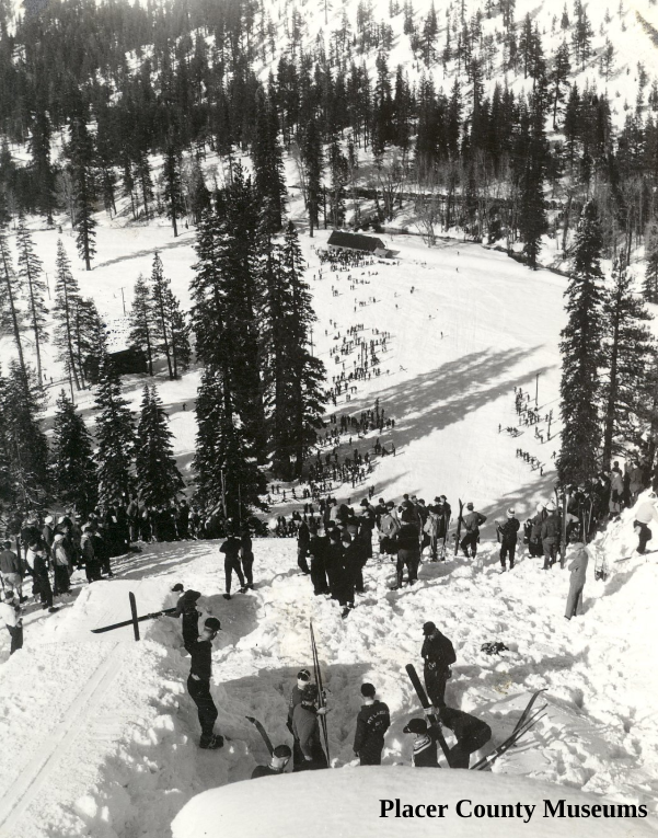
The Ski Jump for the Auburn Ski Club.
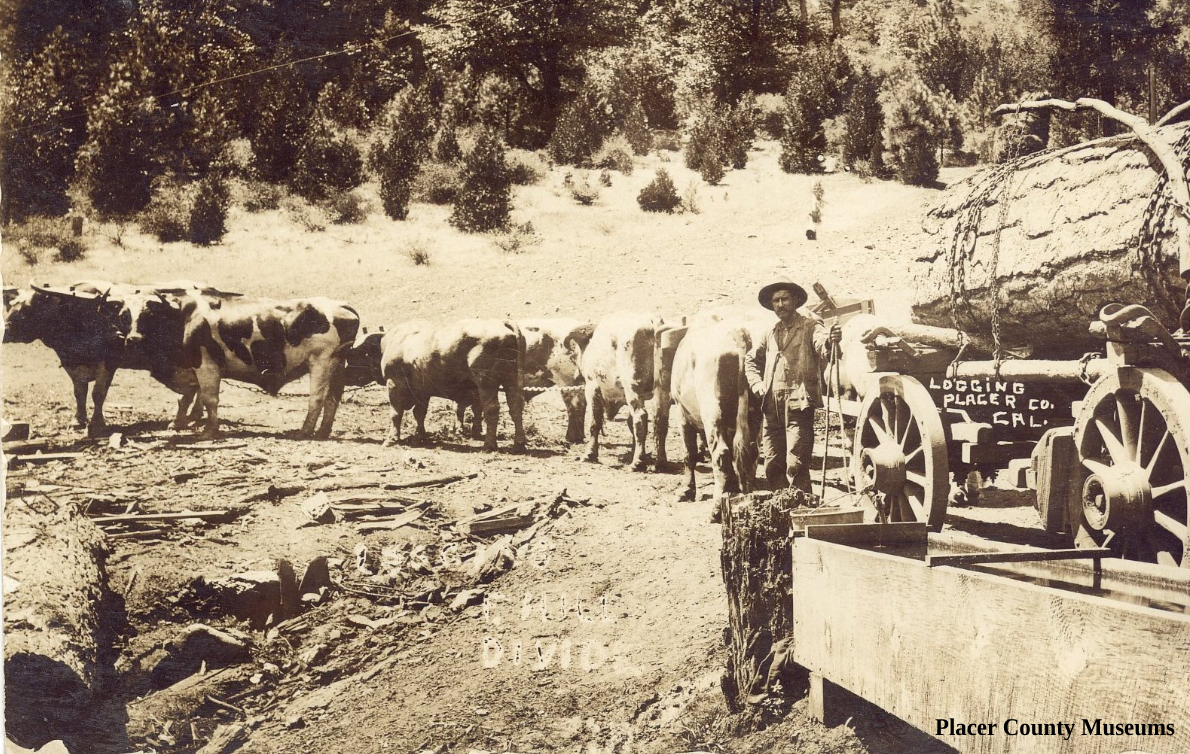
Logger and oxen.
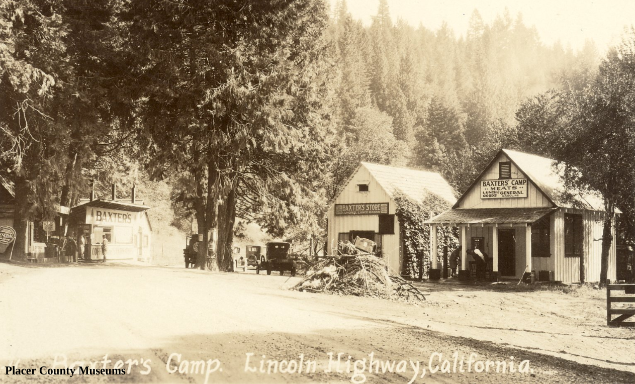
An early Lincoln Highway era photo of Baxter’s.
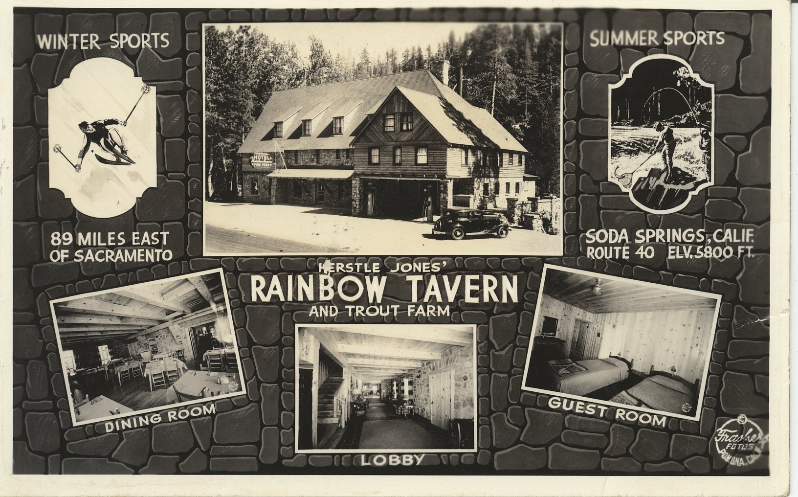
A wonderful postcard describing the activities one can enjoy.
This section of the town was destroyed when Interstate 80 was put in.
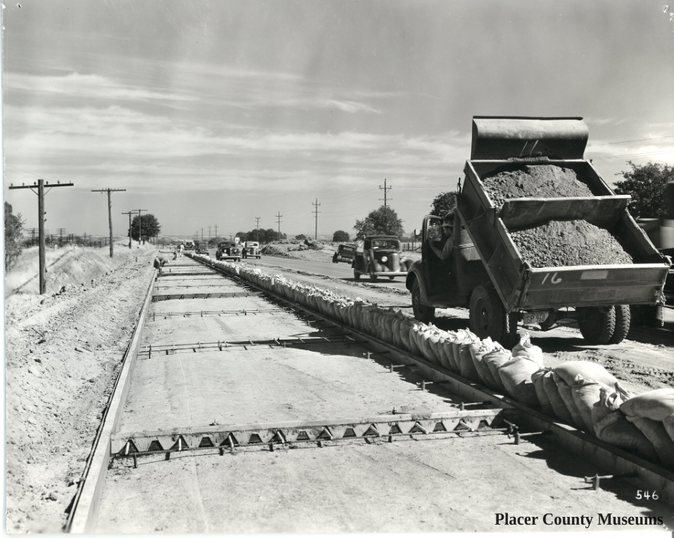
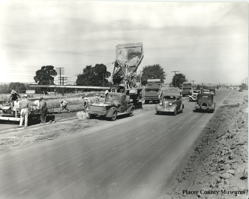
Between Rocklin and Roseville.
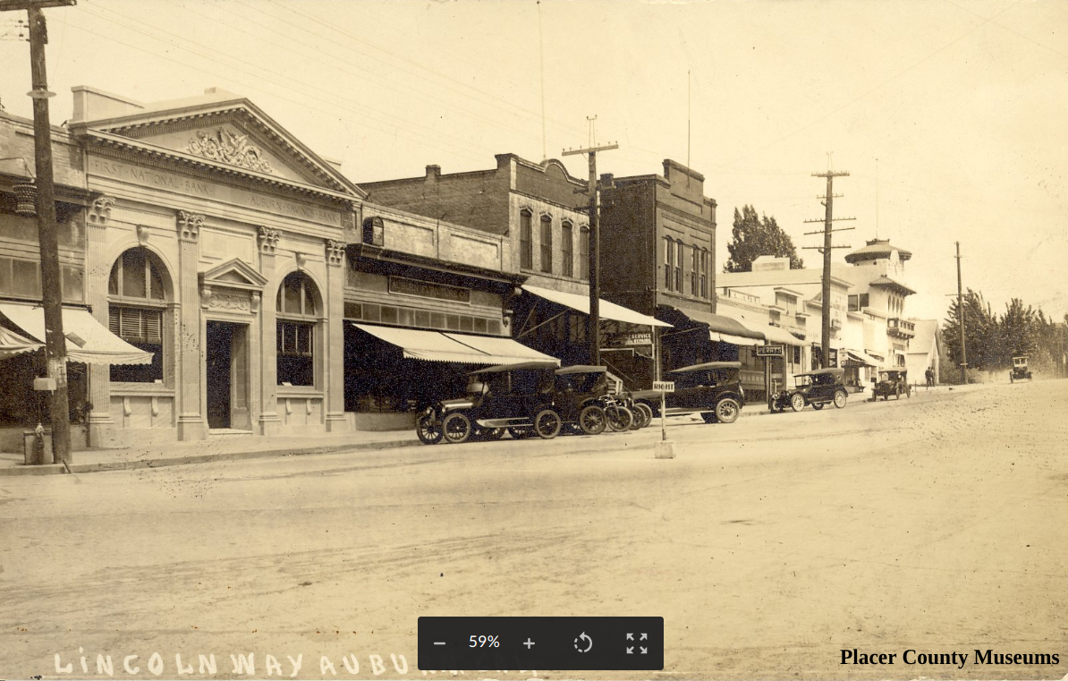
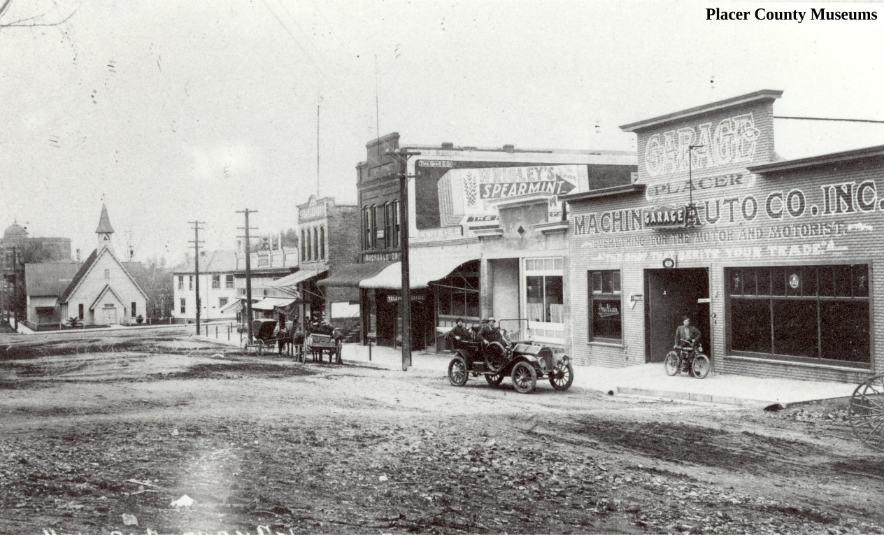
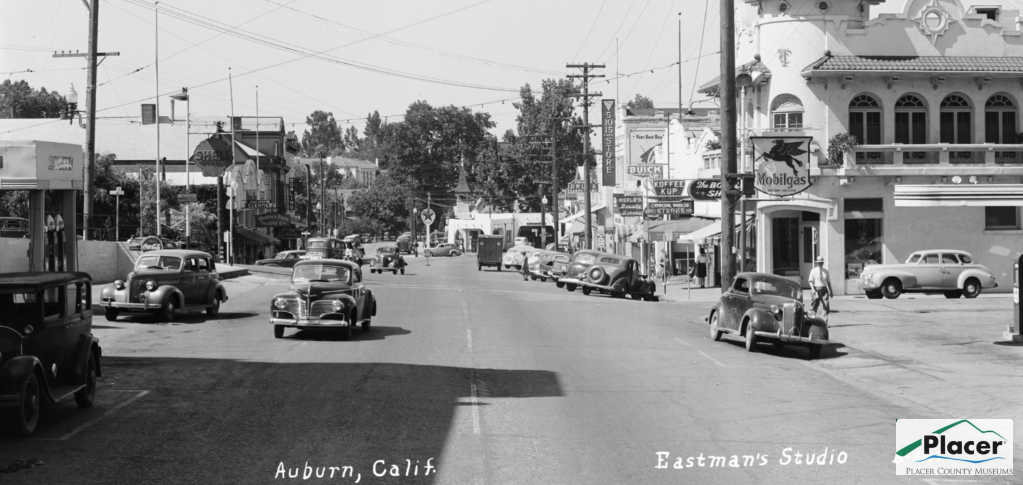
This is a photo showing the Lincoln Highway, looking north towards High Street. There is a car headed our way on that street. Check out the Lincoln Highway “L” painted on the telephone far left.

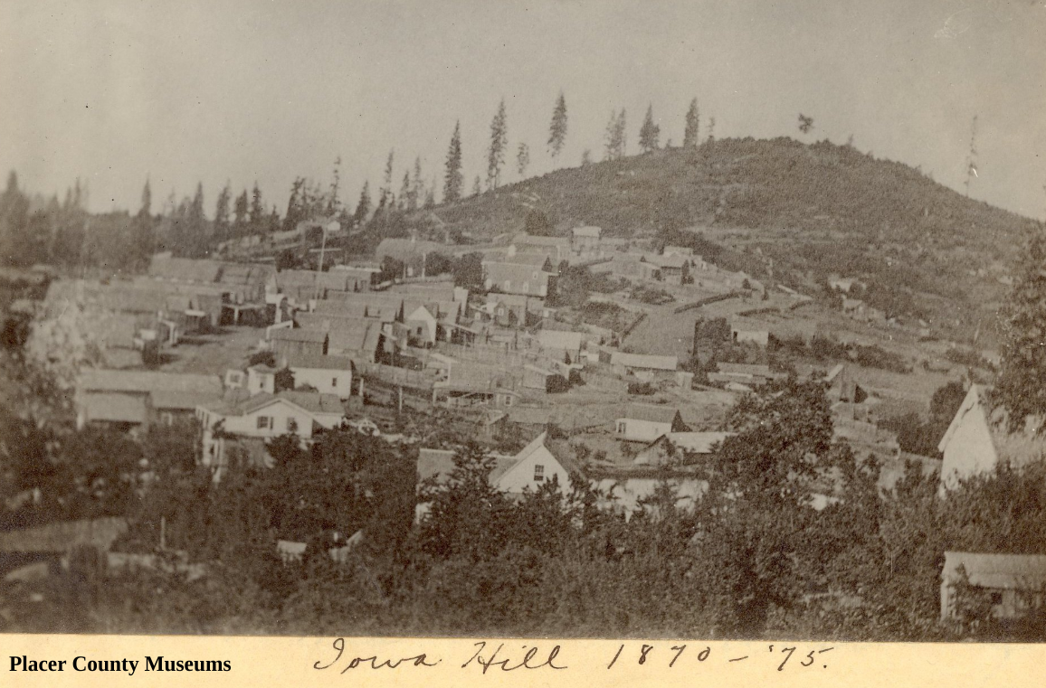
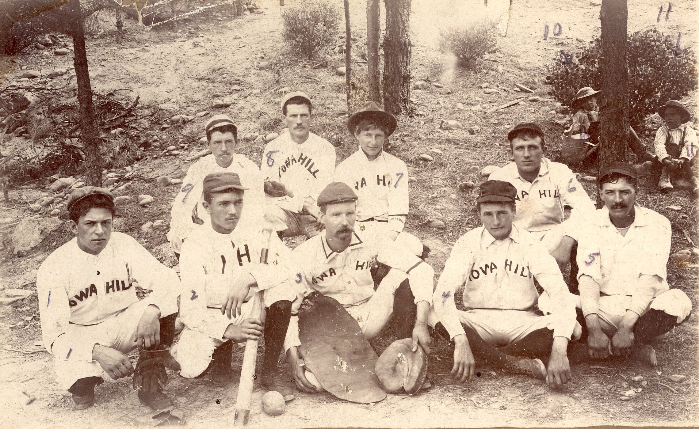
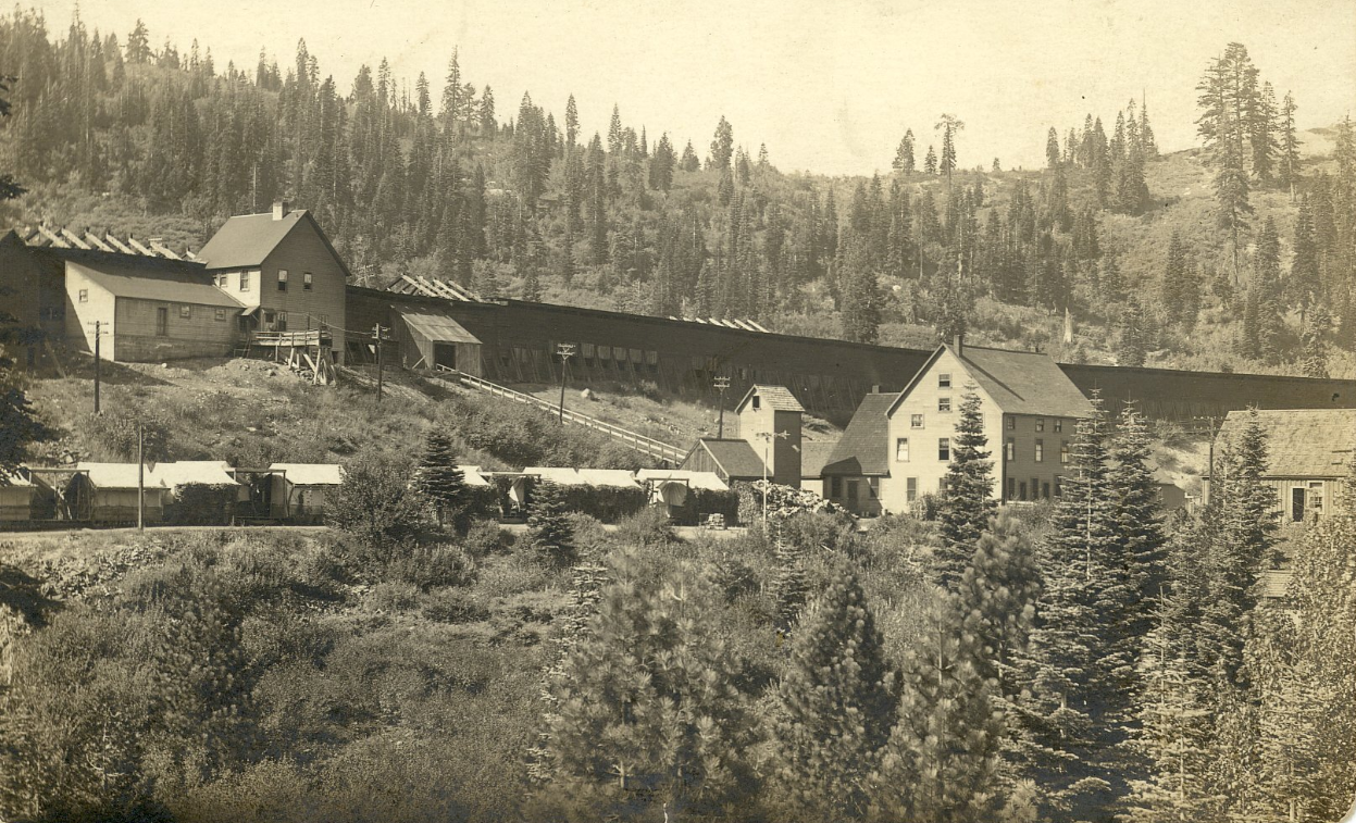
The town of Iowa Hill from a distance.
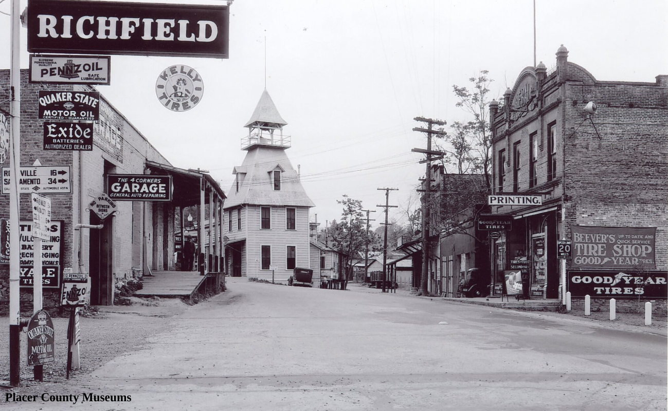
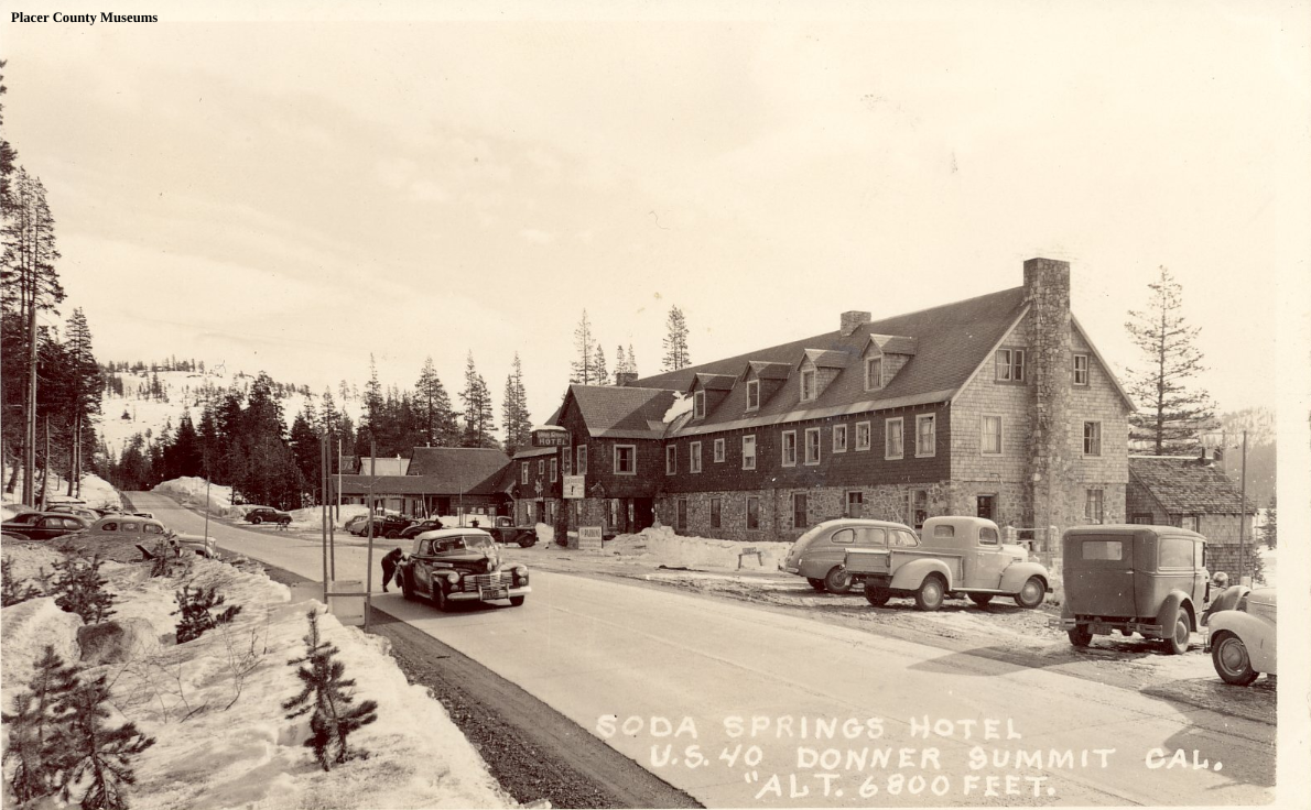
Highway 40 headed through town.
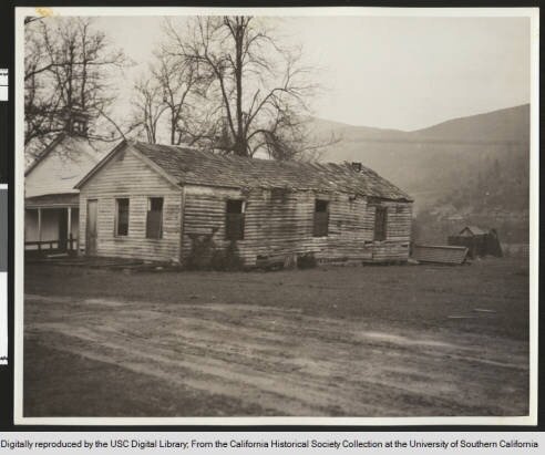
One of the few buildings left from the old days.
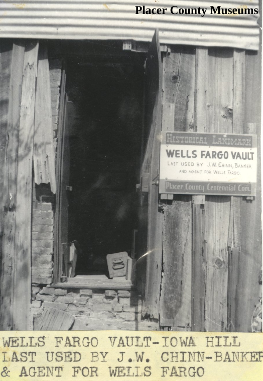
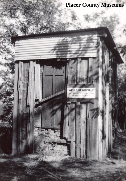
Last used by J.W. Chinn-Banker & agent for Wells Fargo.
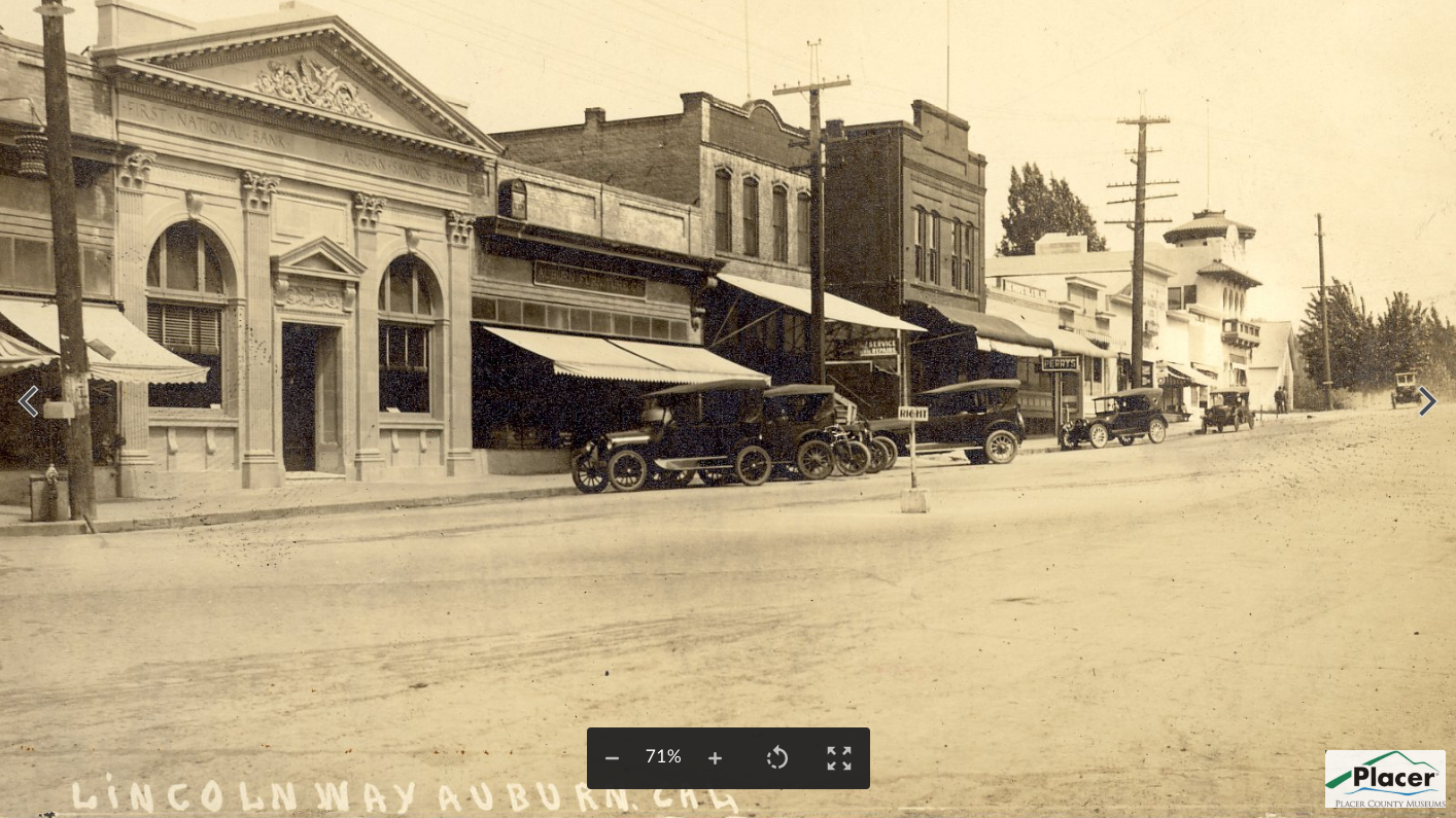
The Lincoln Highway “L” can be seen painted on the telephone pole far left.
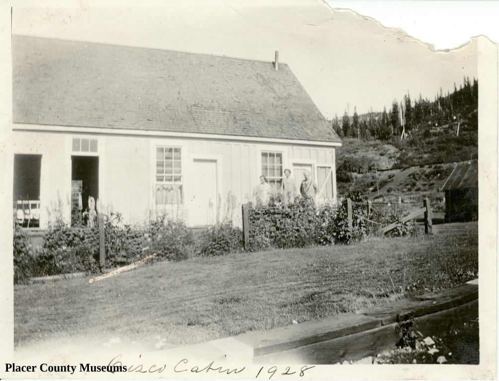
The tents are lined up below the Southern Pacific snow sheds near Cisco, the old railroad town.
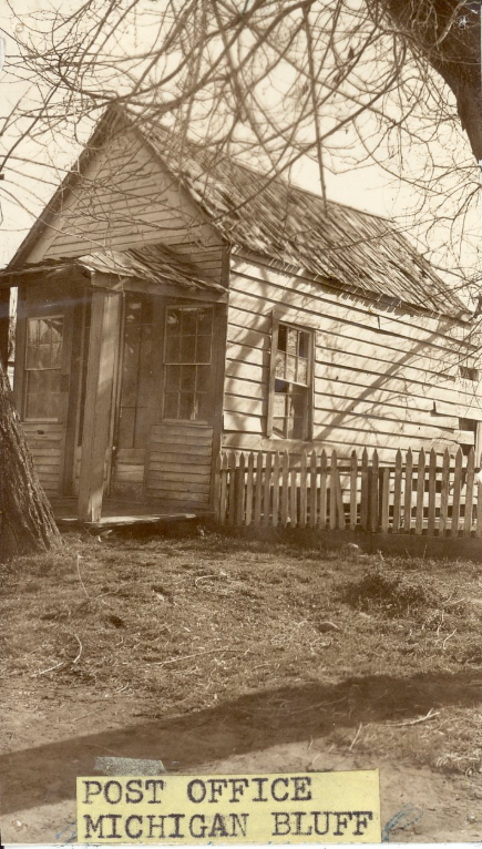
A pastoral scene from the old town of Michigan Bluff located 4.35 east-north-east of Foresthill.
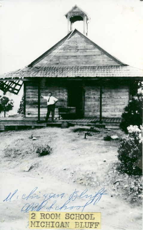
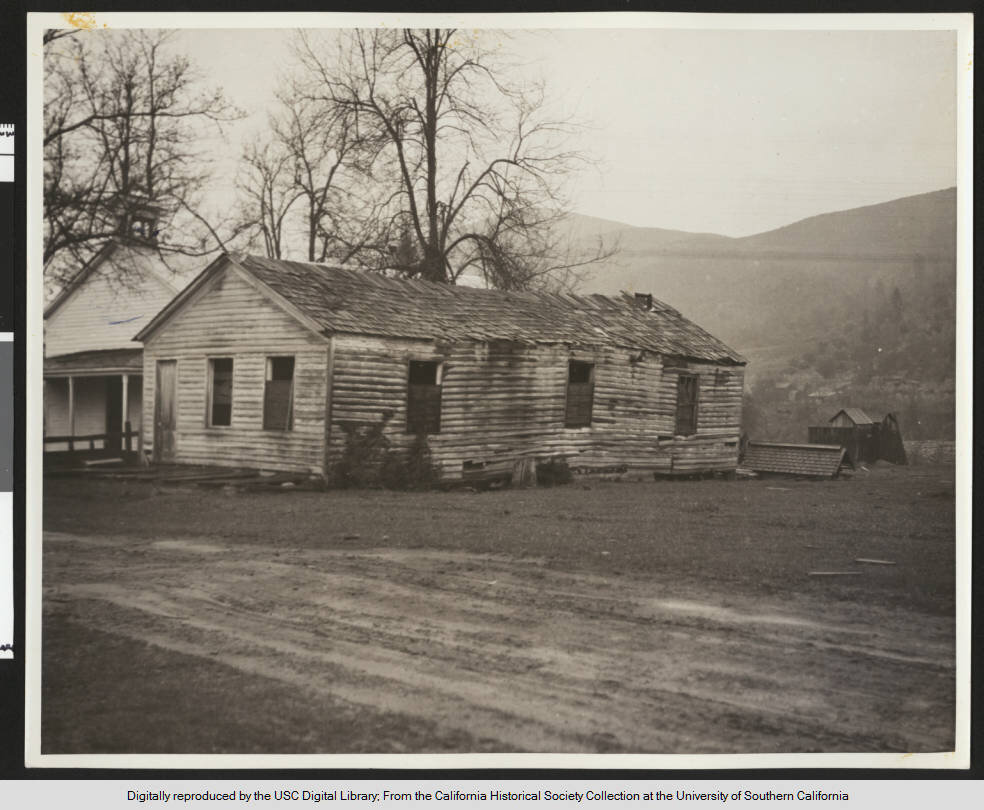
Michigan Bluffs two-room school House.
The Lincoln Highway went through town. This bridge is part of the downtown bypass.
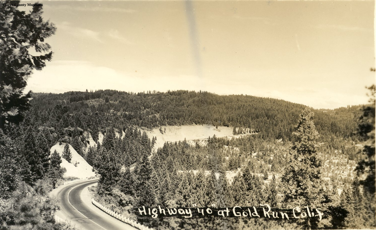
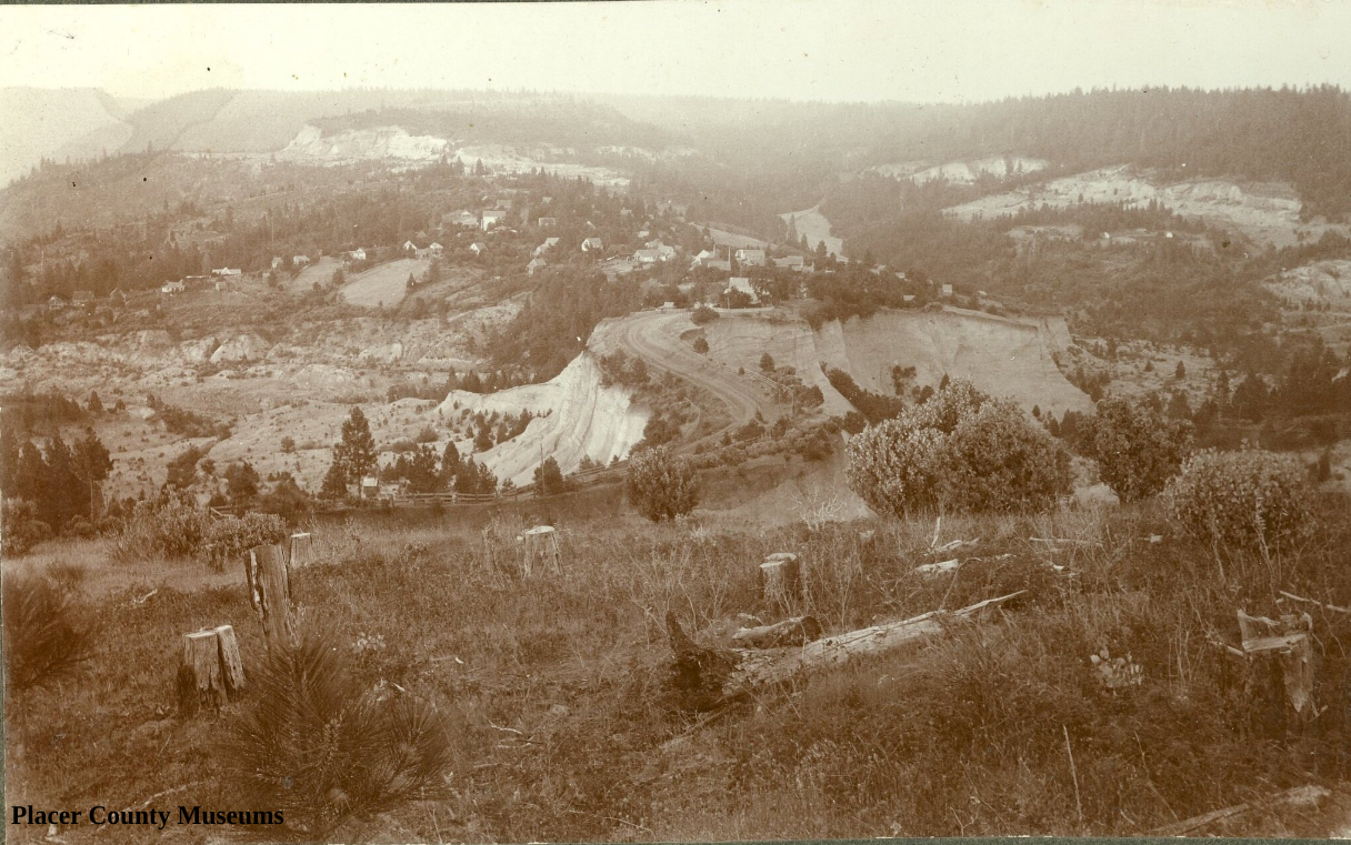
Hydraulic mining for gold caused the white cliffs you see while driving through Gold Run.
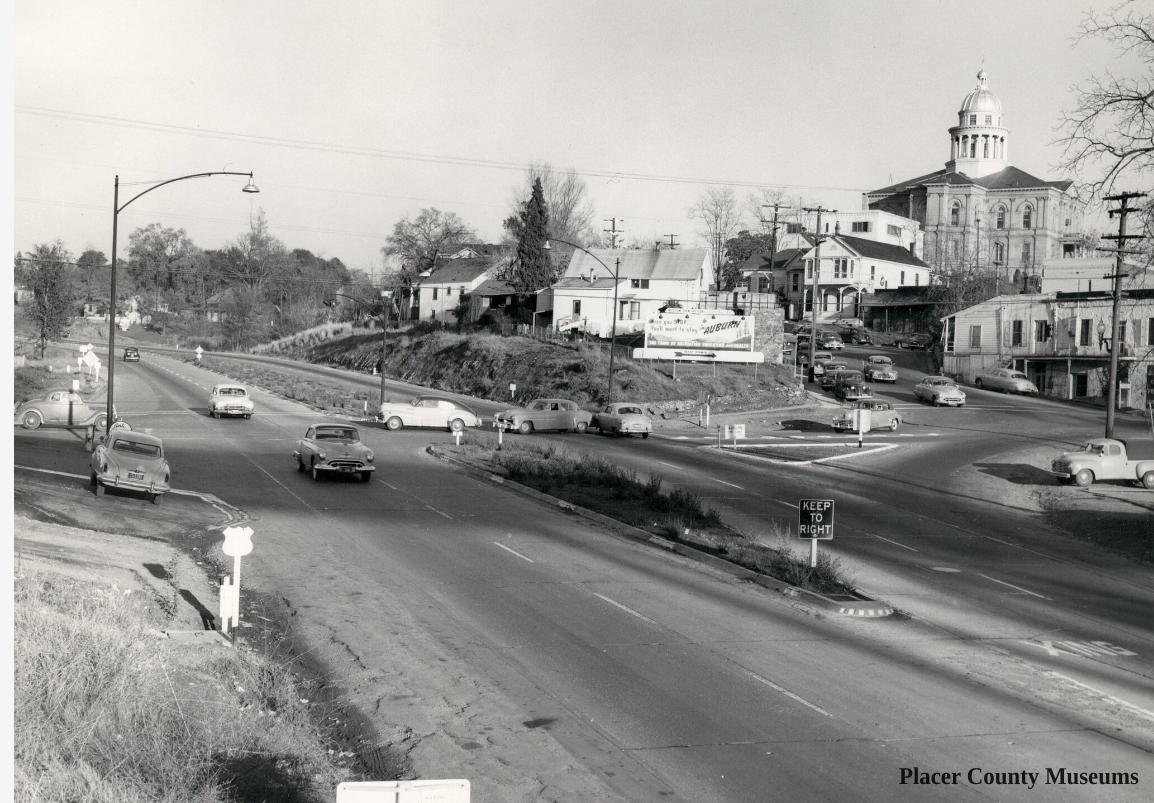
Quiet day on the highway in Auburn. This is now Interstate 80.
Photograph of an exterior view of the original Coloma schoolhouse, ca.1930. The schoolhouse stands center and appears to be made of logs. The windows on the front and side of the house are partially boarded while the door on the left and the walls are discolored and damaged. A second, lightly-colored building stands on the far left and appears to be much less damaged. Several leafless trees stand amongst the buildings, while a small shed can be seen behind a small fence on the right. The town and hillside can be seen in the distance.; Picture file card reads "The original schoolhouse built in the middle 1850s. A modern one now occupies the grounds to the right -- out of the field of the photo".
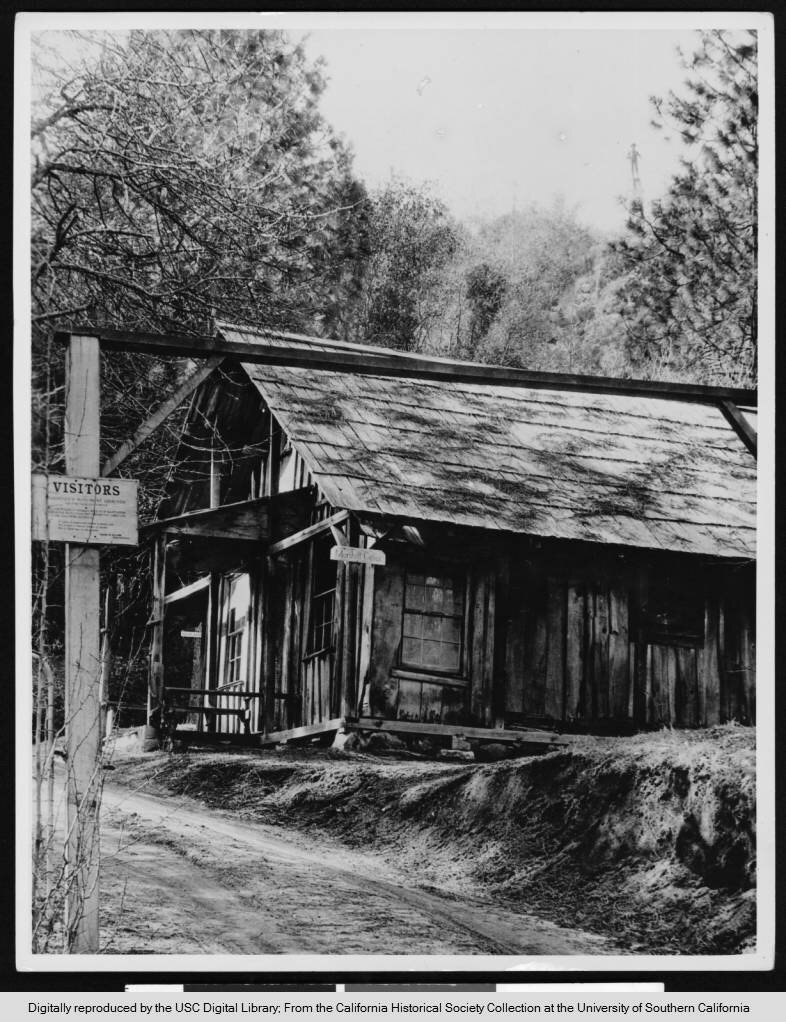
Photograph of an exterior view of the James Marshall cabin in Coloma, [s.d.]. A thin, dirt road extends from the foreground through a frame and a sign for "Visitors" to the woods on the left. The cabin stands at center on a raised dirt bank along the right side of the road. The porch sits on the left and leads to the entrance of the wooden cabin. Two rectangular windows can be seen on the front side of the cabin while two more, one covered in a film of dirt, can be seen on the right. The roof is shingled and covered in plant life while trees crowd the cabin just behind it.
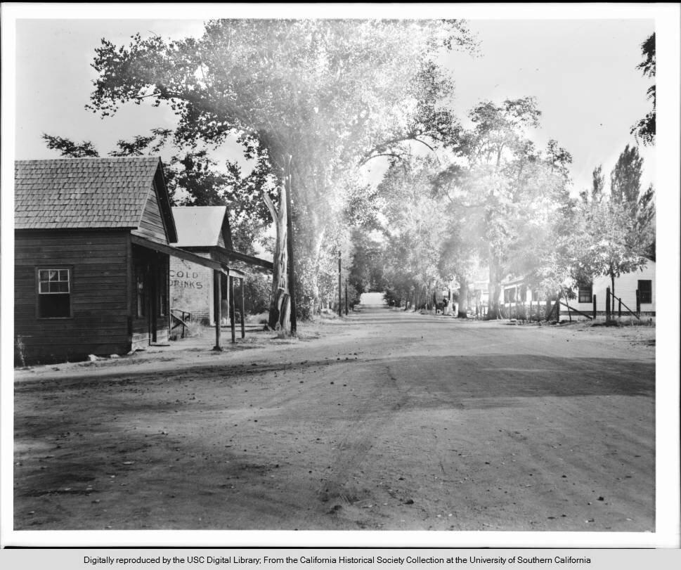
Photograph of an unpaved business street in Coloma, [s.d.]. The broad dirt road is lined with trees on both sides. There are two small buildings at left. Both are wooden and have covered porches. A sign on the second one reads "Cold Drinks". There are more buildings on the right, further in the background. Behind the buildings and out of view on the left is the American River, where James Marshall discovered gold in 1848.; At one time the population of Coloma was 5000; in 1935, it was only 85.
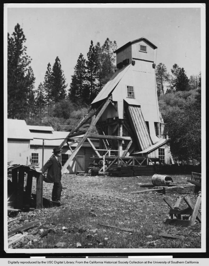
Photograph of a shafthouse of the Sherman Mine in Placerville, ca.1930. The bottom of the triangular structure at center is skeletal while panels cover the top half. Another lightly-colored structure can be seen just behind the structure and extending to the left. While poles and other supplies sit in piles against the tall structure on the right, a man in a suit and hat lean on a post and look towards the trees on the right. More supplies and debris are scattered on the ground on the right and in the foreground while trees and bushes cover the small hill around the shafthouse. "Shafthouse of the Sherman Mine perched high up on the hillside overlooking the town".
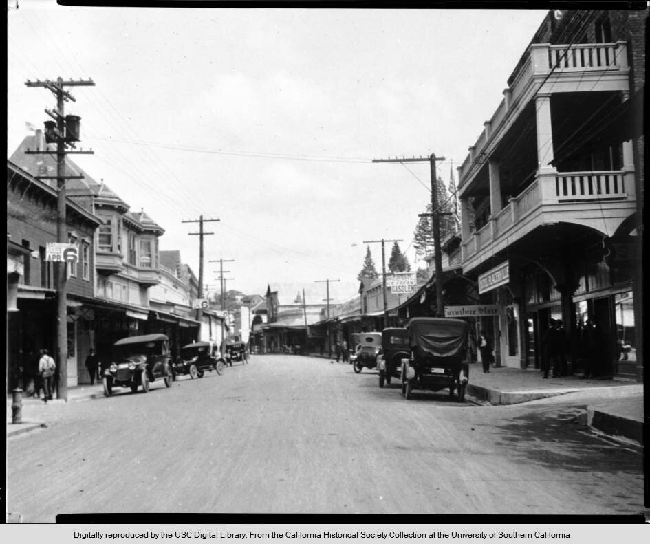
Photograph of a view of a commercial street in Placerville, showing the Hotel Placerville, ca.1930. The paved street occupies the foreground and bisects the image as it recedes into the distance, with several automobiles parked along each side. Two- and three- story commercial buildings, both brick and clapboard, line each side of the street, fronted by concrete sidewalks. A few townspeople loiter on the sidewalks, both at the far left and the far right. Two copies of a sign bearing the text "Apr 6" hang on successive utility poles on the left side of the street. Signs on the right side of the street, from left to right, include: "Forum Grand Royal Ice Cream Gasolene [sic]", "Furniture Store" and "Hotel Placerville". Placerville was formerly known as Hangtown. The building bearing the sign "Hotel Placerville", in the right foreground of the image, is known as The Cary House ; it was built in 1861, and was once the oldest hotel in the town.
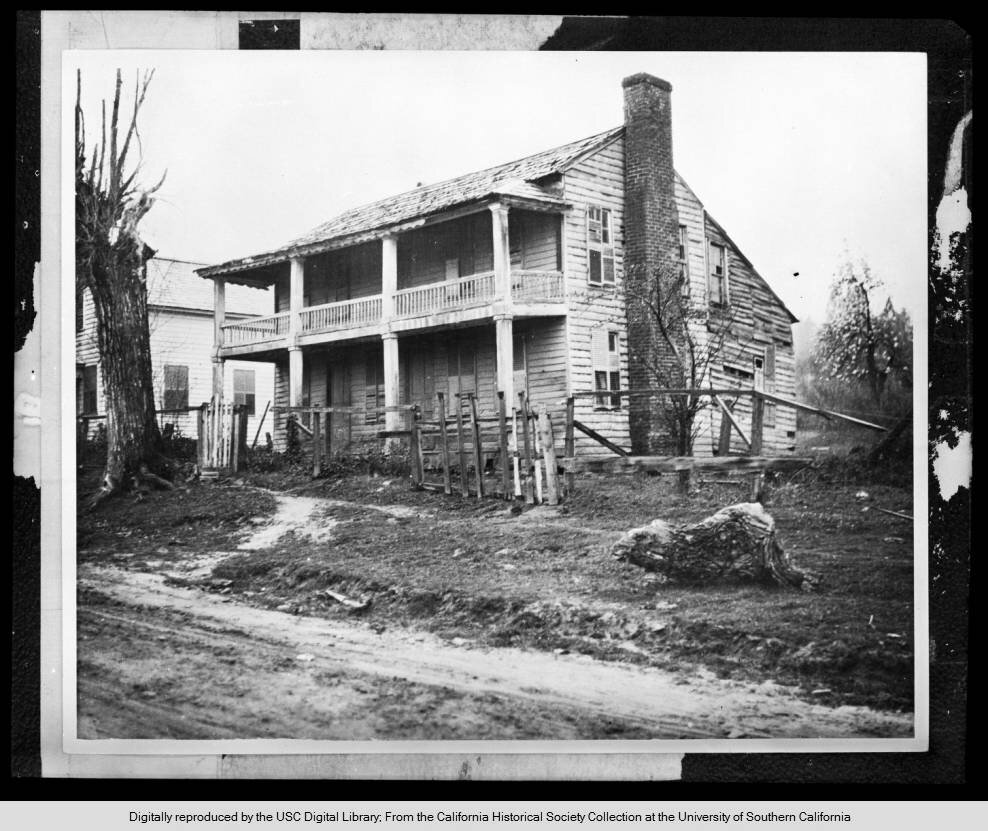
Photograph of an exterior view of the old home of T. Robertson in disrepair, ca.1930. A two-story Regency-style home is pictured at center, turned in three-quarters profile. In front, the tawdry remains of a picket fence dot the edge of sandy ground, with a dead tree visible to the left. The home itself is missing shingles from its roof, and several of its windows are misshappen or feature broken shutters. The second of the home that appears to be annexed to the back seems to be collapsing altogether. In later years, the home was owned by Mr. Alderson.
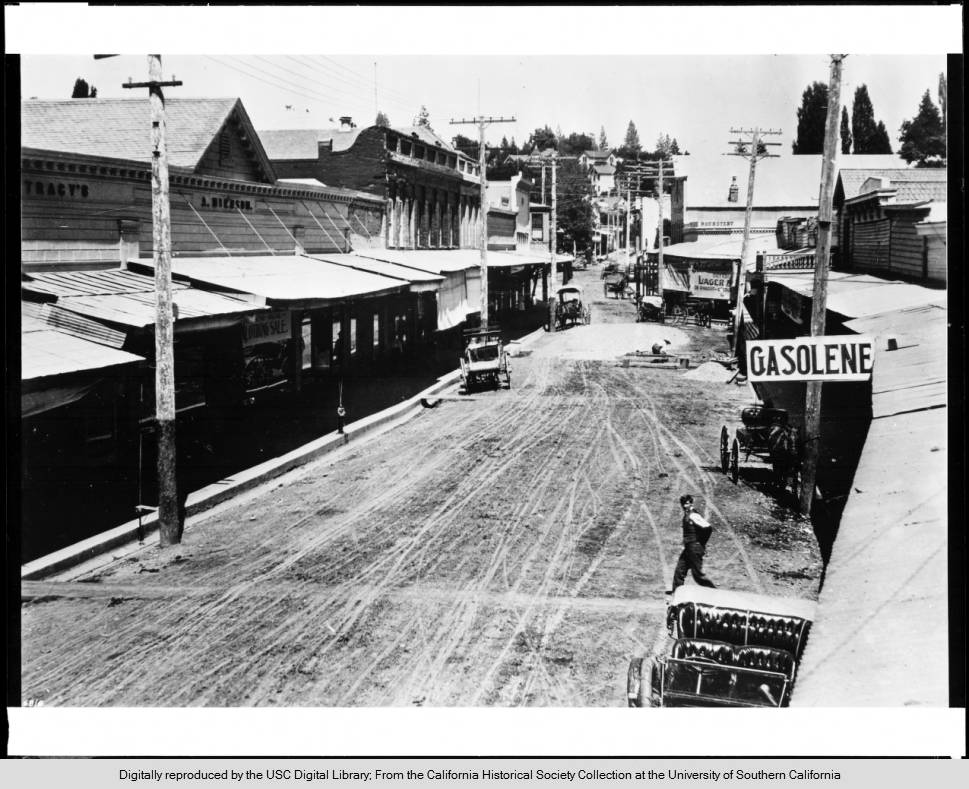
Photograph of a view of Placerville, "where gold is found in the streets", ca.1912. A man stands on the left on top of the raised sidewalk that is shaded by the porches of the buildings that line the sidewalk. The buildings are primarily brick with display windows surrounding their entrance. A lightly-colored street hangs from the porch of a building further down the left side of the street while even further down a boy can be seen crossing the street. On the right a wagon can be seen underneath a sign for gasoline while an American flag hangs low on the building next to it. Electrical poles line the street which appears to be crowded with buildings until tress can be seen in the distance.
The original Coloma School House.
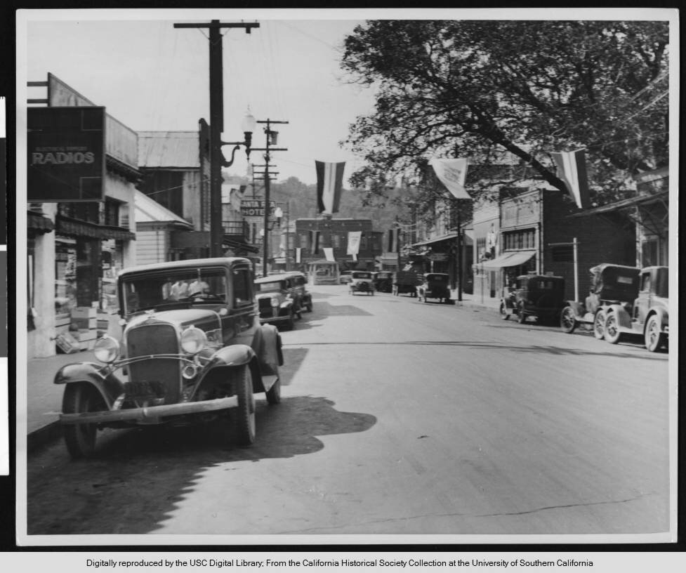
Photograph of a view of Main Street in Placerville, ca.1930. Many automobiles line the street while many buildings line the raised sidewalk. A line with several flags hanging down extends from the right where a tree stands and the left where a radio shop stands in the foreground. A store on the left has stacks of boxes outside the front entrance and a hotel can be seen further down. A brick building can be seen on the right as well as a truck with a fenced bed. More flags can be seen further down and a large building stands facing the end of the street. Light poles and electrical lines line the street and trees can be seen in the background.; Picture file card reads "Hangtown Creek -- in which most of the mining was done -- is in back of the buildings, on the right. The town started in 1848, then known as 'Dry Diggings'. Next year, the name was changed to 'Hangtown' and it took the present name in 1854".
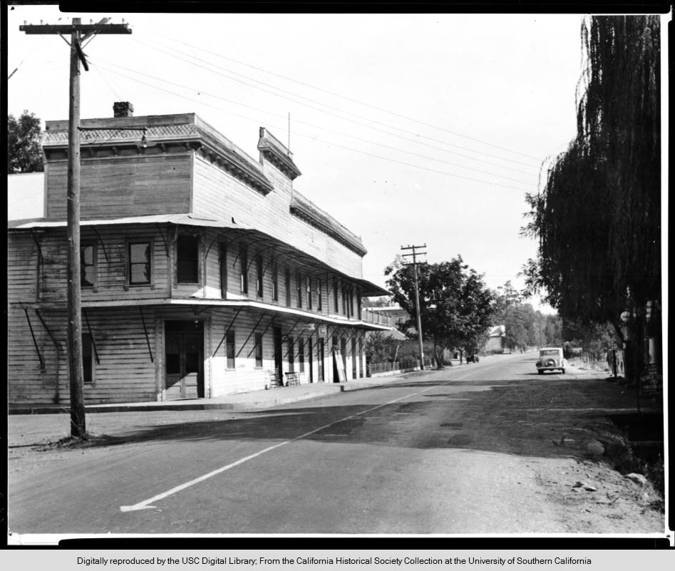
Photograph of a view looking down an unidentified road past the El Dorado Hills Hotel, ca.1930. The three-story hotel is pictured on the right side of the street, jacketed in clapboard siding. The first two floors each feature an awning which extends over the windows and doors. To the right, a ditch can be seen in the foreground, while an automobile can be seen farther away. A long arrow can be seen painted on the narrow, paved road at center.; Old Hills Hotel built 1852. El Dorado Bar on the corner -- almost deserted today -- El Dorado once had a population of many thousand and was an incorporated city.
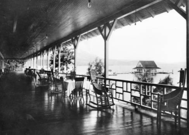
Photograph of a view of what appears to be the Tallac Casino Veranda overlooking Lake Tahoe, ca.1910 The veranda is in the foreground at left and has a wooden ceiling and floor. There are several chairs, including rocking chairs and wicker chairs, as well as three square tables. In the distance at right, the lake is visible, and a long dock juts into the water from left. There is a boat house at the end of the dock. A tall mountain is faintly visible in the background.
Photo: Public Domain. “University of Southern California. Libraries” and “California Historical Society”
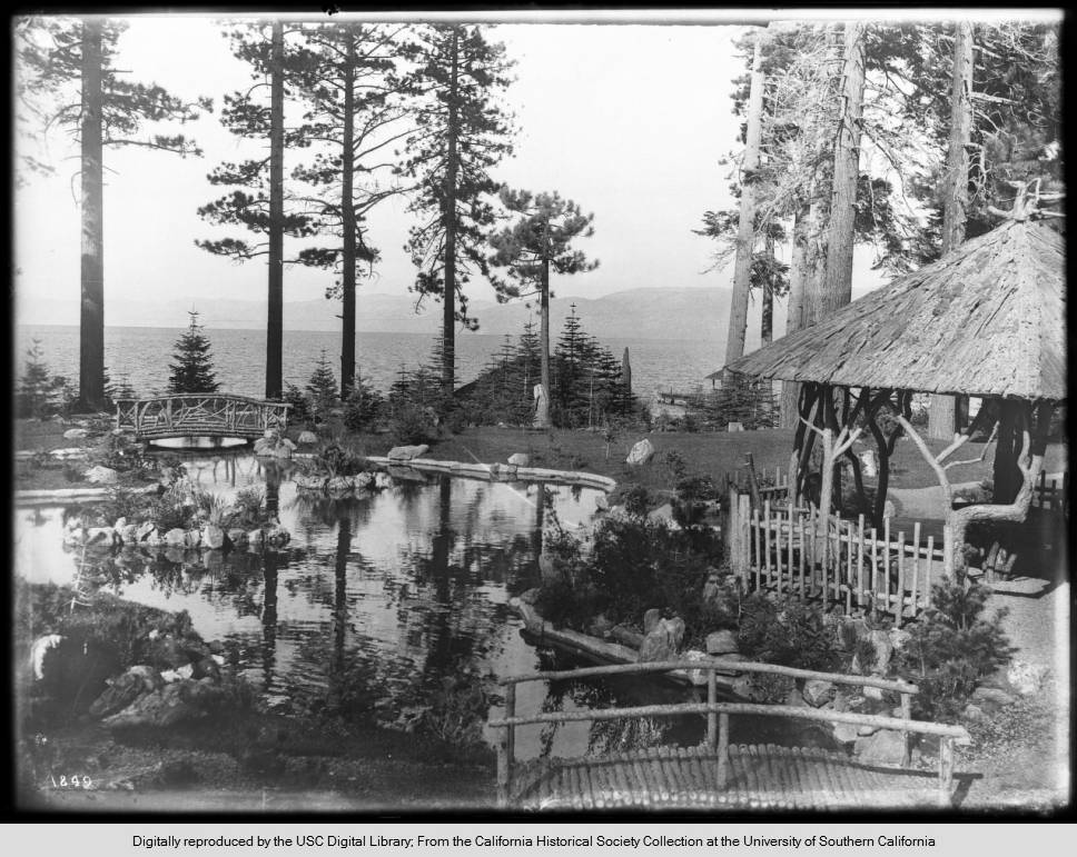
Photograph of the pond and two log bridges at the Tevis Estate at Lake Tahoe, ca.1910. The well-groomed landscape is dotted with fir trees and aesthetically placed rocks. The pond can be seen at left, while a pavilion-like structure with a roof provides a shady resting spot at right. The lake is visible through the trees in the background, while mountains are visible in the distance. Additional information: As of April 2018, the garden still exists. This estate is part of what is now called Tallac Estates.
Photo: Public Domain. “University of Southern California. Libraries” and “California Historical Society”
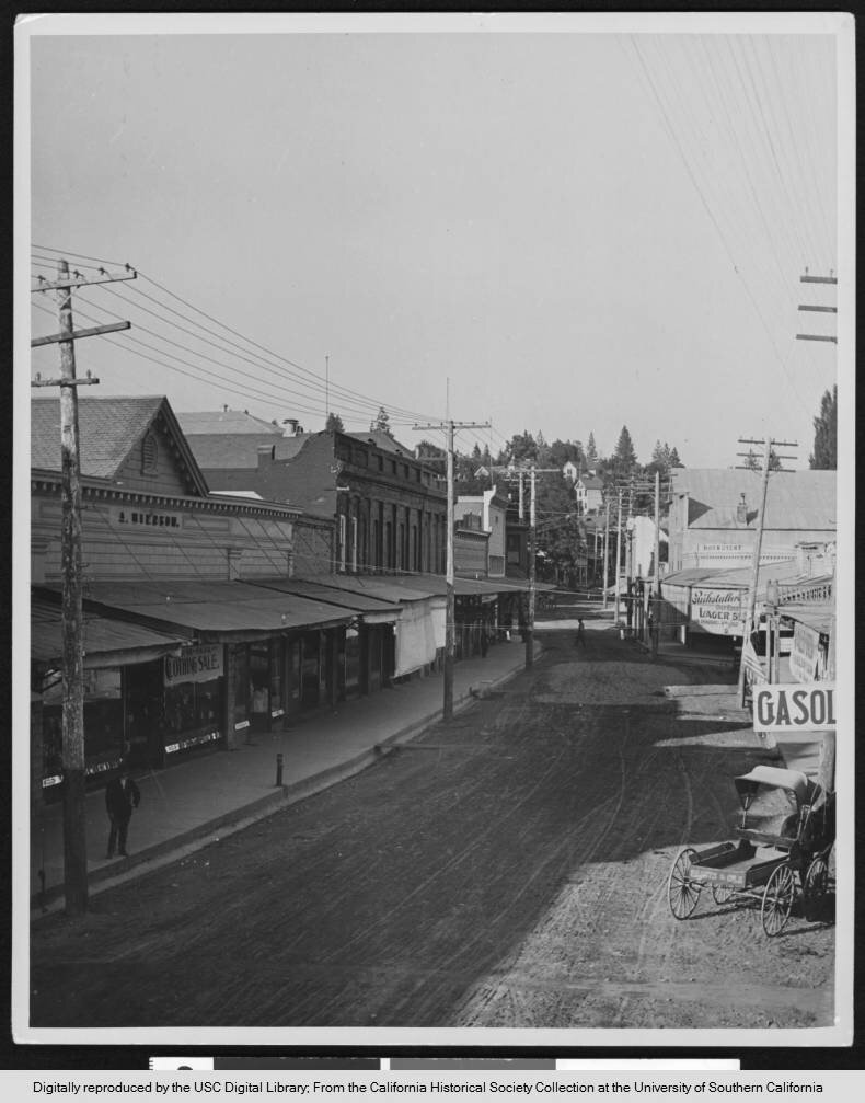
Photograph of a view of a road in Placerville city, El Dorado, California, ca.1912. Horse-drawn carriages are parked along either side of the unpaved street. In the foreground, a man is walking across from right to left, near a sign that reads "Gasolene". Further back, a second man sits on a bench which appears to be situated more or less in the center of the road. Saloon-style buildings with wooden canopies line the street to either side along with utility poles. A house is visible on the hill in the distance, along with trees. Legible signs include: "Clothing Sale", "Roundtent", and "[...] Lager [...]". Picture file card reads: "'Where gold is panned out of the streets.
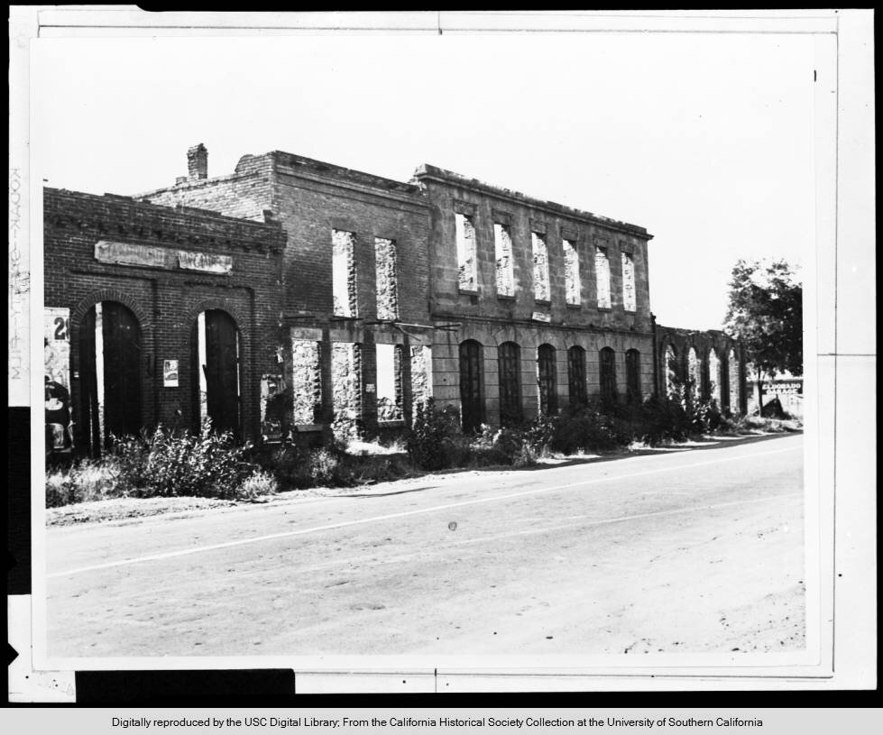
Photograph of the last ruins of the business section of El Dorado, ca.1930. Three flat-faced commercial buildings are pictured just in from the road that cuts across the image from the bottom left to the center right. The buildings -- the leftmost two made of brick -- ascend in height as they progress towards the right. The backs or roofs appear to have collapsed as light can be seen trickling through their glassless windows.; Picture file card reads: "The last of the crumbling ruins of the great and famous mining town of El Dorado that started as a camp, grew to be an incorporated city of many thousands in population and dwindled to a garage, a church and two or three dwellings".”
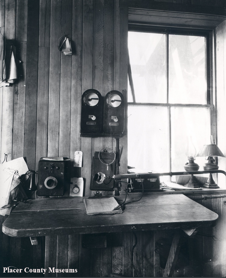
Wonderful still life of the desk at the Soda Springs Train Station.