Donner Pass railroad underpass

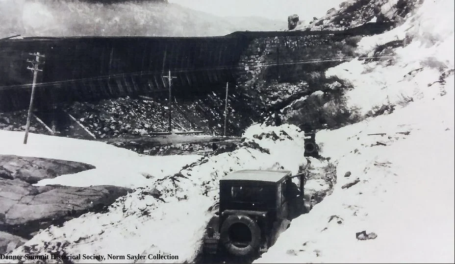
At Donner Pass the Lincoln Highway (1913-1927) did not cross the railroad at grade for long. In 1914 an auto subway opened under the Southern Pacific snowsheds so cars could pass under the rails instead of through them.

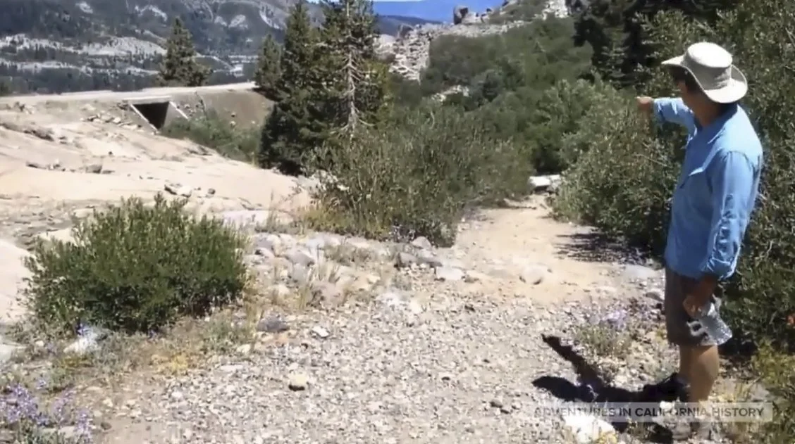
This walk reaches that underpass, often called California's first railroad underpass built for automobiles. It carried the road until the 1926 bridge moved traffic onto a new alignment. Same rocks. Same pass. Old emigrant trail still underfoot.

Would you have driven under those trains in 1914?

Transcontinental Railroad central shaft at Donner Summit, 1868

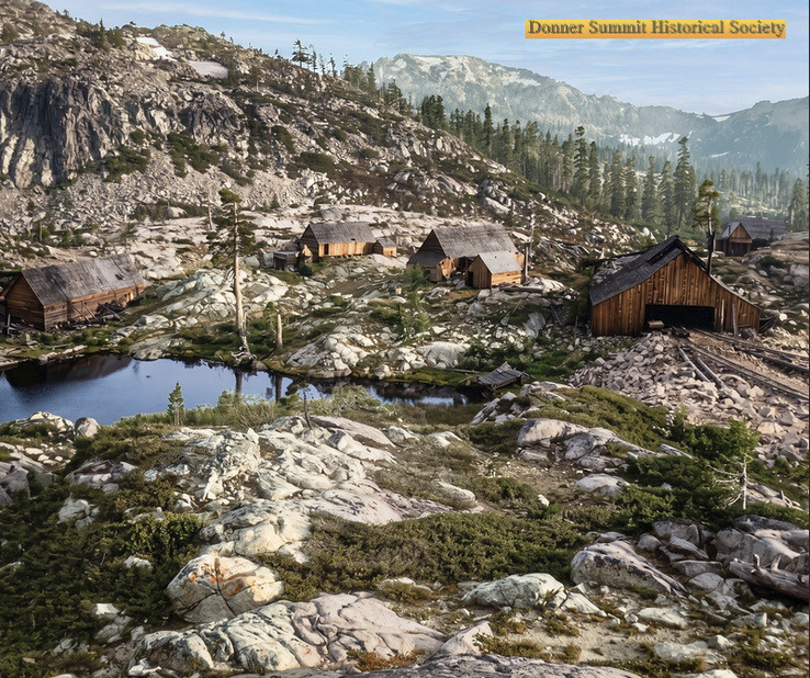
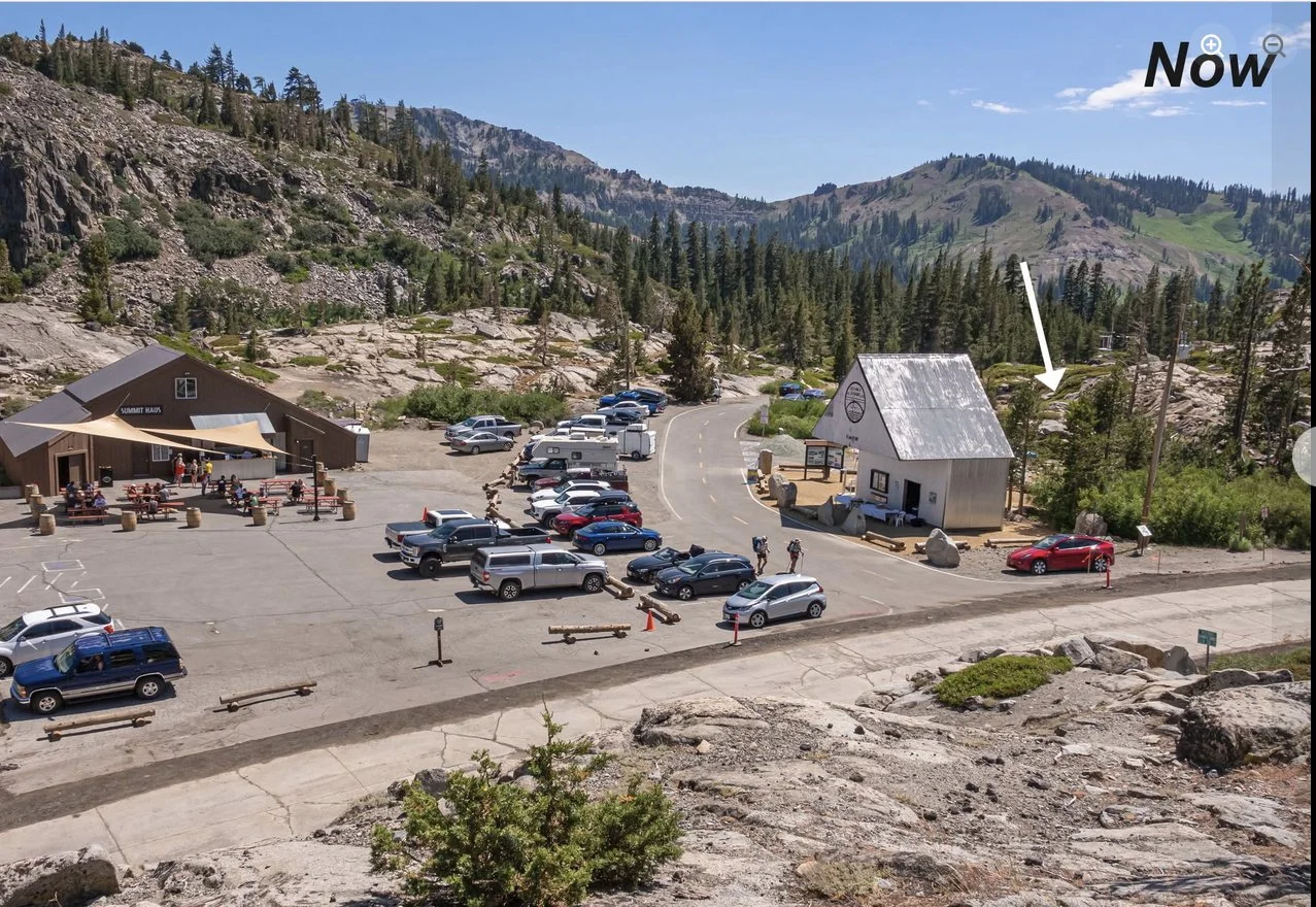
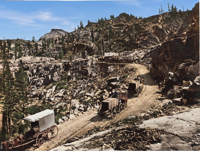
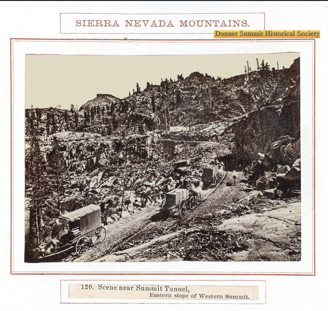
Here is a cool photo showing the construction of the Transcontinental Railroad in 1868. The central shaft was located under that building, with the tracks going into it in the photo on the right. Today that same spot is shown with the white arrow in the photo on the right. We don’t know what happened to the pond. How many of you have stood at Donner Summit, or traveled through the tunnels? Original 1868 photo in comments.

Stay in your lane (Tama County, Iowa)

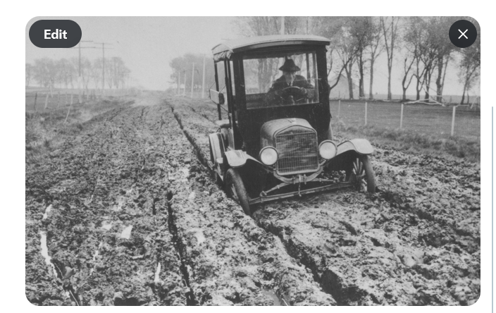
"Stay in your lane!" Not hard to do when your wheels are knee-deep in mud.

As the California Lincoln Highway Association archivist, I recently acquired a treasure trove of Lincoln Highway (1913-1927) material from our former archivist, Gary Kinst. Much of it is California-based. There is also material on the entire stretch from New York to California. Let’s explore this highway together.

Starting with this photo of Tama County, Iowa, which was infamous on the original Lincoln Highway (1913-1927). After rain, the rich Iowa soil turned into "gumbo" that packed wheels and threw mud "higher than the telephone poles," Henry Joy of the Lincoln Highway Association wrote after getting stuck near Tama. The 1924 Official Road Guide to the Lincoln Highway even warned that trying Iowa dirt roads right after a rain was "folly."

Imagine leaving New York for California and having to time your trip to avoid this. That is why the Lincoln Highway (1913-1927) was created: a paved coast-to-coast highway.

Ford Model T on the Lincoln Highway in Placerville

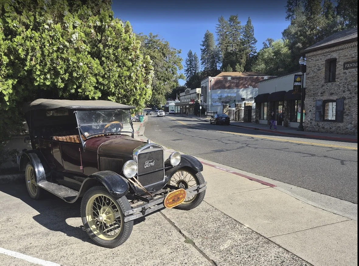
A Ford Model T sits at rest next to The Lincoln Highway (1913-1927) in Placerville. The wooden license plate in front says “Hangtown, CA,” which was Placerville’s name in the 1850s. I’m told by Grok that this is a Model T Touring Car, about 1917-1922. How close is that date range?

California Trail west of Tragedy Spring (1848)

We are still on the California Trail (1848), approximately 1/2 mile west of Tragedy Spring. One thing you’ll note is the extensive fire damage in the forest that has yet to be cleaned up. There is no “trail” to follow on the ground. We had to spot unburned trail markers in the trees, with many missing. No GPS up here either, so we couldn’t trace our tracks. I find it amazing that this was a Transcontinental “highway” of the 19th Century. There is something special about being here. We’re walking in the footsteps of history.

Maiden's Grave to Tragedy Spring on the 1848 California Trail

We decided to see if we could complete the hike we started a few weeks ago, from the Maiden's Grave to Tragedy Spring in Amador County, along the 1848 California Trail. We only got so far, as fire had wiped out many of the trail markers. We stopped last time on an eastward journey because we couldn't find the trail. This time we decided to head west from Tragedy Spring. We found the trail and completed the hike. We found some cool stuff along the way; I will relate it in another video. Coordinates: 38°38'22.64"N 120°08'48.66"W

The 1852 Johnson Cutoff Trail at Lake Tahoe by Cave Rock

The 1852 Johnson Cutoff Trail at Lake Tahoe by Cave Rock. There are still deep wagon swales visible. One of the clearest places left where you can walk in the exact tracks of the pioneers. The view over the lake makes the climb worth it. The trail comes back out on Highway 50.

Hope Valley, Alpine County: Pioneer Trail at Carson Creek

Monica and I headed out to beautiful Hope Valley, Alpine County, to see the California Pioneer Trail where it crosses Carson Creek.