
Monday took us to the high country for one last chance to enjoy it before the first snow of the season, maybe on Thursday. Monica and I had On Yesterday, Monday, we had intended to visit Yesterday, Monday, we had intended to visit Prosser Reservoir, just north of Truckee, to follow the old Emigrant Trail. We never made it! We usually pick some destination as a goal, but if we find something else along the way that interests us, we will change plans, and that's what happened Monday.
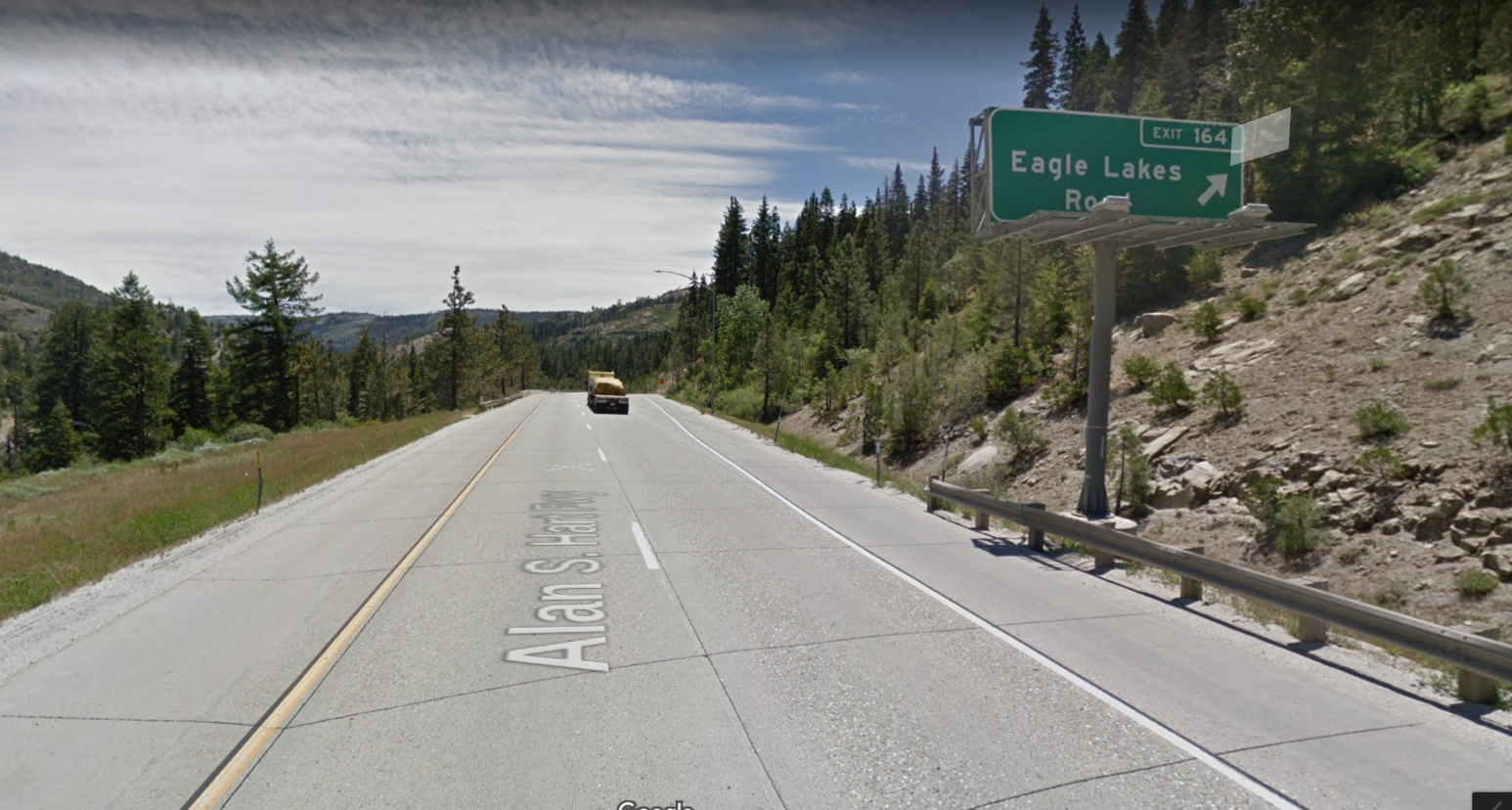
Eagle Lakes exit on the eastbound lanes of Interstate 80.
On the way, we had decided to visit Eagle Lakes Road, just of Highway 80. If you turn right after exiting the freeway, you have access to the original Lincoln Highway. There is a T marker there indicating it was also the Truckee Trail Emigrant route. We had made that visit a couple of weeks ago but now wanted to turn left and cross under the freeway as we had seen some homes there, between the two expressways. The area is so narrow and surrounded by cliffs that Interstate 80 has two routes over this place. One is the eastbound lanes and the other the westbound lanes, separated by about a quarter mile. Between these two expressways, the south fork of The Yuba River passes, with a few cabins built along the river. Just as we were passing across the river, we noticed another road, which I assumed to be a lost section of Highway 40, the highway that predated Interstate 80.

Highway 40 was built in 1926 and operated as an Interstate highway system until the present Interstate 80 was constructed in 1956. Highway 40, in many cases, followed the old Lincoln Highway, which was America’s first transcontinental automobile road. In this area of The Sierras Highway 40 followed the Yuba River, while The Lincoln Highway and the emigrant trail avoided the steep, narrow canyon and followed a route on a ridge top.

On this map you can see the amazing number of trail and routes through this narrow gap in the mountains. The red line is the lost section of Highway 40 we walked. The blue line in the Emigrant Trail and the original alignment of The Lincoln Highway. The yellow line is The Union Pacific Railway, and the white lines are the two sections, eastbound and westbound of Interstate 80. What’s no shown is the oil pipeline and cable lines that also transverse this spot. Amazing place!

Once we left the car and started walking down the old roadbed, we were greeted by this fantastic rock retaining wall. They had to do this as there was no other way to support a road in this narrow canyon. It appears that after highway 40 the people who built Highway 80 decided to split the expressway and avoid this tight place. The old roadbed runs about a quarter mile to an old bridge crossing which has had the bridge removed. The remains of the bridge were used to make a retaining wall for the new Interstate 80.

Old site of Highway 40 bridge, with present day Interstate 80 bridge, westbound lanes behind.
What a fantastic find for us. I imagine very few people have seen this as most are speeding by on Interstate 80, and there are no services at The Eagle Lakes exit. It's fun to explore these old sections of road as you can hear the present travelers speeding by on the Interstate, oblivious to the history around them. This spot is an example of why we "slow down and take the road less traveled".
Here is a short video of our Eagle Lake Roads adventure.