
The Lincoln Highway was America’s first transcontinental highway in 1913. You could cross the country following local roads, but piecing them together into one grand cross-country trip was difficult. What the Lincoln Highway did was put a route that you could follow on a map, and along with directional signs, you could head out from Times Square, New York, and follow the road all the way to the Palace of the Legion of Honor in San Francisco.
In California and Nevada, unlike other states, the Lincoln Highway spit into two separate routes. One route entered California near Verdi, Nevada, and roughly followed the current Interstate 80 to Sacramento. The other “scenic route” entered California at Stateline, Nevada, and roughly followed the current Highway 50 through Placerville and into Sacramento. Once in Sacramento both routes followed the same path to San Francisco.
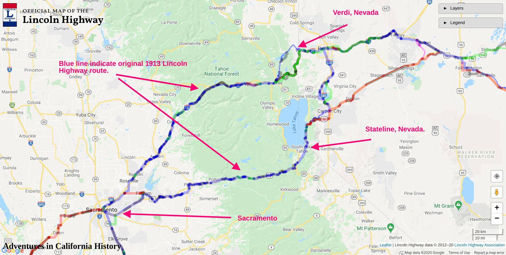
The map above, which is interactive, can be found here at the Lincoln Highway Association website. I have marked the map with the location of the two routes and their entry spots along the border between Nevada and California. A motorist back in the day would make the decision on which route to follow when they were in Reno. It’s in Reno where the road splits and follows the two different routes. Leaving Reno the motorist headed down to Carson City and up and over the mountains to Stateline and South Lake Tahoe.

The photo above was taken at Stateline sometime after 1928. We are looking into Nevada from the California side, as we can see the Nevada state line sign on the right. The red arrow is pointing at a Lincoln Highway concrete directional post. 2,436 of these posts were installed by the Boy Scouts of America on September 1, 1928 at 9:00 AM, across the country. This was the Lincoln HighwayAssociation's final act as the Highway was now numbered, Highway 50, and the association disbanded. Since we know the date these markers were placed, any photo with the posts shown is after September 1928.

In the above photo we see a couple of tired looking scouts and their marker in 1928.

In our next blog post we will be traveling down Pioneer Trail, headed west on the old Lincoln Highway. The next stop will be along Pioneer Trail at a very cool old bridge site and a Trails West “T” marker letting us know this is also the old pioneer Johnson’s cut-off trail. The original 1913 route of the Lincoln Highway often followed the older pioneer trails over the mountains of California and Nevada, making it a great road to follow and experience our amazing history.