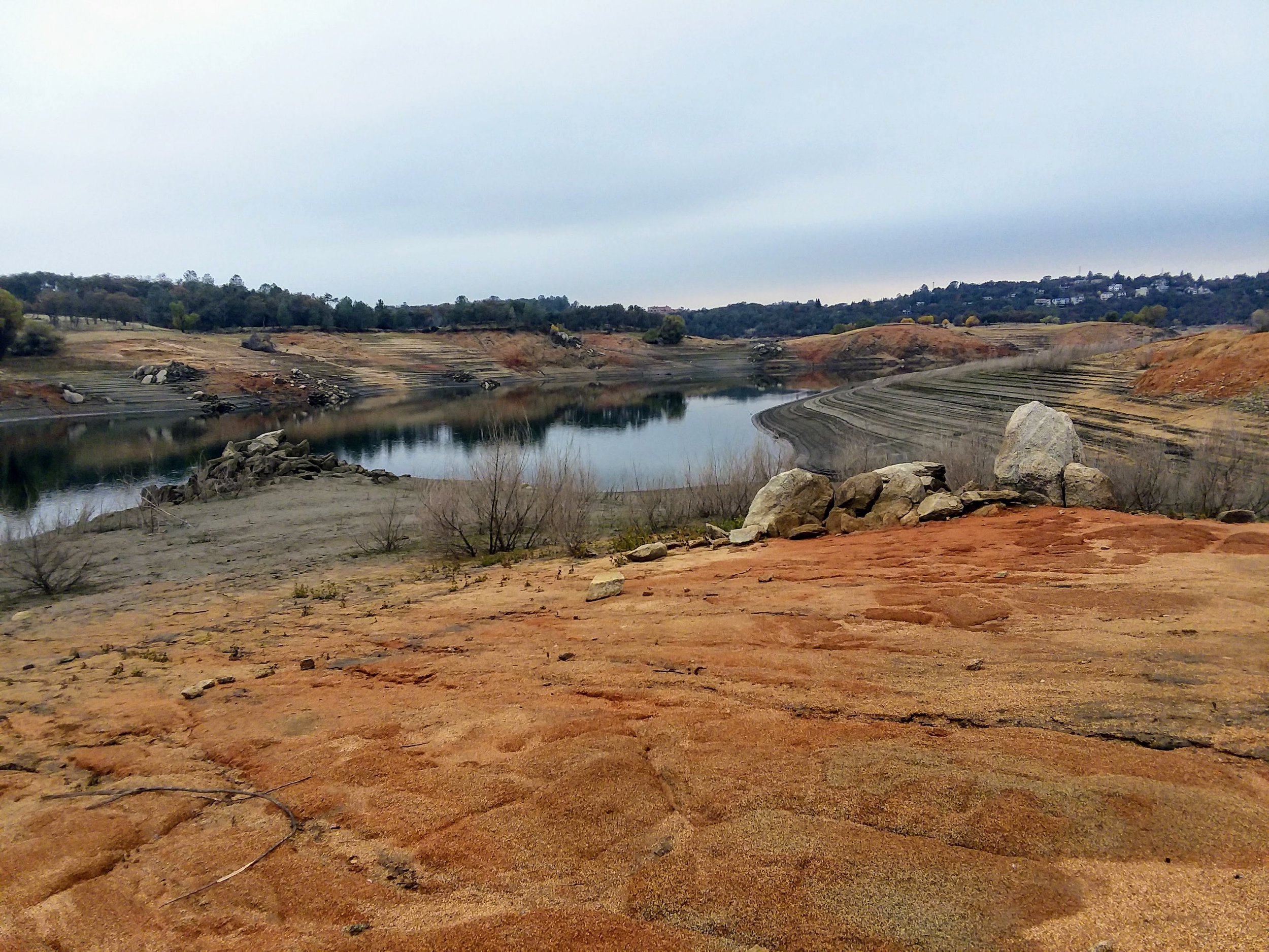
Folsom Lake has receded enough that artifacts the lake submerged over 70 years ago are visible once again. We have explored the site of the Rattlesnake Bar Bridge before. On this visit, we also walked the old road section that had made an appearance since the water has receded. We had wondered about the route of the road and how it made its way to the bridge. A wonderful section of the road is quite visible, as seen in the photo above. This is facing away from the bridge site, headed away from the bridge.
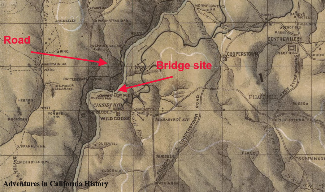
1873 map of the Georgetown Divide showing the bridge site and road. Click map for a larger view.
Rattlesnake Bar Road was a well used crossing of the American River all the way up to the lake filling in 1955/56. This was an easy way to cross the river and access Pilot Hill headed east or Auburn headed north west. Once the lake was filled this old crossing was inundated and the road on the El Dorado County side was changed to Goose Flat Road, still a county road, though not maintained and on now private land.

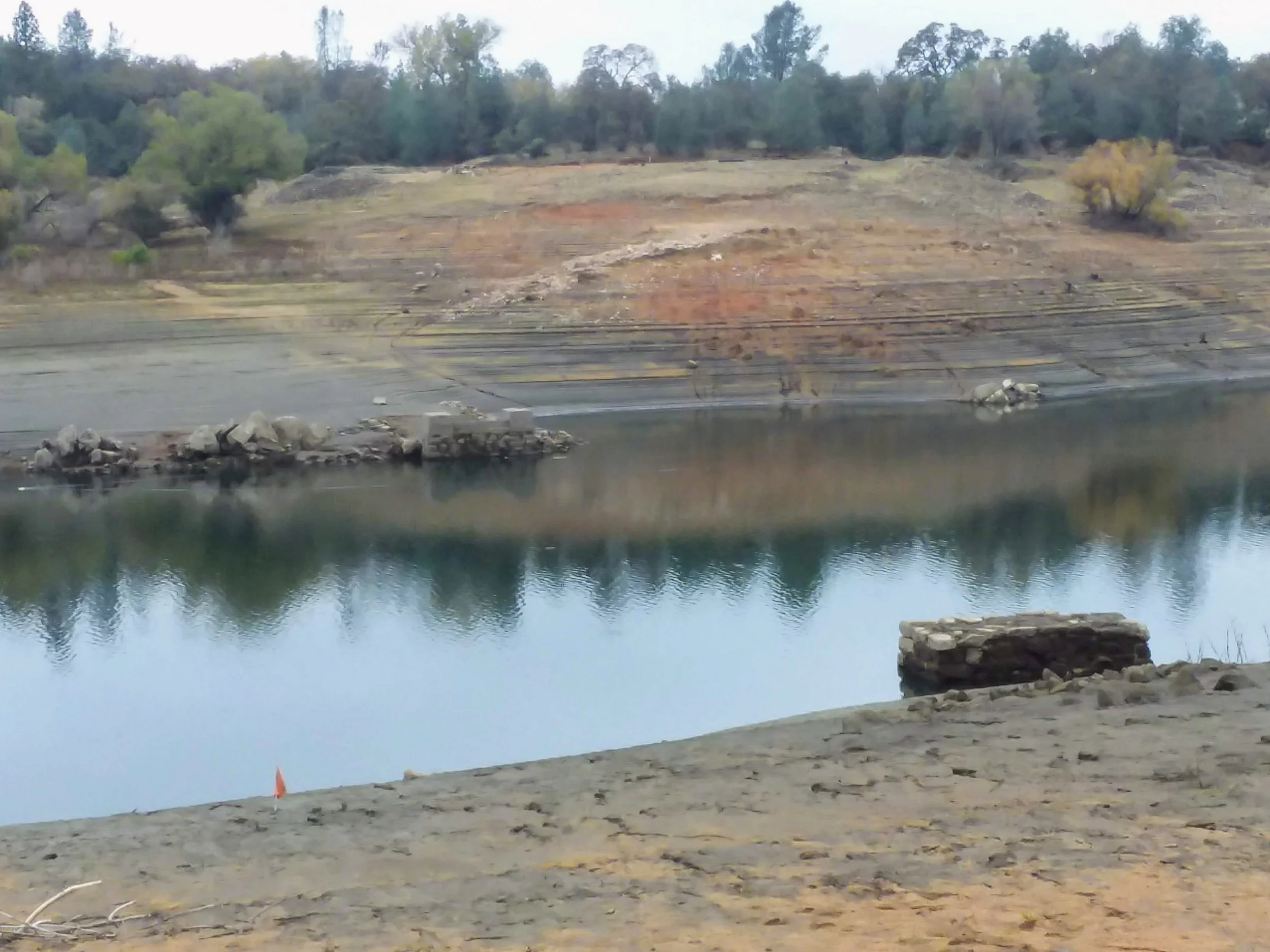
Bridge foundations on either side of the north fork of the American River. Looking from Placer County.
The above photo is from the Placer County side and shows the two foundations on either side of the river. The lake was low enough on the day we visited that the Placer County side's road is visible and shows the approach to the bridge site. The old road does not follow the present-day Rattlesnake Bar Road into the state park where the bridge stood but follows its own course, hidden from view most of the time. Below is a section we found covered with asphalt.

We have located the short sections of the road in the photo on the map below. You can also see the bridge foundation locations from this satellite photo, though the lake submerges both.
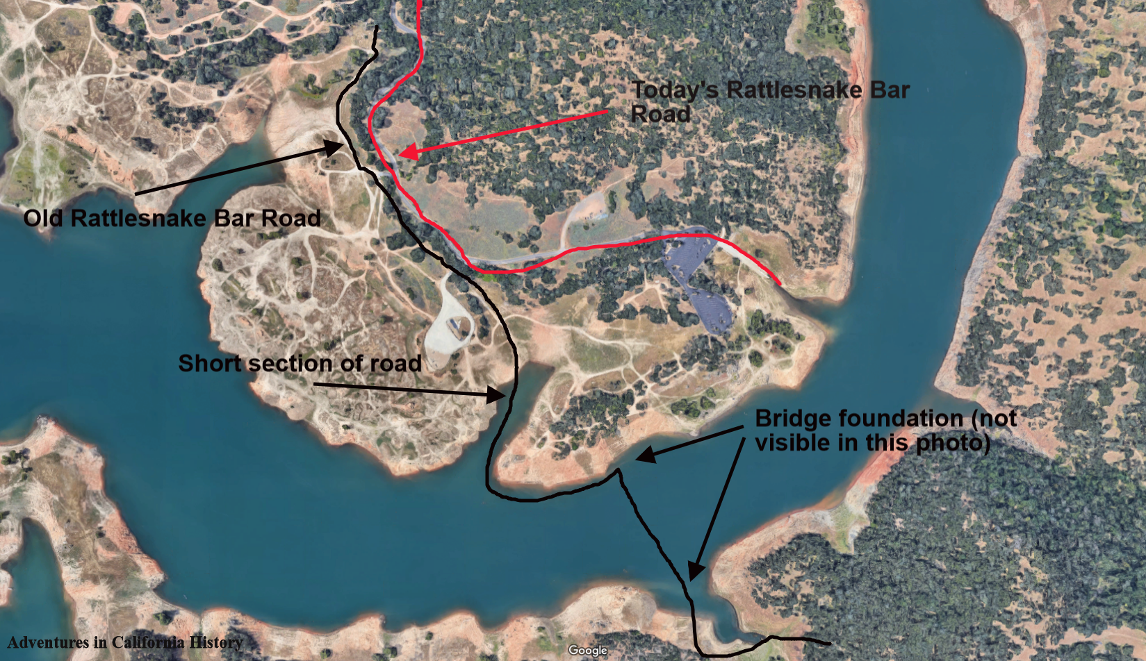
Click map for a closer view.
We enjoyed checking out the surreal landscape of a low Folsom Lake. All of the area around Folsom Lake was mined by gold seekers during the 19th and early 20th Centuries. That with the rising and lowering of the reservoir has created an otherworldly landscape with multiple levels of dirt of different colors. Quite striking and combined with the history of the area makes for a great day trip.
Below is a photograph of the old bridge. There is a man and a boy in the photograph along with smoke coming out of the bridge tenders shack. The printing above the man reads, “All persons driving or riding faster than a walk over this bridge will be fined to the extent of the law.”
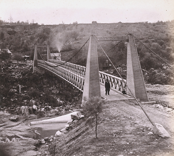
The Rattlesnake Bar Bridge, 1860s to 1870s. Can you see the child in the photo?