Nevada County

We're on our way to Timbuctoo!

In 1850 Timbuctoo, like most Gold Rush towns, built itself from the wealth generated by gold panning. It is located on a bluff above The Yuba River, close to the gold-bearing sand bars, but high enough to avoid flooding. Once the easy gold was panned out, they moved on to hydraulic mining of the bluffs around 1854. It's through this method of extraction that Timbuctoo gained its fabulous wealth.

Hydraulic mining in Timbuctoo.

Hydraulic mining in Timbuctoo.

As the town grew, it built a theater that could house 800 people, a bank, bakery, hotels, even an ice skating rink! The wealth continued to flow until 1884, when downstream farmers sued to end all hydraulic mining in the state. Hydraulic mining caused massive amounts of sediment to move downstream, causing flooding and a loss of agricultural land. It was also making riverboat travel difficult as sandbars would form and re-form, making navigation tricky. The District Court in San Francisco agreed and shut down all hydraulic mining. Timbuctoo was doomed!

Timbuctoo in 1862. The stage is passing in front of Stewart’s Wells Fargo Store.

Timbuctoo in 1862. The stage is passing in front of Stewart’s Wells Fargo Store.

The court ruling putting an end to hydraulic mining, which caused Timbuctoo to decline as miners their families and the businesses that grew up to support them moved away. Soon there was very little left of the town. During the 20th Century, there was an effort to preserve what little was left. Stewart's Wells Fargo Store was the most robust of what was still standing. The remaining townspeople had it preserved with a new roof and commemorative signs.

The preserved Stewart’s Store in 1945.

The preserved Stewart’s Store in 1945.

During the early part of the 20th Century, Timbuctoo enjoyed a revival as a historic stop on the road. It became quite popular with people looking for the story of California's history. Before 1980 the main road passed through town, making it much easier for people to stop and check it out. When Highway 20 was re-aligned in the 1980s, it bypassed Timbuctoo, and like so many other Gold Rush communities, it faded away.
Stewart’s Store today.

Stewart’s Store today.

Soon the impetus that had driven the people to try and save the remaining structure(s) also died, and rumors of gold in the old building walls brought vandals, and they tore the old structure down. Now there are no standing structures from the early days, just a crumbling mass of bricks. You have to see the old photos and drawings of the town to get a feel for how wealthy and busy Timbuctoo was.

Monica checking out the old bridge crossing of The Yuba River.

Monica checking out the old bridge crossing of The Yuba River.

There is so much to explore near Timbuctoo. The road coming in from the west passes over the Yuba River, where you can see the old bridge's support that crossed the river. The Town of Samrtsville is just a mile or so from Timbuctoo and has a great story of its own. Is it spelled with an "s" or not, Smartville? A little further lies Rough and Ready, a town that also built itself from gold and its spot on the old Emigrant Trail to Johnson's Ranch in Wheatland.

Timbuctoo in the 1860’s and the exact same spot today, 2018.

Timbuctoo in the 1860’s and the exact same spot today, 2018.

Here is a short video, less than 5 minutes, concerning our adventure at Timbuctoo.

Searching for the Emigrant Trail, Mt. Olive Road, Nevada County

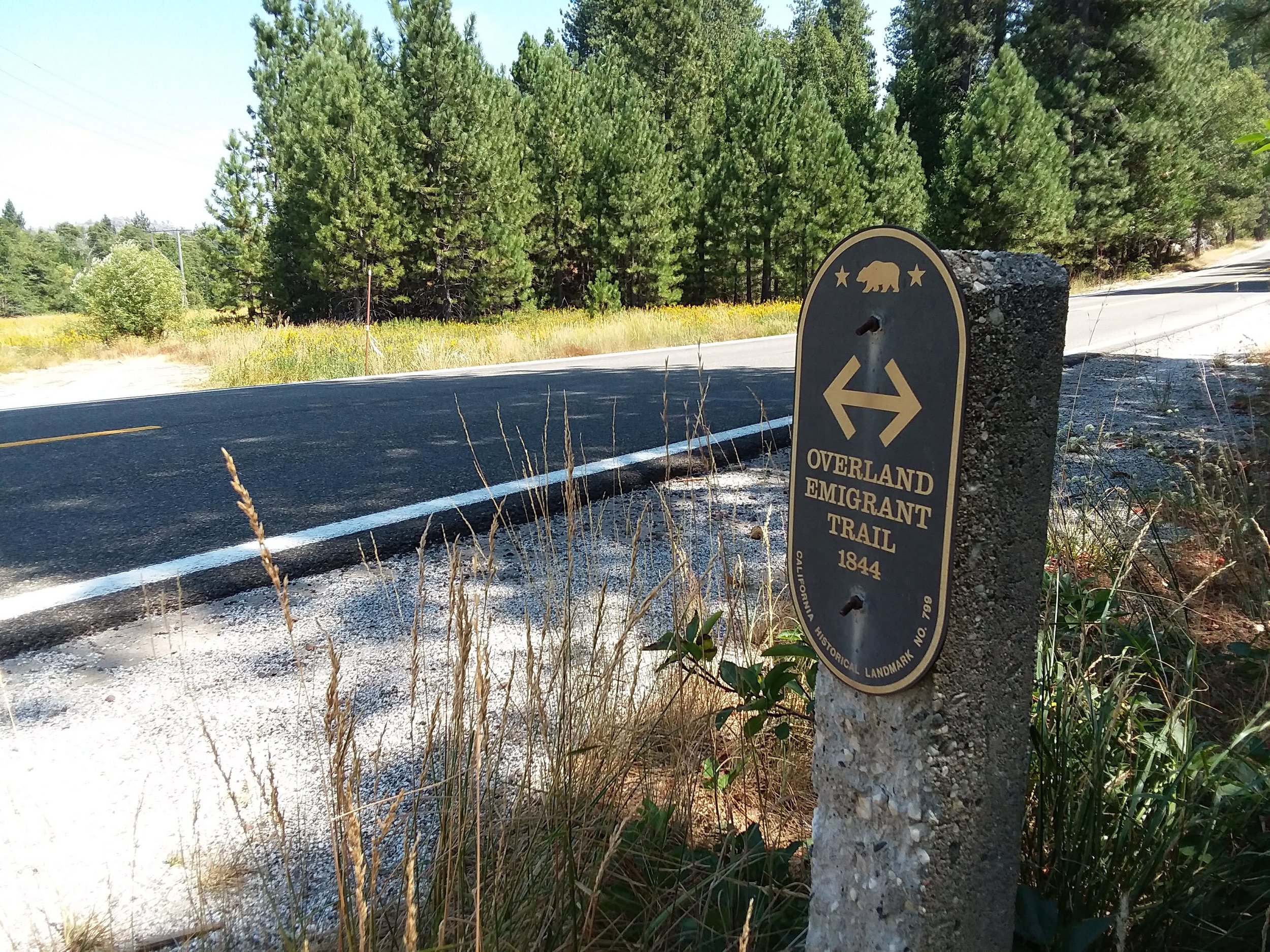
Monica and I spent Monday at Yuba Gap, in the high country of The Sierra, looking for the old "Overland Emigrant Trail." While we didn't find any "T markers," we did spot a stone obelisk on Laing Road. You wouldn't know what this thing was unless, like us, you had seen them before with their sign attached, as this one in Bear Valley does. I'm not sure whether these signs are being stolen, or fall off, but we have come across more of these markers without their signs than with them.

Concrete marker with sign

Concrete marker with sign

The next day, Tuesday we stayed a bit closer to home and tried to locate the trail in the foothills above Grass Valley. We had read the descriptions of how the path followed Lowell Ridge before dropping down towards Chicago Park area. The name Mount Olive stood out from our research so when we found the road we drove it! Coming down Mt Olive Road, it makes a sharp right-hand turn, and that's when Monica saw the "T marker." We are on the trail!

Monica and T Marker for Mt. Olive

Monica and T Marker for Mt. Olive

Something looked different about this marker. It seemed it faced in an odd direction, east. Hard to read. There was also a large pile of gravel in front of it. We took some pictures and proceeded down Mt. Olive Road looking for more signs of the trail. Once at home we opened up Emigrant Trails West webpage, looked up the Truckee Trail, and the picture of this particular T marker was there! However, a house has been built right on the trail. I have put two pictures up, one from the Trails West webpage, and our photo from Tuesday. This house is entirely new, as it also does not show up on Google Maps.

Photo from Trails West webpage.

Photo from Trails West webpage.

Our day was complete, as we found another section of the trail. What's worrying though is the rapid pace of development going on in the foothills of The Sierra. It's quite a desirable place to live, and we saw many new homes popping up here and there. Our concern, as history buffs, is what will people do with these old places and trails. Some don't even know what they are building on, or in some cases, don't care. How can we preserve these beautiful pieces of history, without denying people their private property rights? As fan's of the trails, it's a bit of a shame to see them paved over and in some cases forgotten.

The same spot as above but now with a house.

The same spot as above but now with a house.