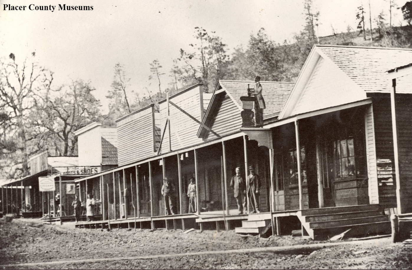
This is a fabulous photo from the Placer County Museums showing a portion of the business district of Colfax taken in the 1870s, during the town's heyday.
Gold
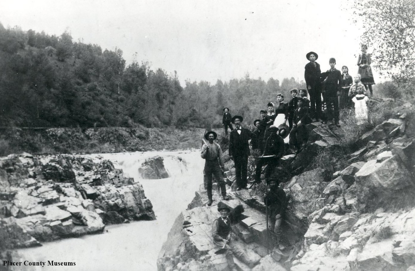
A group of people stand next to Salmon Falls.in 1887. Photo: Placer County Museums
The Falls of Salmon Falls.
There were once falls at Salmon Falls, now inundated by Folsom Reservoir. The rocks were blasted away in the 1920s, helping with logging operations, which floated timber down the river. Below is a screengrab of our 1873 map of the Georgetown Divide showing the old townsite.
Salmon Falls got its start in 1849 with miners working the creeks, including Sweetwater Creek, which the town grew up next to. Once Folsom Dam was constructed, this entire area flooded. The town’s cemetery was exhumed and the bodies re-buried at the “Re-location Cemetary” at El Dorado Hills.
In low rainfall years, the town re-emerges from its watery fate, and you can visit some of the old town sites. Here is a link to more info on this area.
1873 map showing Salmon Falls. See the entire map here.
Meyer’s Dance Hall and Saloon ruins.
Georgetown Divide History Tour, Part 2
Our next stop on our tour of the Georgetown Divide is the 1855 Meyer's Dance Hall and Saloon, just up Beach Street from the site of the old bridge at Lotus. You can read about the old bridge crossing at our first post of the tour here. Following the map and turning around in the church parking lot, we head back towards Highway 49, where we find the ruins of the old hall on the left.
Before the town was named Lotus, it was known as Marshall, named for the discoverer of gold. In 1850 the name was changed to Uniontown in honor of California's entrance into statehood. The name of the town was changed again to Lotus in 1881. This road was the old route from Sacramento to the goldfields, and many would pass this business. Dancing was quite the entertainment back in the days before electricity, and this spot was known as a "miners delight."
Now we head back towards Highway 49 and turn left onto Highway 49, but the old road went straight, behind Marco's Restaurant and back out towards Highway 49. You can see the old route as a green line on our maps. It's good to know the old way as the descriptions of various features often relate to their location with "the road," which usually implies the historic route, not the road we travel on today.
Just a short distance to the north we will arrive at the site of the long-gone town of Michigan Flat, the place where the Stanford Brothers, Leyland, and Thomas, laid the foundations for their great wealth as proprietors of a general merchandise store.
We’ll talk about that place with our next post.
Photo: Placer County Museums
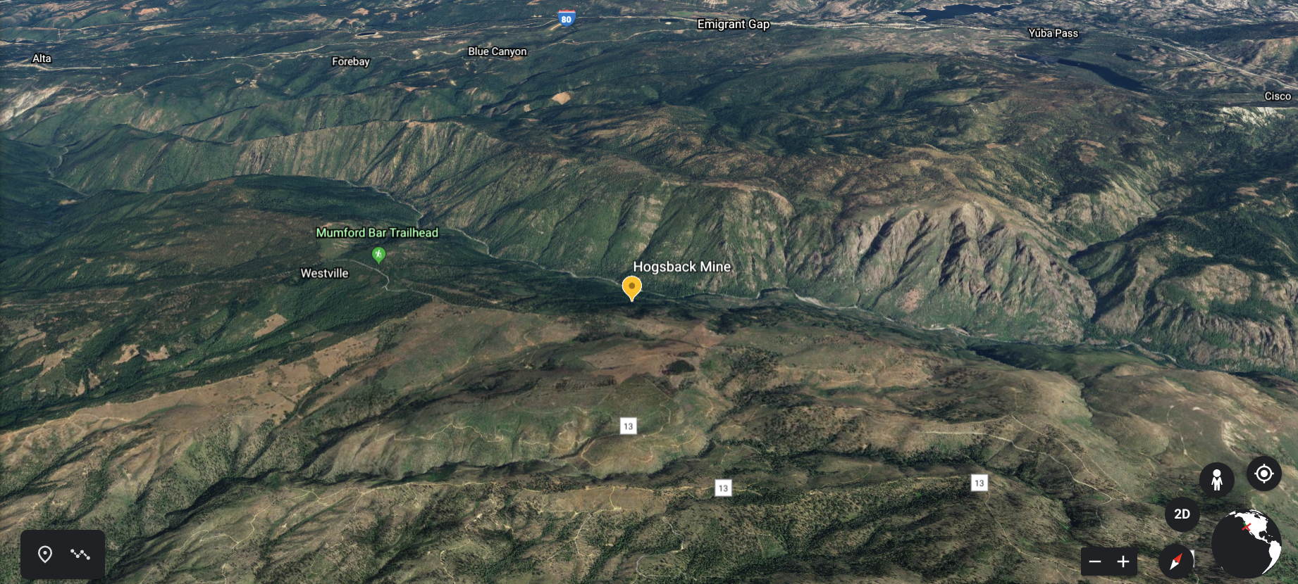
The Hogsback Mine near Foresthill
The Hogsback Mine on the Foresthill Divide was owned by the French “Compagnie des Mines d'Or du Forest Hill Divide," with headquarters, Paris, France. The following is from the Placer County Historical Society, “the regular force of men employed consists of 15 miners working 8 hours per day; 2 engineers, working 12 hours per day; 2 drivers, working 12 hours per day; two blacksmiths, working 10 hours per day; one timberman, working 10 hours per day, divided into three shifts, and working two 3 ½ -inch Ingersoll Eclipse drills on columns”.
This mine commenced work on April, 28th, 1888. here we read more from the Placer County Historical Society paper, “PROGRESS FOR A WFEK 48.7 FEET. 12 men, 7 days (84 days), at $3 $252.00 3 men, 7 days (21 days). at $3.25 68.25 1 man, 7 days (7 days), at $3.50 24.50 114 lbs. safety niter powder No. 2, at 13c. per lb. 20 52 350 feet triple taped fuse, at 72 c. per 100 feet 2 52 50 lbs. chemical wax candles, 14 oz , at 13c. per lb 6 62 2 boxes XXX blasting caps, at 80c. per box 1.60 224 feet lumber, at $22.50 per M 5.04 1040 lbs. steel rails (16 lb) (195 ft.) at 4c. per lb.. 41.80 Bolts and fish-plates, at 50e, per pair 4.00 Car oil .15 40 bushels charcoal, at 20e. per bushel 8.00 Wear and tear, etc 1.00 Total cost $435.80 Cost per foot $8.94 Not a timber was used in this ground, and it is still standing without any.”
Google Earth view of the mine and surrounding topography.
Photo: Placer County Museums
Pelton Water Wheel, Mammoth Bar Mine, 1895
This man is standing next to Pelton Water Wheel, located inside the wood cover. Lester Allan Pelton invented the Pelton Water Wheel in the 1870s. In 1860, while living in Comptinville, a gold mining community, he designed an efficient energy source that was able to turn water into power.
Figure from Lester Allan Pelton's original October 1880 patent
Mammoth Bar was a mining community located on the Middle Fork of The American River.
"Shafthouse of the Sherman Mine perched high up on the hillside overlooking the town".
It’s easy to forget just how many gold mines there were in El Dorado County at one time. Most have long ago closed, and the buildings torn down, burned down, or just fell. The above photo shows the Sherman Mine, c.1930s, which was located right in Placerville, behind the El Dorado Irrigation offices on Mosquito Road.
This description accompanied the photo. “The bottom of the triangular structure at center is skeletal while panels cover the top half. Another lightly-colored structure can be seen just behind the structure and extending to the left. While poles and other supplies sit in piles against the tall structure on the right, a man in a suit and hat lean on a post and look towards the trees on the right. More supplies and debris are scattered on the ground on the right and in the foreground while trees and bushes cover the small hill around the shafthouse”.
I found the location using Google Earth, where you can see the hill and where I think the mineshaft was. It was very active from 1905 to 1911, with a total production of $136,000. “The deposit, a five-foot-wide vein of gold-bearing quartz, was developed by a 750-foot inclined shaft with levels at 100, 200, 300, 400, 500, and 750 feet; winze sunk from 750 feet and 5500 feet of drifts. The ore as treated in a ten-stamp mill.”
You would have heard that ten stamp mill, as well as other stamp mills in the area. One aspect of life in the foothills during the gold mine days we forget was the constant sound of stamp mills pulverizing rock to recover the gold better. The sounds were so ubiquitous in our area, that if they stopped, it could indicate problems at the mine. “Why did the mill stop”?
Below is a Google Earth view of the site.
Damascus, a ghost town in Placer County
It’s 1885, and The Damascus Brass Band has come to play a tune. Many small towns hidden in the foothills and mountains had brass bands. Some locations even had more than one band with the Italian, German, and British sometimes fielding their bands. If there was competition, it seems it was a friendly sort, with the Fourth of July, and other celebrations an occasion to “strike up the band!”
Damascus, Placer County.
This photograph shows the town of Damascus, in Placer County. It was located about seven miles south-east of Dutch Flat in a very isolated part of the county. The area started drift mining in 1850. In 1875 the Hidden Treasure Mine was discovered and worked until the mid-1930s.
You have to look closely to see these homes in Damascus.
Formerly the town was known as Strong’s Diggings after the founder of the town, Dr. D.W. Strong. In 1856 the post office was established, and the name Damascus chosen. Why they chose this name is a mystery, as the older town of Damascus is in the country of Syria. I’m guessing the town got this name the same way the town of Timbuktu, in Yuba County, garnered it’s. These towns were so far “out there” from anything else exotic names like Timbuktu and Damascus represent unusual out of the way locations.
A nice clear photo of Damascus in 1905. Mining was still taking place, but a bit more limited than during the Gold Rush and later 1800's.
The above map shows the location of the town. If you would like to check it out on Google Earth and see the relationship with the other towns, follow this link.
Iowa Hill baseball team and a surprise.
The Iowa Hill baseball team in the late 1800s. A typical small-town baseball team, with a couple of young kids hiding behind a tree. At one time, Iowa Hill was a prosperous mining town that was producing $100,000 a week in the mid-19th Century. Fielding a baseball team to play the other gold mining towns was the regular practice, as baseball was the pastime sport of choice in those days.
You never know what you're going to find out when we post these photos. We heard from a person who is the keeper of Iowa Hill's memories, and she related this story. "Native son and big-league baseball champion William "Seattle Bill" James was the waterboy--he is the child behind the tree. He returned to his home town for a visit in October 1914 following the World Series win of his Boston Braves against the "unbeatable" Philadelphia Athletics, largely due to Bill's pitching."
Wow, that young boy's fascination with the team grew into a career that took him far away from this old mining town. You never know what you'll find out with these old photographs from a time gone. Above is a photo of William pitching for the Boston Braves.
Photos: Placer County Museums
Gold Run on Highway 40. Donner Summit Historical Society, Norm Sayler collection
Gold Run on Highway 40
Monica and I headed upcountry to Donner Summit the other day. Whenever possible, we take the old Lincoln Highway/Highway 40 route. It's slower-paced, and you get to see the small towns along the way. This is the "old-trading" post at Gold Run. I had not seen this photo before, but was familiar with the spot, as it's where the current Gold Run post office is located. This was the old Lincoln Highway before it became Highway 40 in 1928. Gold Run's history goes back to the gold rush era and hydraulic mining, which is how Gold Run made its fortune. When hydraulic gold mining was outlawed in the latter 19th Century, the town dwindled in size and importance.
Gold Run, California today.


