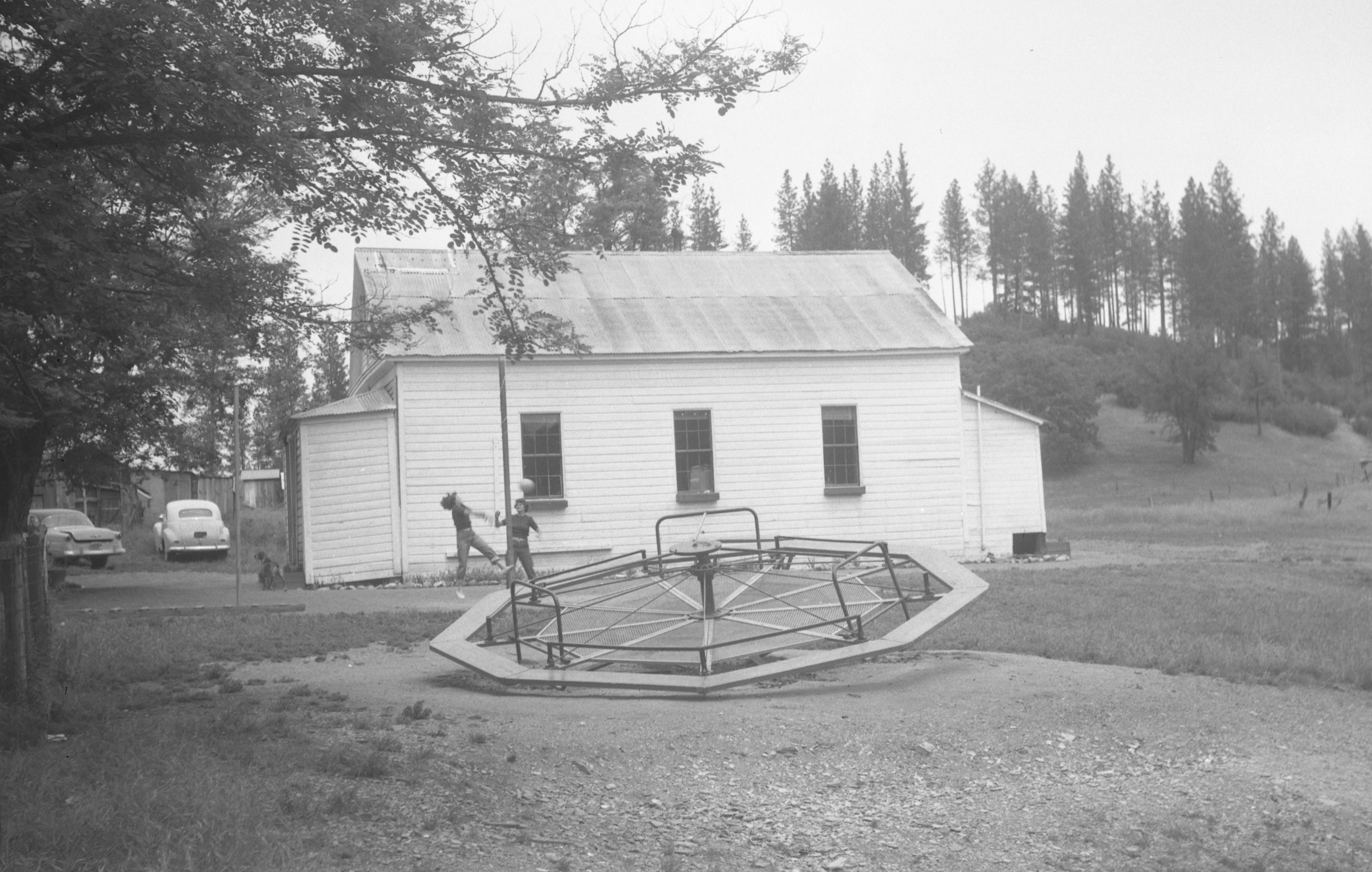
Above is a Paul L. Henchey photograph taken in June 1953 that shows the old Greenwood schoolhouse, which is still standing today. You can find the location on the map at the bottom of the post.
When you hear from the elders about how dangerous and fun old playground equipment was, this is a prime example. The merry-go-round looks to be an advanced version of other merry-grounds that did not tip. With the conventional merry-go-round, kids would propel themselves using their feet to gain speed as the contraption spun around, throwing off those who couldn’t hold on!
This merry-go-round not only spins but seems to tilt, adding to the g-forces and making it even harder to hold on. You can zoom in on the photo to get a better view.
My question for those who remember this is, how was it propelled? Does it look like there may be a handle in the center used to tilt it or propel it? Was this powered by the kid’s feet like the non-tilting versions? You can see two children playing tetherball behind the merry-go-round. A lone dog stands at the entrance.
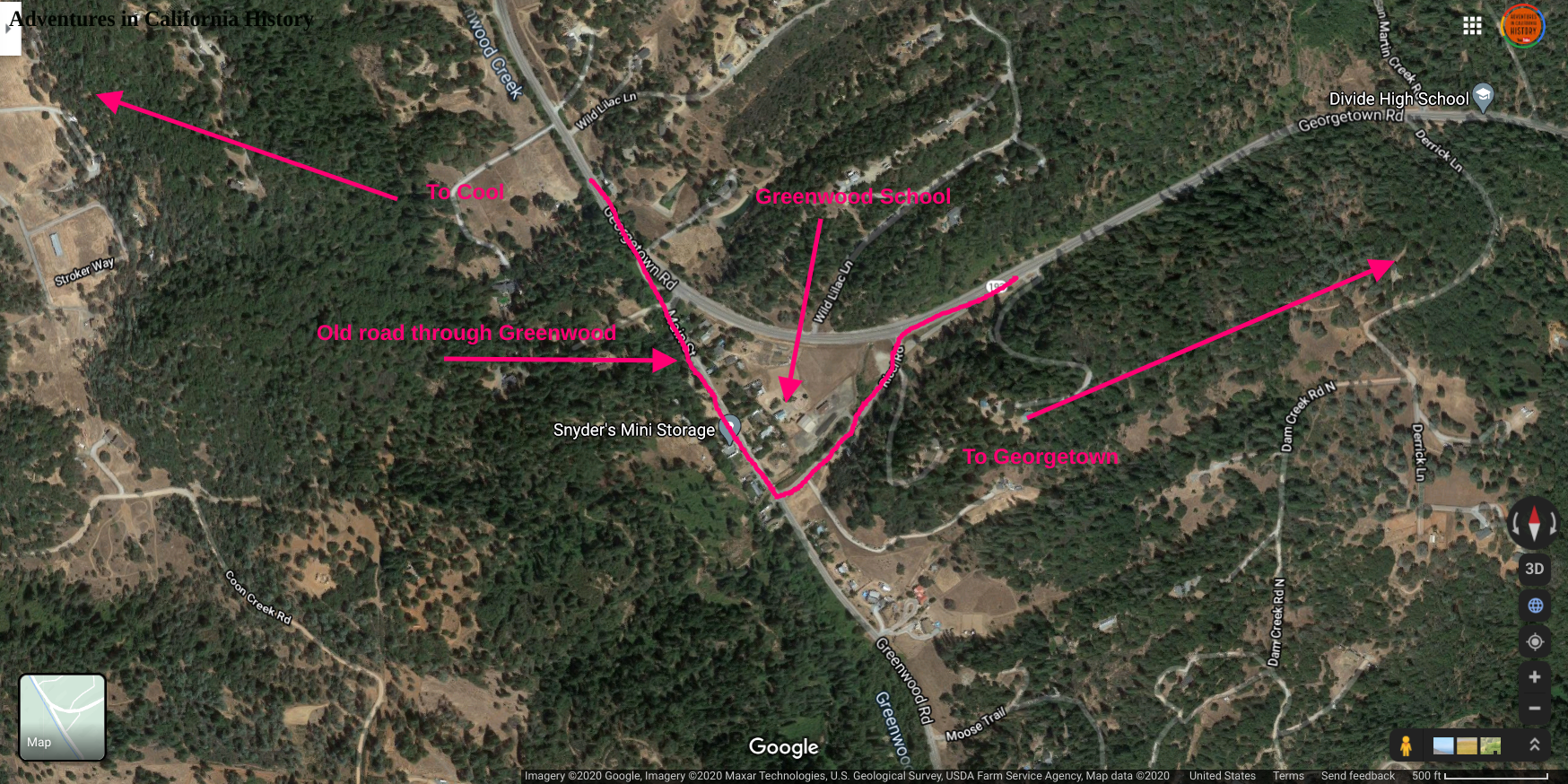
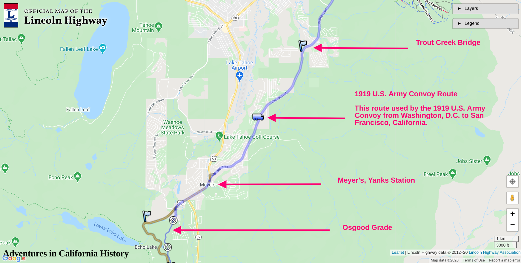
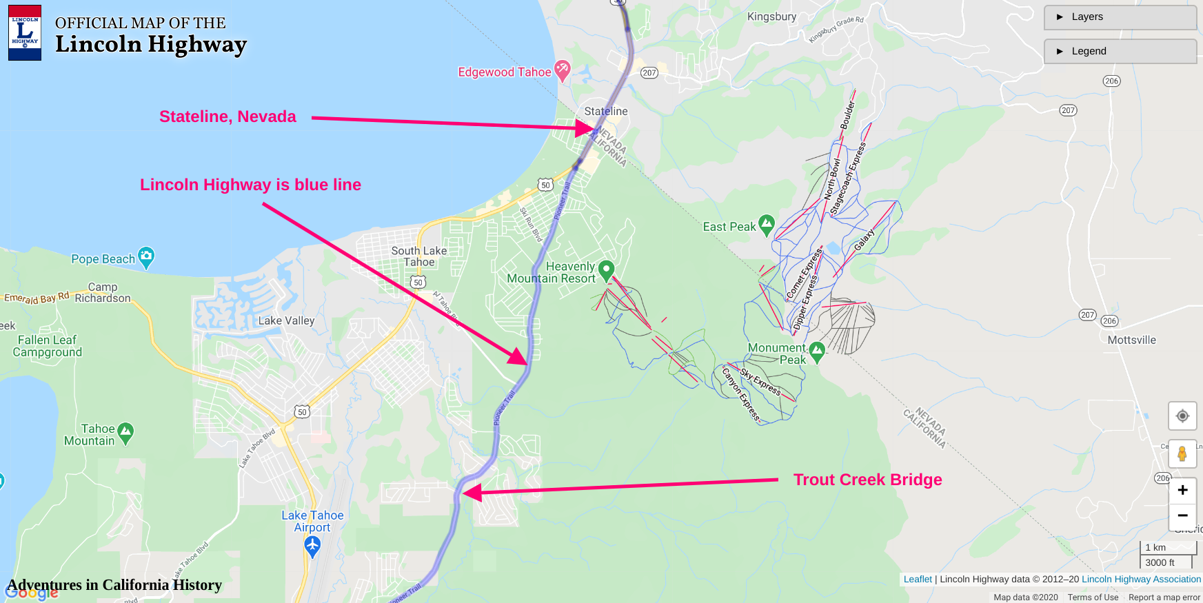
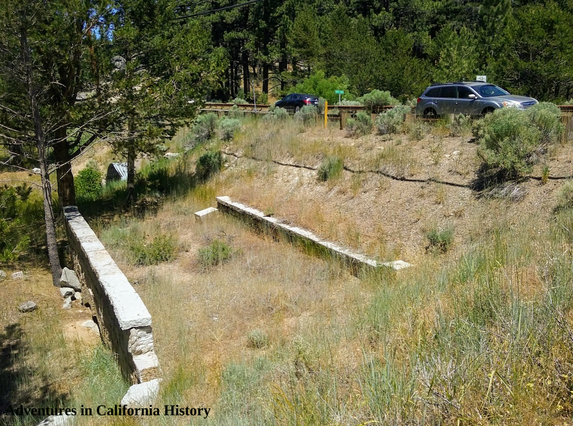
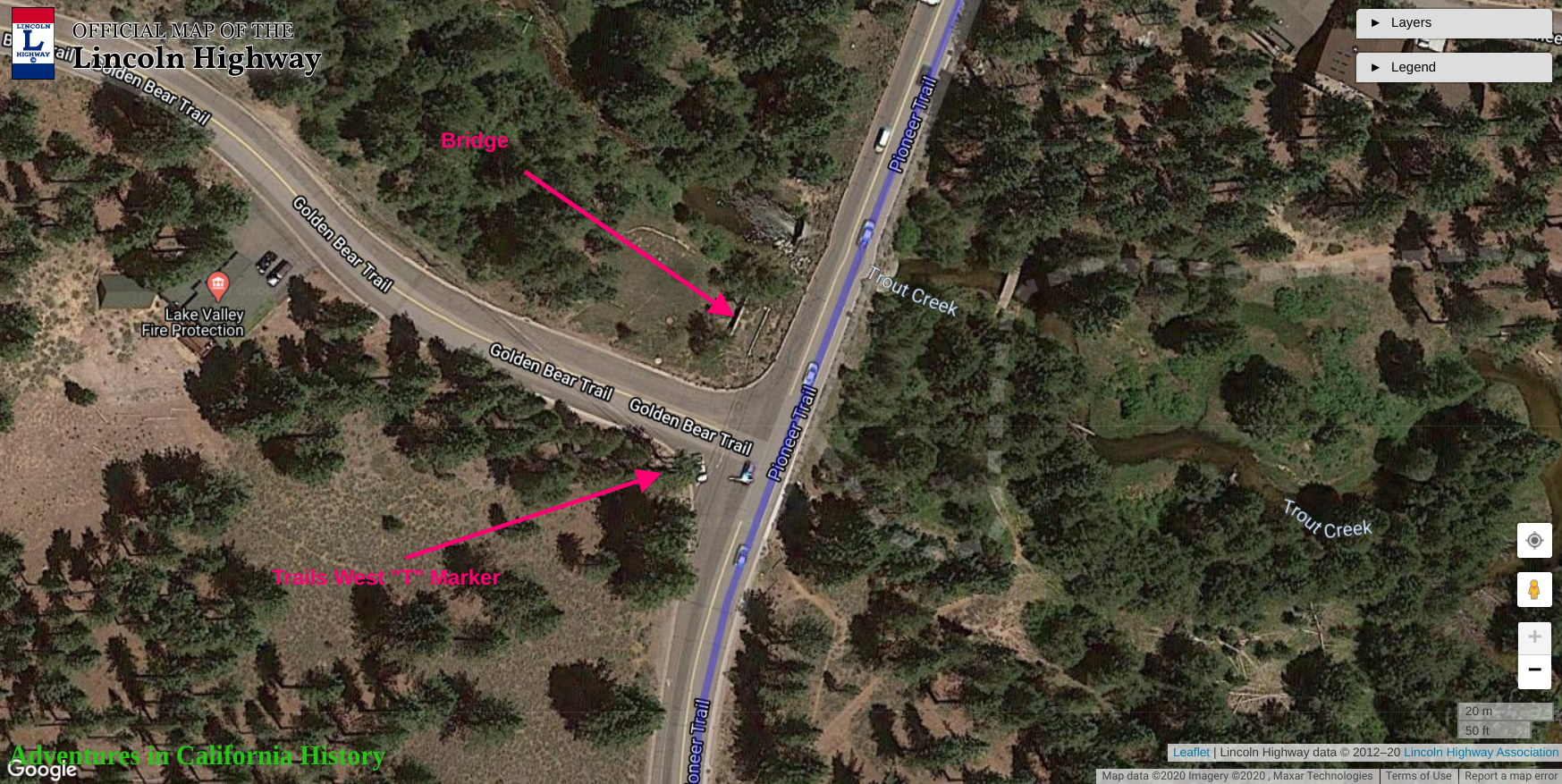
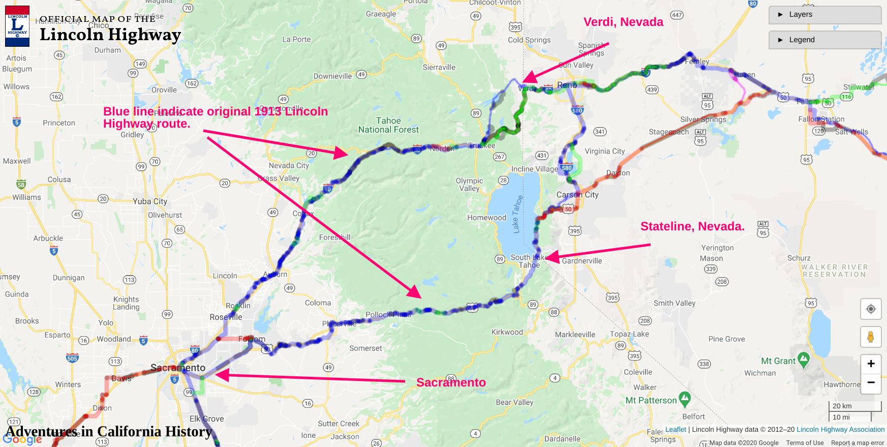
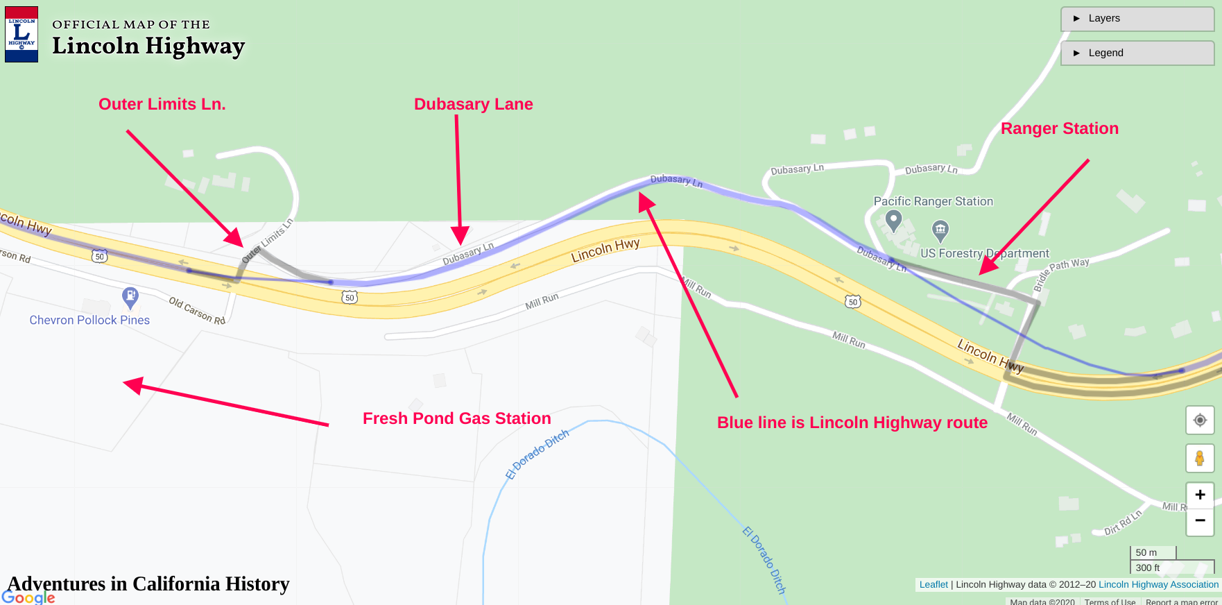
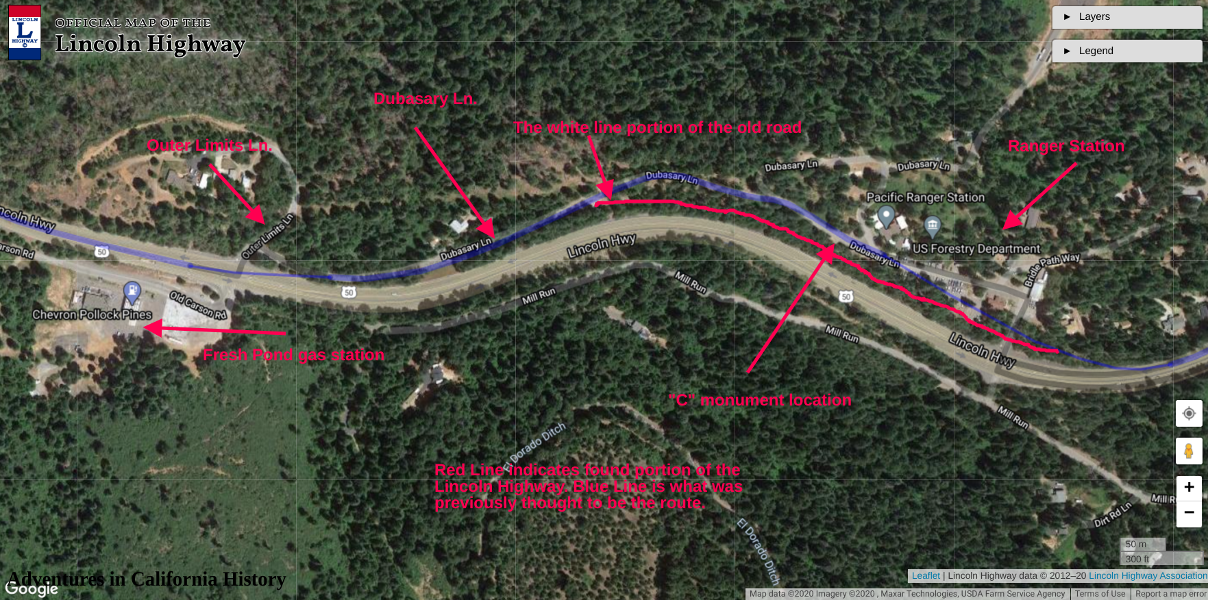
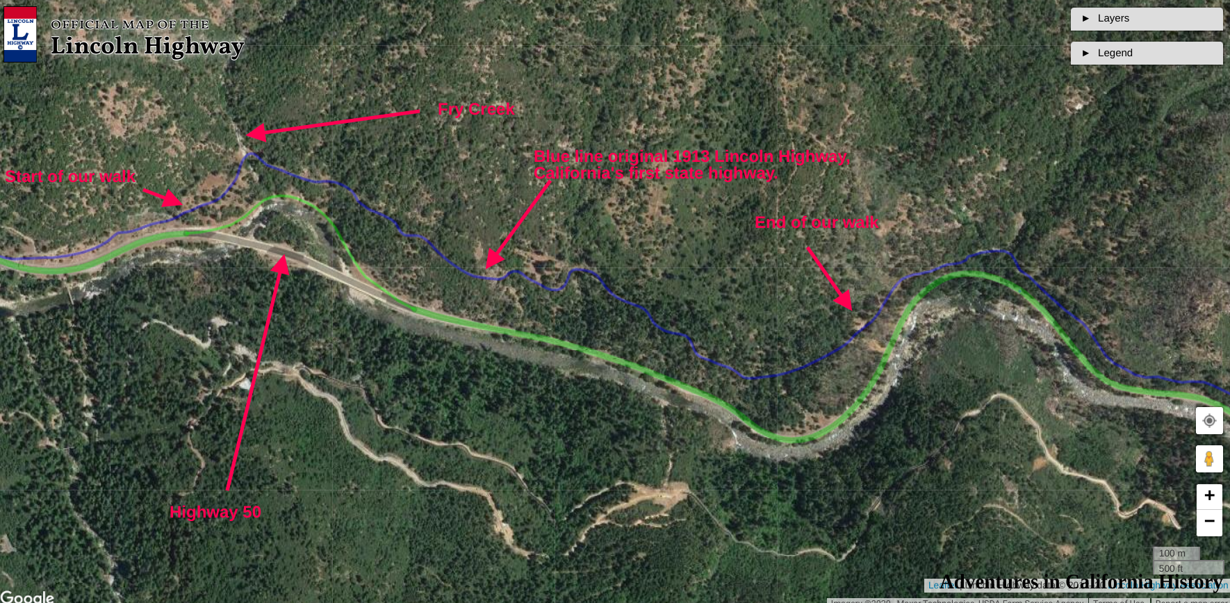
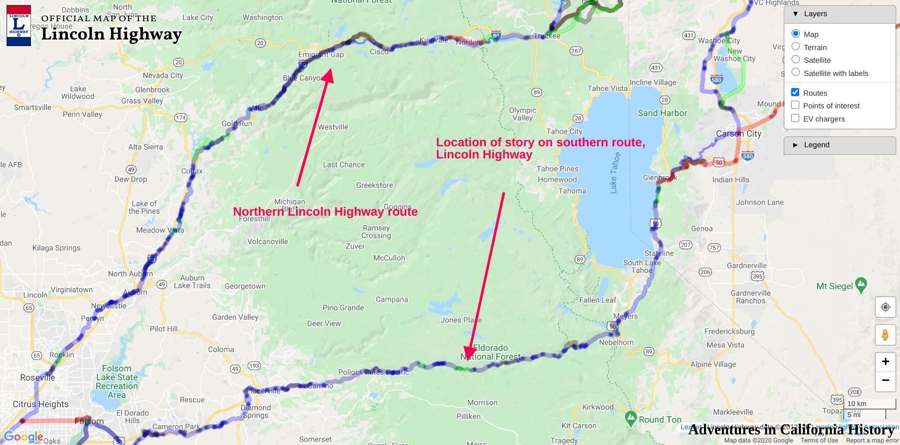
Map showing location and features. Click the map for a larger view.