
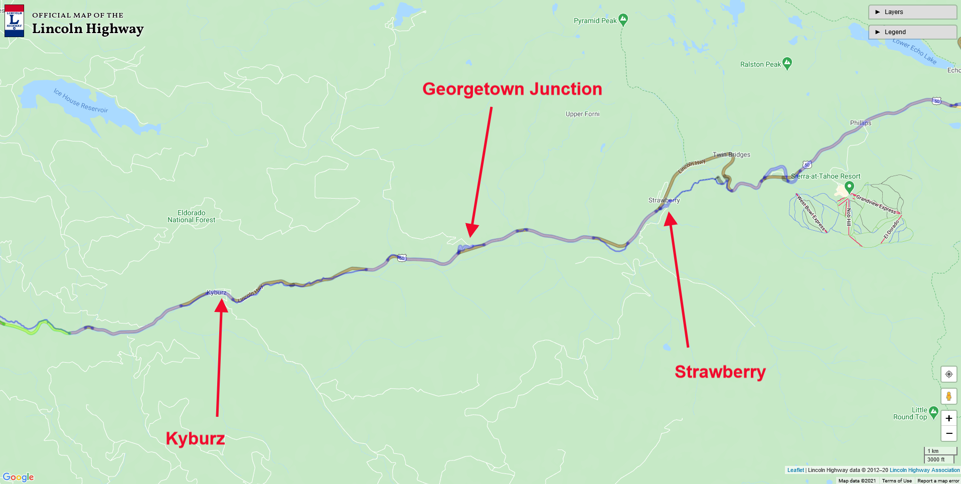
Map of the area between Kyburz and Strawberry, and The Georgetown Junction. Click map for larger view.
Leaving Strawberry, we head down the old Lincoln Highway, which Highway 50 closely follows today. However, there are many places along the freeway where the Lincoln Highway followed a more casual route. Milestone 41 is one such road, which today acts as an entrance to summer cabins. A number of these milestone roads were the Lincoln Highway, including Milestones 34 and 35. Another place the old road veers from today’s path is Wright’s Lake Road and the Georgetown Junction.
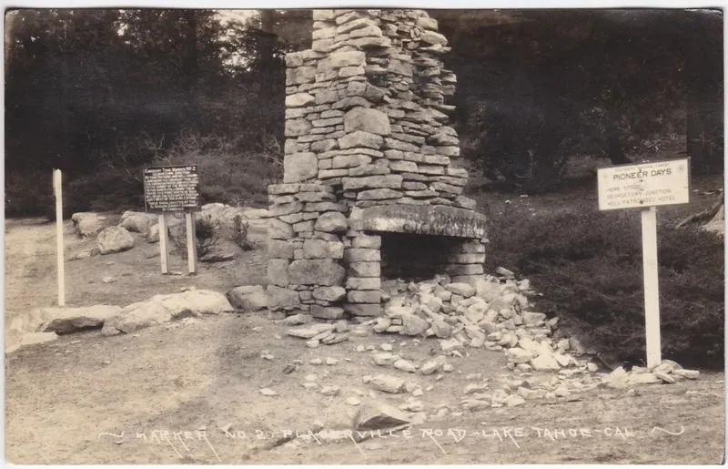
The Georgetown Junction once had a toll house, where a stone chimney left from those days stood well into the 20th Century. It seemed to be a popular place to take a photograph for Lincoln Highway and early Highway 50 for travelers. At its earliest, Georgetown Junction was where Johnson’s Trail left the river and climbed high up to Peavine Ridge, and eventually down to the river and a crossing at Bartlett’s Bridge. Later, after 1858 the state took over control of the road and built a new trail leaving the river further west at Silver Fork and the Sugar Loaf House site. Georgetown Junction then became a cut-off road for travelers headed to Georgetown rather than Placerville.

Monica on a found segment of the highway, off Wright’s Lake Road. Highway 50 is below, and to the right.
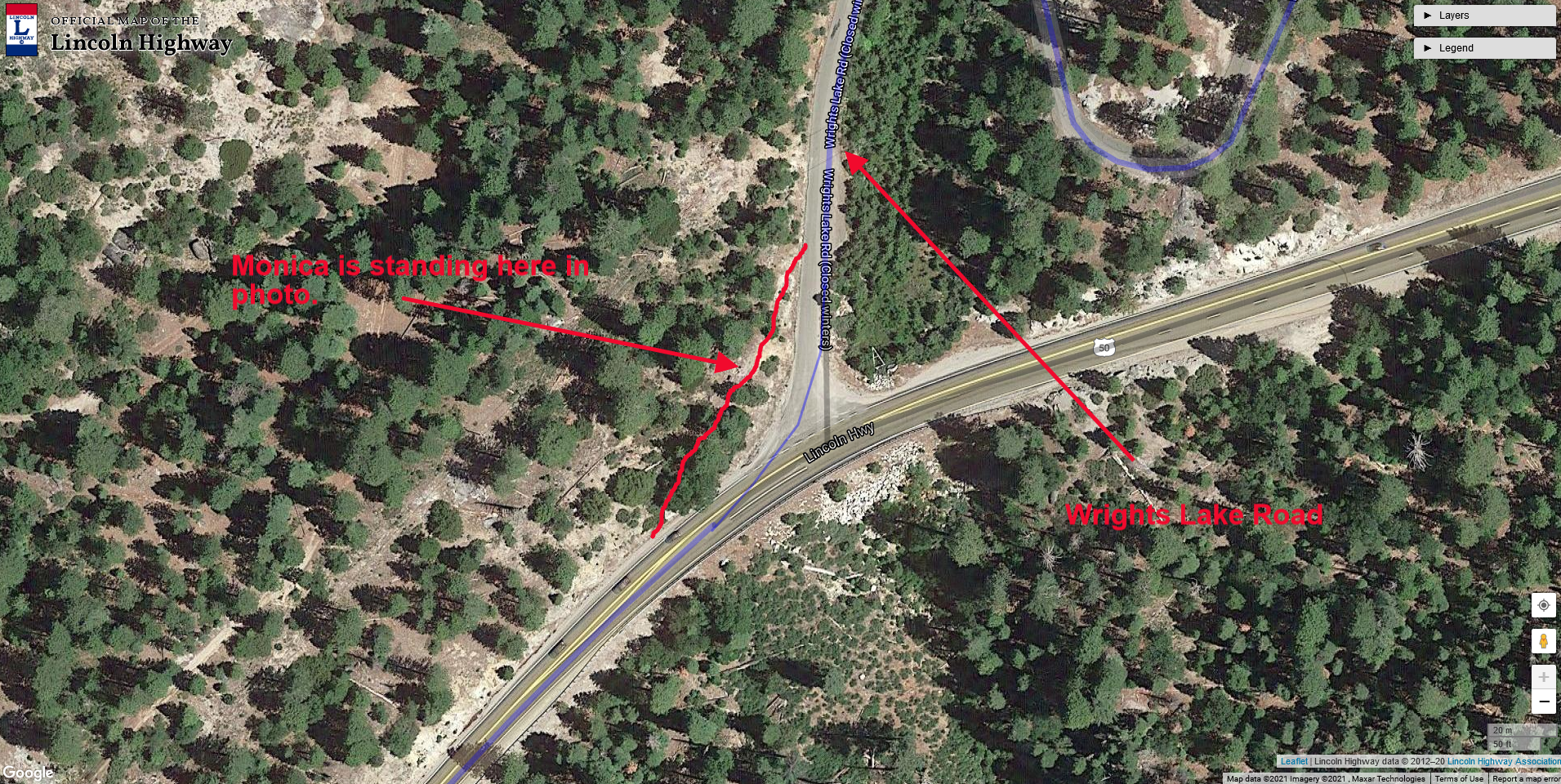
Map showing new segment in red. Wrights Lake Road is The Lincoln Highway. Click map for larger view.
While we were exploring the area around Wright’s Lake Road, we discovered a small stretch of the old Lincoln Highway at the Wright’s Lake Road turnoff. On the map at left, you can see a red line indicating the section of the found road. You can see Monica standing on that portion of the road in the above photo, with Highway 50 down below and Wright’s Lake Road to the left.
Continuing downhill from Wright’s Lake Road, we come to a wide spot on the right that is the site of Fred’s Place, a top-rated stop for food and lodging from the Lincoln HIghway days well into the Highway 50 era. We have written about Fred’s Place before. You can read more about it here.

During the Highway 50 era, Fred's Place placed the fake, wooden CHP car to get people to slow down as the grade here was quite steep, and people tended to pick up speed.
A bit further downhill from Fred's Place's site is Milestone Tract 34, which enters and exits on your left side. Drive this section of forest road to experience the Lincoln Highway in its original form. Half-way down Milestone 34, we come to the site of the "Register Rock,” or “Split Rock," which acted as a billboard back in the day. Some of the writing is still visible, such as an ad for pianos in Oakland.
Below is a short 2-minute video Monica and I made a few years back on Milestone 34.