We are looking east from the west side of Donner Lake, approx 1920’s. The building seen is the office for the Donner Lake Camp, an early “autoist” campground. In the close up below we can see a “Red Crown” gasoline sign, as well as a car headed down the road. The road curves around the lower part of the photo and ends up at the right side where it would soon start the climb up towards the summit.
Lets stay in a Quonset hut tonight!
Driving the old roads like the Lincoln Highway or Highway 40, you come upon the early rest stops and motor lodges that once lined the highways. Back in the day, people had to stop more frequently on their travels. Your auto might need to have it's radiator filled, gasoline topped off, or oil added. Most stops would have food available, and some even had rooms to rent for the night. Early motor lodges and motels were seen frequently in all the small towns along the way as people didn't travel as far each day.
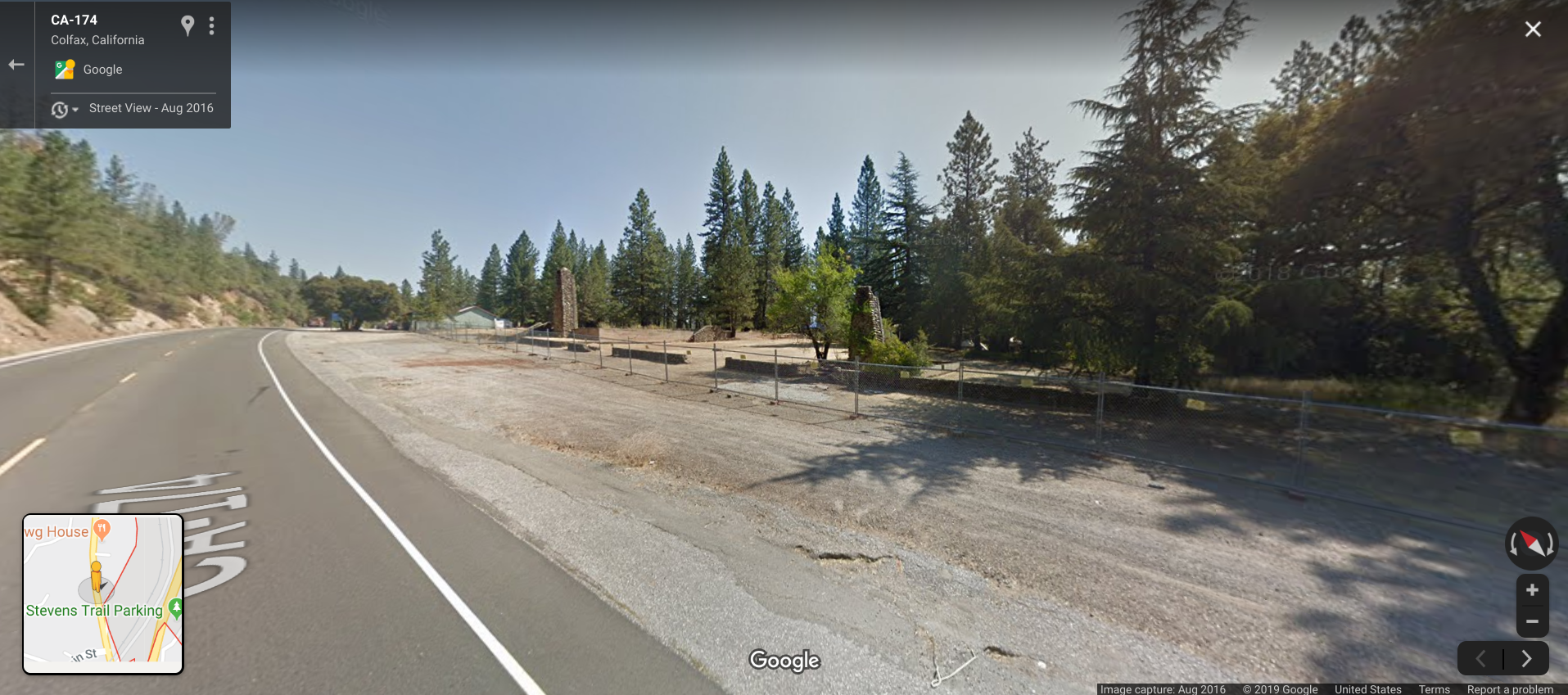
Just outside of Colfax, along old Highway 40 and Lincoln Highway (today's Highway 174), one could cozy up to their very own Quonset hut, complete with stone fireplace, at the Quonset Village Motel. Quonset huts were quite popular just after World War II when the Army sold their excess war supplies, including these huts. We capitalize Quonset as it's Quonset Point, Rhode Island, where the huts were built.
The view today. One Quonset hut is still standing, and all the stone fireplaces are lined up in front of their long-gone huts. Click the above photo to control the view.
Dedication of corner stone for Donner Memorial
On June 10th, 1910, a dedication ceremony was held at the Breen cabin's site, including members of the Donner Party in attendance! This dedication was to formally mark the spot that would, in about 8 years, hold the massive statue and support for the Donner Party Memorial. An immense granite cornerstone was inscribed and placed at the corner of the Breen cabin's site.
The inscription on the stone read, "This cornerstone marks the site of the Donner Party cabins where a monument will be erected under the auspices of The Native Sons of the Golden West to the pioneers that crossed the plains."
This evocative photograph shows CF Mc Glashan, Truckee attorney, who spearheaded the monument construction, speaking to the assembled audience. Sitting on the stand listening are three of the Donner Party survivors, Virginia Reed Murphy, Patty Reed Lewis, and dressed in white, Francis Donner Wilder. All three women would show up 8 years later for the monument dedication.
Photo of unfinished Donner Memorial statue, and cornerstone from Donner Summit Historical Society, Norm Sayler Collection.
Donner Monument, unfinished
I am working on a video concerning the construction of The Donner Pioneer Monument and came upon this intriguing photo. It shows the Donner Memorial without the statue of the family on top. The base was hand built and the sculpture installed piece by piece.
What captured my attention was the immense cornerstone sitting next to the base. The stone was dedicated a few years before as the start of the year's long effort to get the statue up. It marked the corner of the Breen cabin, who were members of the Donner Party. We see the cornerstone in pictures taken before, during, and just after the monument was dedicated. However, sometime after that, it went missing, and no one knows what happened to it.
Army Convoy, 1919
In 1919 the U.S. Army decided to send a convoy of trucks, motorcycles, tractors, and men on a transcontinental trip from Washington DC to San Francisco. The road they would follow was the recently completed Lincoln Highway. Some of the convoy's journey was filmed, and we look at the section from western Nevada to San Francisco, California. The text comes from a diary and film record made during the trip.
Dedication of The Pioneer Monument
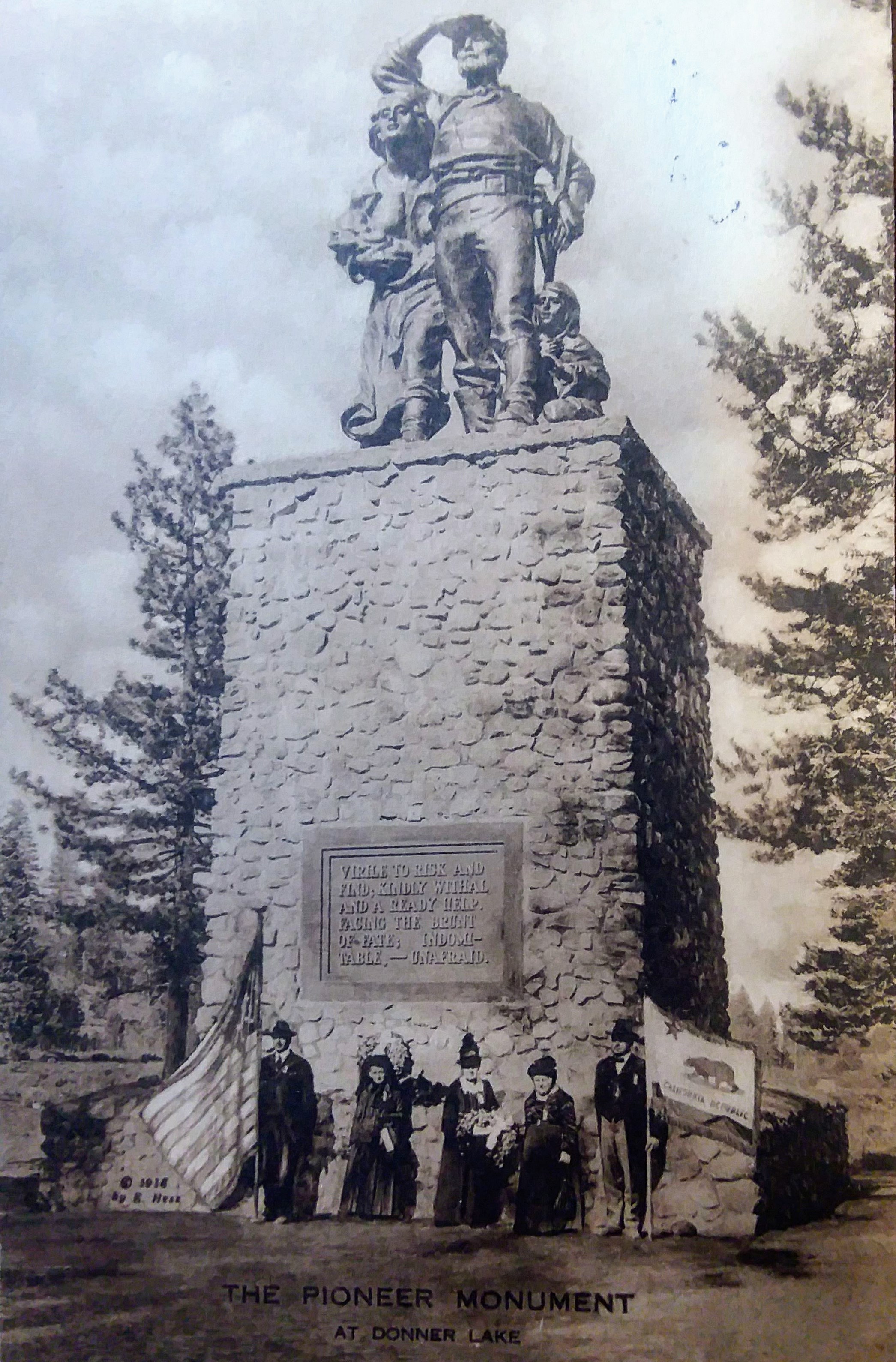
Here we see a familiar landmark, The Pioneer Monument at Donner Memorial State Park. On June 6, 1918, a grand unveiling of the monument took place, complete with two governors and survivors of The Donner Party. The above photograph, from left to right shows Governor Emmett D. Boyle of Nevada, Martha J Patty (Reed) Lewis, Eliza P. Donner-Houghton, Frances E. Donner Wilder, and Governor Wm. D. Stevens of California.
What an amazing photograph! Three of the survivors have returned to the site of their travail, to witness this historic event. Notice the governor of Nevada holds The United States flag, while the Governor of California holds the state flag. The building of the monument is an interesting story in itself, and I hope to have a video up soon concerning its construction.
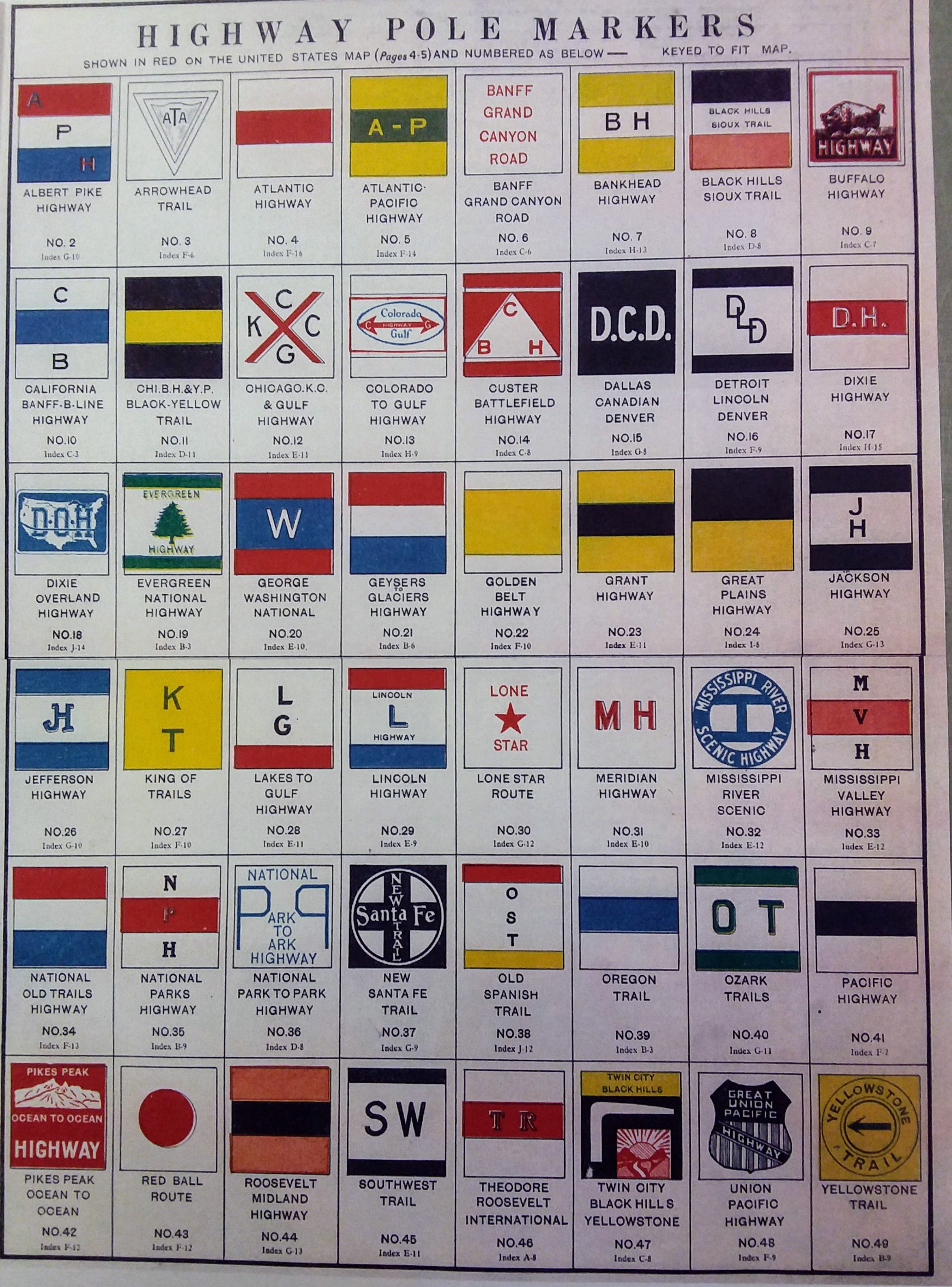
Highway pole signs from Donner Summit Historical Society, Norm Sayler collection
Historic highway pole markers
Before there was Interstate 80, or Highway 50 roads had names like Lincoln Highway or Yellowstone Trail. These pole markers guided motorists or “autoists” as they traveled to their destination. The emblem would be either painted on telephone or telegraph poles or warped around and secured in the case of metal signs. You would find them where a critical turn was needed, or just to let you know you were on the right path.
Victory Highway at Boca, Ca.
Victory Highway at Boca
Here we see a lone automobile headed west, towards Truckee, Ca., while driving on the Victory Highway at Boca. The Victory Highway in this area follows the route of the later Highway 40. This photo would be from after 1921 when the Victory Highway, a monument to WWI soldiers, was organized.
We can see the railroad bridge over the little Truckee River at right, and further to the right what appears to be a flume, likely coming from the old Boca Ice Company. The car is traveling to the spot where Boca Brewing had its operation, by this time long gone. We can also see a Southern Pacific train in the background.
Gold Run on Highway 40. Donner Summit Historical Society, Norm Sayler collection
Gold Run on Highway 40
Monica and I headed upcountry to Donner Summit the other day. Whenever possible, we take the old Lincoln Highway/Highway 40 route. It's slower-paced, and you get to see the small towns along the way. This is the "old-trading" post at Gold Run. I had not seen this photo before, but was familiar with the spot, as it's where the current Gold Run post office is located. This was the old Lincoln Highway before it became Highway 40 in 1928. Gold Run's history goes back to the gold rush era and hydraulic mining, which is how Gold Run made its fortune. When hydraulic gold mining was outlawed in the latter 19th Century, the town dwindled in size and importance.
Gold Run, California today.
Highway 40, Donner Summit area.
Where was this highway photo taken?
These two photos from Jack Duncan seem to show Highway 40 "near Donner Summit," according to the caption. I'm having a hard time locating this particular spot. It looks much like the area between Cisco Grove and Big Bend, but the old road on the right rises much more rapidly at that location. The second photo below seems to show the same area, but check out all the traffic. If you know where this photo location is, please let us know.