Searching for the Emigrant Trail at Alder Creek

One of our great joys is finding the actual routes of the emigrants, the emigrant trails. These are not always easy to find. In the case of The Donner Camp at Alder Creek, there are trail signs, though at times they are spaced quite far apart, or missing as the trail gets closer to Prosser Reservoir. We assumed the Donner Party set up camp along the trail, so it must be close to the Donner Tree, against which they built their winter home. Soon we spotted some small green "Emigrant Trail" markers near the tree. Following these, we realized they were not following the well-worn path from the interpretive trail, but headed through a thicket of trees and up and over a ridge. There was little to indicate the trail went up the ridge, except for the trail markers. Standing at the bottom of the hill the next trail marker was so distant we could hardly see it, but we did see it with effort, so we went that way!

DSC00757.JPG

There is no trail to walk in. We were traipsing through sagebrush in our shorts. We were so excited to see the trail path that we didn't notice our legs being scratched up quite nicely from the sagebrush. In some spots, we could see the outlines of ruts, made by hundreds and thousands of wagon wheels, and in other places no sign, except for the trail markers, which seemed to come in four different guises. The first, and easiest to spot where the small green "emigrant trail" shields. These looked the newest of the markers, and we have seen these same markers at various places along the Truckee Trail. The wooden markers, the ones we could read, seemed to say "Emigrant Trail" with an arrow showing the way, west. Many faded beyond recognition but seeing their outlines we knew we were on the right track.

20180828_131252.jpg

One of the most exciting finds for us was the discovery of the unique "Donner Trail" shields that were painted on trees using white paint. The markers were splitting up as the trees had grown. They seemed the oldest of the markers we saw that day. I would love to know who painted these and the time frame.

20180828_154856.jpg

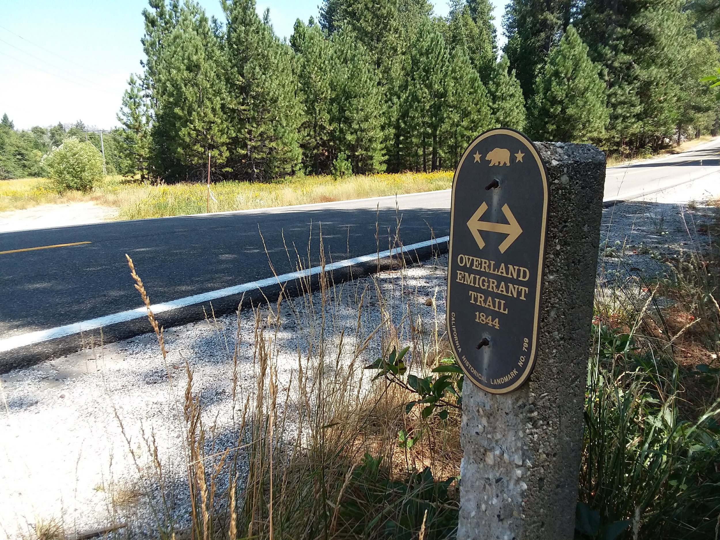
The last marker, which was indispensable in marking a section of the path was the concrete post. It was the final sign that we were on the trail, until Prosser Reservoir, and the now flooded crossing at Alder Creek. It did not have the sign indicating "The Overland Emigrant Trail" like the one pictured in Bear Valley. We have seen a couple of these markers without their interpretive signs in a few places. Unless you knew what they represented, you would never know you're on the trail. We couldn't find any more markers from the concrete post to the reservoir.

20180813_134510.jpg

Donner Camp at Alder Creek is a favorite spot of ours, now that we have discovered it for ourselves. The east side of The Sierra has a unique charm with its sagebrush-covered hills, and this spot is exceptionally beautiful. Anyone interested in The Overland Emigrant Trail, or the story of The Donner/Reed Party should include this place, as well as the nearby Donner Historical Park near Donner Lake in their visit.

Here is a short video of our trip to Donner Camp at Alder Creek, and our attempt to find the old Emigrant Trail.
Searching for the Emigrant Trail, Mt. Olive Road, Nevada County

Monica and I spent Monday at Yuba Gap, in the high country of The Sierra, looking for the old "Overland Emigrant Trail." While we didn't find any "T markers," we did spot a stone obelisk on Laing Road. You wouldn't know what this thing was unless, like us, you had seen them before with their sign attached, as this one in Bear Valley does. I'm not sure whether these signs are being stolen, or fall off, but we have come across more of these markers without their signs than with them.

Concrete marker with sign

Concrete marker with sign

The next day, Tuesday we stayed a bit closer to home and tried to locate the trail in the foothills above Grass Valley. We had read the descriptions of how the path followed Lowell Ridge before dropping down towards Chicago Park area. The name Mount Olive stood out from our research so when we found the road we drove it! Coming down Mt Olive Road, it makes a sharp right-hand turn, and that's when Monica saw the "T marker." We are on the trail!

Monica and T Marker for Mt. Olive

Monica and T Marker for Mt. Olive

Something looked different about this marker. It seemed it faced in an odd direction, east. Hard to read. There was also a large pile of gravel in front of it. We took some pictures and proceeded down Mt. Olive Road looking for more signs of the trail. Once at home we opened up Emigrant Trails West webpage, looked up the Truckee Trail, and the picture of this particular T marker was there! However, a house has been built right on the trail. I have put two pictures up, one from the Trails West webpage, and our photo from Tuesday. This house is entirely new, as it also does not show up on Google Maps.

Photo from Trails West webpage.

Photo from Trails West webpage.

Our day was complete, as we found another section of the trail. What's worrying though is the rapid pace of development going on in the foothills of The Sierra. It's quite a desirable place to live, and we saw many new homes popping up here and there. Our concern, as history buffs, is what will people do with these old places and trails. Some don't even know what they are building on, or in some cases, don't care. How can we preserve these beautiful pieces of history, without denying people their private property rights? As fan's of the trails, it's a bit of a shame to see them paved over and in some cases forgotten.

The same spot as above but now with a house.

The same spot as above but now with a house.

Donner Camp Historic Park

Situated along Highway 89, just north of the town of Truckee, along Alder Creek is the Donner Camp Historic Site., where the Donner Family set up camp during that fateful winter of 1846-47. Monica, and I had visited The Donner Memorial State Park located along the shore of Donner Lake. It recounts the stories of the Murphy, Breen, Reed, and other families that spent that winter huddled in their primitive shelters. What we didn't realize until we started to research the event was The Donner Family had broken an axle on their wagon and had to stop for repairs at Alder Creek when the snow started falling, and they had to make camp there. While there were some visits between the two camps by various members of the party, they mostly had to ride the winter out separated.

20180828_124555.jpg

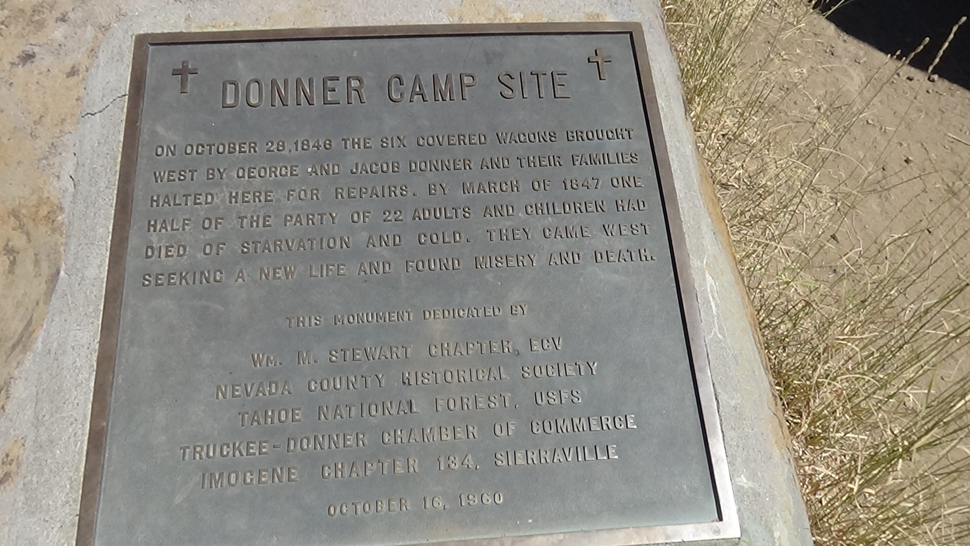
It was a beautiful day in early August when we visited the site. I had watched a documentary on some archaeologist that had recently visited this site and dug around what was called The Donner Tree. This tree, now a dead stump, acted as support for the families attempt to build a structure out of branches, animal hides, and the tree. It was in this crude structure the families rode out the winter. There is a memorial plaque attached to a rock next to the tree.

DSC00759.JPG

We walked the interpretative trail for a bit, but our natural wanderlust pulled us away as we tried to follow the Overland Emigrant Trail that passes through the camp. There are markers and signs from various periods attached to trees guiding one in the direction of the trail. Unlike the marked and well walked interpretative trails, the actual Overland Emigrant Trail is overgrown and in many cases quite hard to find. We did manage to follow the markers to a place above the hill but then lost the trail. However, a little further down, towards Prosser reservoir, we found an old stone obelisk, which we knew from experience held a sign indicating the trail. We feel pretty confident we found the path down to the reservoir, which at the time of was called Prosser Creek.

20180828_131252.jpg

If you're into Mountain Biking, like we are, there is a great single track ride called, The Commemorative Emigrant Trail", which "roughly" follows the original trail from the camp, past Prosser Reservoir, all the way to Stampede Reservoir, a fourteen-mile trip. We rode a portion of it from The Camp to Prosser Reservoir, a smooth ride. Someday next year we plan on riding out further, though 28 miles round trip might be a bit much. The bikes were very helpful in getting us to places inaccessible by car. The sheer beauty of this place in the eastern Sierra makes it well worth visiting, and when you add the historical context it becomes a must visit for anyone interested in early 19th Century California, the Emigrant Trails and the story of the Donner Family. The descendants of the Donner’s planted a commemorative pine tree near The Donner Tree after it died in the 1990's. You will see a memorial marker nearby. Donner Camp Historic site is a place of quiet beauty and respect for the hardships the emigrants faced on their trek westward.

Here is a short, less than five minute video of our exploration of the area.

Verdi, travelling through history

Recently Monica and I visited Verdi, Nevada, looking for the east end of The Lincoln Highway in California. The Lincoln Highway was America's first transcontinental road, running from New York and ending at Lands End, San Francisco. Construction began in 1913 and tied together various roads and pathways into one traversable route. Before that, if you wanted to cross the country, you were on your own.

lincoln4.jpg

Here in California, there were two routes over The Sierra. One traveled from Reno through South Lake Tahoe and down the present Highway 50, while the other passed north of Tahoe through Truckee and down roughly where the present day Highway 80 runs. Eventually, the Lincoln Highway was taken over by more modern numbered highways, and soon many sections of the old road were abandoned.

It’s these old sections of road that appeal to us. Often they pass through places that were once centers of activity, and now are bypassed and forgotten. Verdi Nevada is one such place. It’s where the Lincoln Highway leaves California and enters Nevada at the Von Schmidt Borderline on Dog Valley Road.

Most people driving on Interstate 80 quickly pass through Verdi on the way to Reno, just a few miles away. Those of us interested in California history feel the pull of this old town and its history. A place that was for over 70 years was a center of traveling activity, with The Central Pacific Railroad passing through, as well as The Truckee route of the famous Overland Emigrant Trail, and of course The Lincoln Highway and the later Highway 40. Once Interstate 80 was built by the old town in the 1950's it's fate for the next 70 + years was sealed. The city seems to be growing again, with transplants fleeing the higher living prices in California.

20181022_171205 (1).jpg

We arrived in at Vedi, Nevada in October to find the mountains and landscape awash in color. Having grown hungry, we found a picnic table at Crystal Peak Park right on The Truckee River. Turns out that right across from the table was a Trails West "T" Marker! We were picnicking on the old Truckee Trails famous 27th crossing! Right in front of us 170 years prior the first emigrants traveling across the country passed this way. The Donner-Murphy party, as well as thousands of others, made the last crossing of the river right here. Talk about a history buffs dream picnic table!

20181022_135721.jpg
20181022_140129 (2).jpg

A couple of miles from Crystal Peak Park we found the California Nevada borderline on the old Henness Pass trail. Now known as Dog Valley Road, at one time it was teeming with thousands of travelers headed to a new life in California, or a few years later headed from California into Nevada for the great Silver rush of the Comstock Mines. Now it's a lonely spot missed by most people. Our kind of place!

20181022_154700 (2).jpg


The Von Schmidt borderline is a fascinating place. California and Nevada had been going back and forth about where the actual border between the states was. In 1872 a San Francisco civil engineer named Allexey W. Von Schmidt was retained to find the boundary and mark it with metal obelisks, one-mile apart. The project was never completed as Von Schmidt ran out of funds and the state wouldn't cough up any more. Here is a link to more info concerning The Von Schmidt Borderline. http://bit.ly/2NZmUVi If you read the article link some photos look to be taken not that long ago showing the obelisk behind a chain link fence, having been rammed by a pickup truck. Not sure when it was done, but the new protective barrier and cage are very well done. Someone has taken the time to put this very historic spot back into shape. Now it can remind others just how important this place was.

20181022_154803 (2).jpg

We headed up Dog Valley Road a bit, but it's so bumpy, and our time was running short, that we decided to turn around before the summit and head back down to the borderline. Keep your eyes open as we spotted a Trails West "T" Marker which can be found on our map. Both Monica and I have great fun trying to spot these "T" markers, as they are generally right on the old trails, which often don't run right where the present day road is. Great fun is reading the quotes printed on the signs, generally from a traveler passing this way over 150 years ago.

DSC01084.JPG

Be sure to check out the "center" of the old Verdi. The Verdi Historic Museum is there and bit the first generation, and later incarnations of the Lincoln Highway pass through here. The first person to cross the country by Motorcycle, George Wayman, traveled here in 1906 on his way from San Francisco to New York. They have a sign there commemorating the feat.

20181022_145751 (2).jpg

We will be going back to Verdi one of these days. There is so much to explore there, and we want to drive from Verdi up and over Henness Pass to Truckee on the old road so we can complete our ongoing history map showing the route of The Lincoln from Auburn to Verdi and The Von Schmidt Borderline.