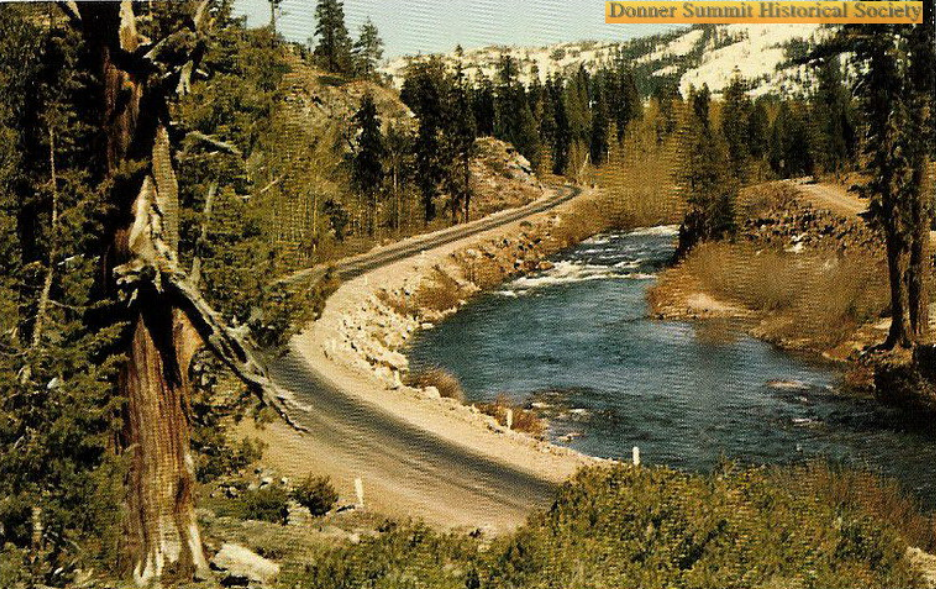
This particular spot along the Yuba River has been recorded over the years as transportation has changed. The river is a natural passage once one has passed the summit, headed west. The earliest course along this route were the native people, followed by the first emigrant train across the Sierra, The Stevens-Townsend- Murphy Party. Soon after, others followed this “Overland Emigrant Trail” to realize their dreams. The photo above, taken at the time the road was the Dutch-Flat Donner Summit Wagon Road (DFDLWR), between 1860 to 1870s.
Photo: Donner Summit Historical Society, Norm Sayler Collection.
The DFDLWR operated from 1861 to 1871, with no tolls collected after 1869. The road was less traveled once the Transcontinental Railroad was completed in 1869, as traveling by the railroad was much faster. Over the next 40 years, the three counties maintained the road, but maintenance was limited, as only local traffic used it.
In 1913 the Lincoln Highway used the old road as part of its transcontinental route, with improvements were made so that automobiles could traverse over the mountains on the old wagon road. The above photo taken by TC Wohlbruck shows the road as the Lincoln Highway, sometime in the 1920s.
In 1927 the Lincoln Highway became Highway 40, which in these parts closely followed the older Lincoln. Soon traffic became unbearable. A new highway was built, which is visible on the northern side of the river, opposite the older Lincoln Highway in the above color photograph. The old DFDLWR and Lincoln Highway were no longer maintained as traffic moved to the more modern thoroughfare.
Donner Summit Historical Society, Norm Sayler Collection.
Eventually, as traffic grew Highway 40, it was plagued by crowded roads, such as we see in the above photograph. In 1956 Interstate 80 was the solution! We can see one of the Interstate’s bridges being built in the photograph with the right side of the bridge passing over the older Lincoln Highway.
Map of the location.


