The 1913 route of Lincoln Highway from the Second Summit outside Verdi to Truckee is likely some of the least visited sections of the old road. This route was active with transcontinental drivers until 1926 when the Truckee River's new route was completed. That Truckee River route is the path that Highway 40 took, and Interstate 80 follows today. The Dog Valley route soon lost most of it’s its traffic and became what it is today, a back road, little traveled, filled with history.
The above map shows the general location, from Verdi, NV., to Truckee. The yellow symbols are Trails West “T” markers placed on the old emigrant route. The markers are placed on or directly next to the original trail. In between the signs, the route is often undetectable, and that is why my lines from one marker to the next are often straight. We don’t know the actual route, yet.
Before reaching the Stampede Reservoir, we come to a famous crossroads mentioned by the emigrants and still existing today. Henness Pass Road, which we had been traveling on, continues west towards Camptonvile. Our road, the Lincoln Highway and DFDLWR, will become Dog Valley Road. We will use Stampede Reservoir Road to get over the dam and around the lake.
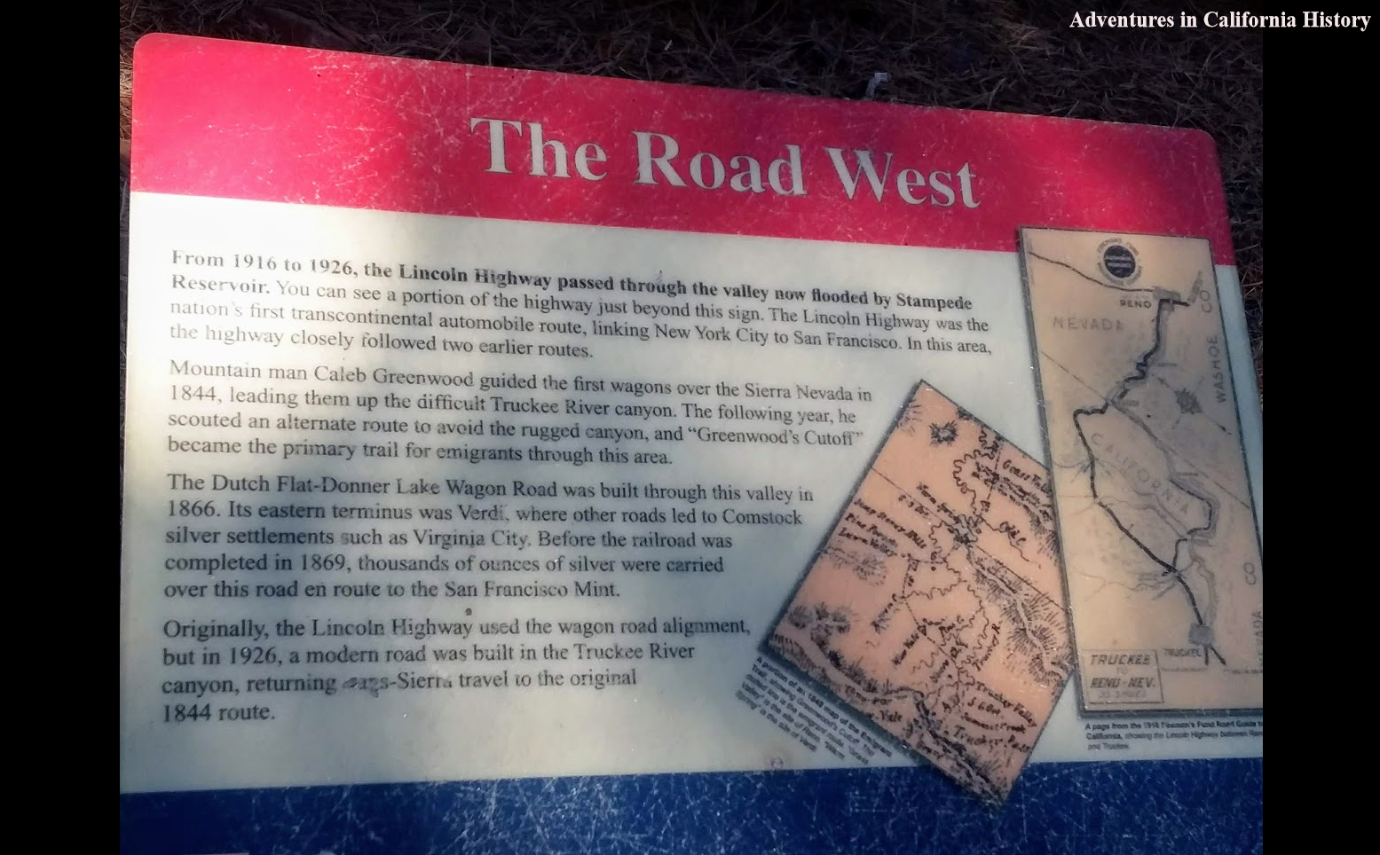
In the lake, we can see the line representing the road going around two small islands that are visible when the lake level drops. The small iron bridge that used to cross the now flooded Little Truckee Rive may still be located under the water. The road then rises out of the reservoir and passes by a parking lot that was, unfortunately, built right over the road. The sign below explains what was lost.
Once we pass Stampede Reservoir, we will have the opportunity to see five different Trails West “T” Markers showing the Emigrant Trail route. Rarely will we miss the opportunity to veer off course to take in the history of these markers. Some of California’s most interesting history is located along this stretch of road. Sometimes we can see the emigrant trail's actual route, and in those cases, we have detailed the route on our map. Wagon ruts and rust stains on rocks are often the best indicators that you're on the trail.
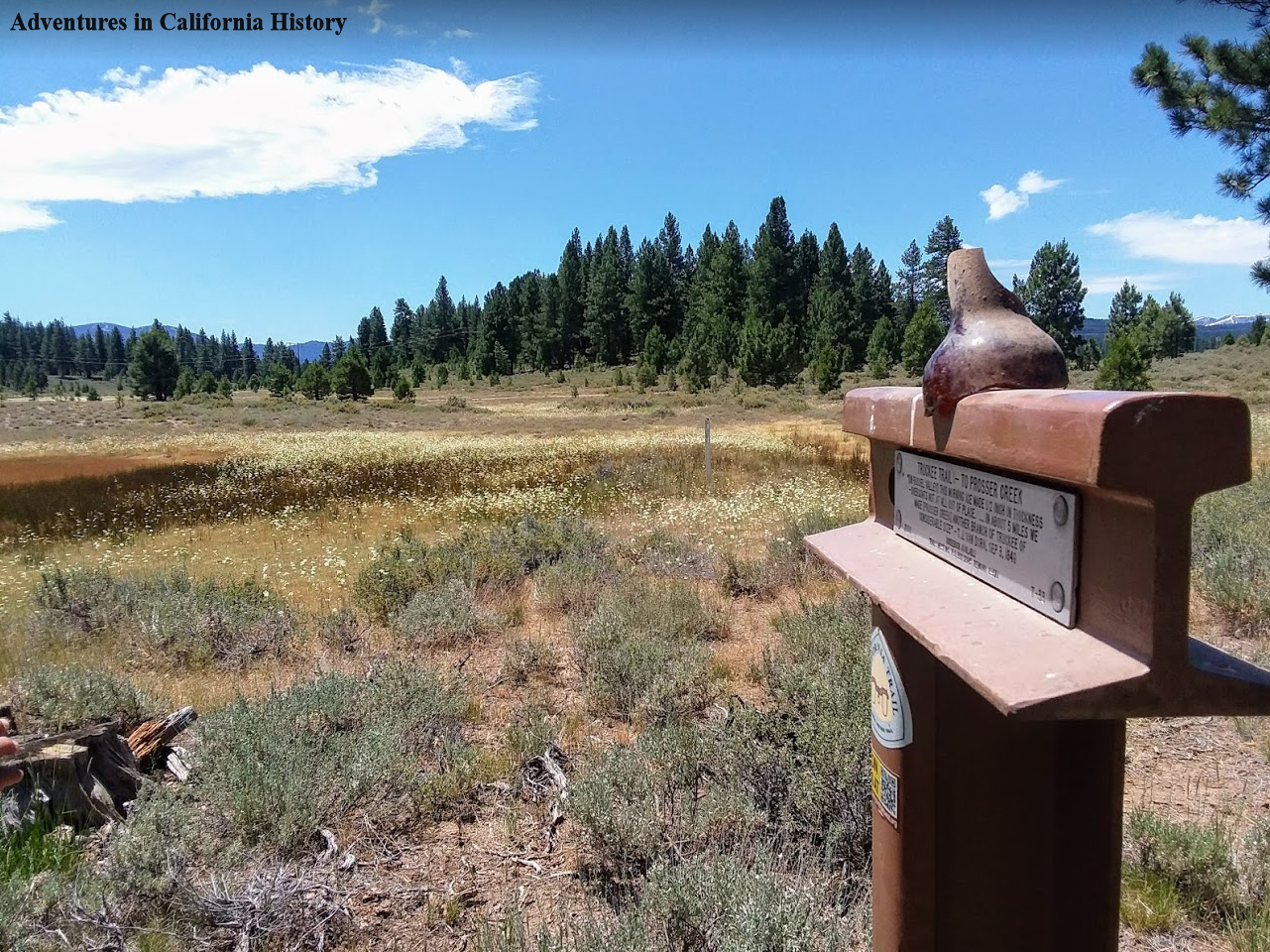
The photo shows Trails West “T” Marker, T-33, “To Prosser Creek”. You can vaguely see the wagon wheel ruts moving off into the distance.
Sign between Stampeded and Prosser Reservoirs. Notice the emigrant trail sign at lower left, pointing the way.
We now arrive at Prosser reservoir where once again we find the old road has been flooded by a reservoir, in this case, built-in 1963. You pass over the dam to get around the lake, and once past the reservoir, our next stop will be Truckee.
There is a great side trip to the Donner Party Campsite, where that family and others overwintered while the rest of the wagon train was caught at Donner Lake, then known as Truckee Lake. Monica and I visited that a year or so ago and put together this short video.
The area from Summit One on Henness Pass Road to Prosser Reservoir is one that we will visit again. We would love to make the drive on Henness Pass Road from the crossroads we described to Comptonville, which is quite a distance filled with all sorts of history. There are also a couple of T Markers and old building sites we need to explore. It’s beautiful out there, and with the added history, it is an area that could fill a lifetime of exploration.
Our next adventure, Part 5 on the Lincoln Highway’s northern route, will be in Truckee, a very historic town.


