

Monica and I took a trip to Verdi, Nevada on Wednesday, hoping to catch some fall color and experience some history. Verdi is on the old emigrant route as well as the transcontinental highway. We wanted to walk a section just outside of town that features three bridges or bridge sites, two railroad lines, the Truckee River, and of course, the Lincoln Highway.
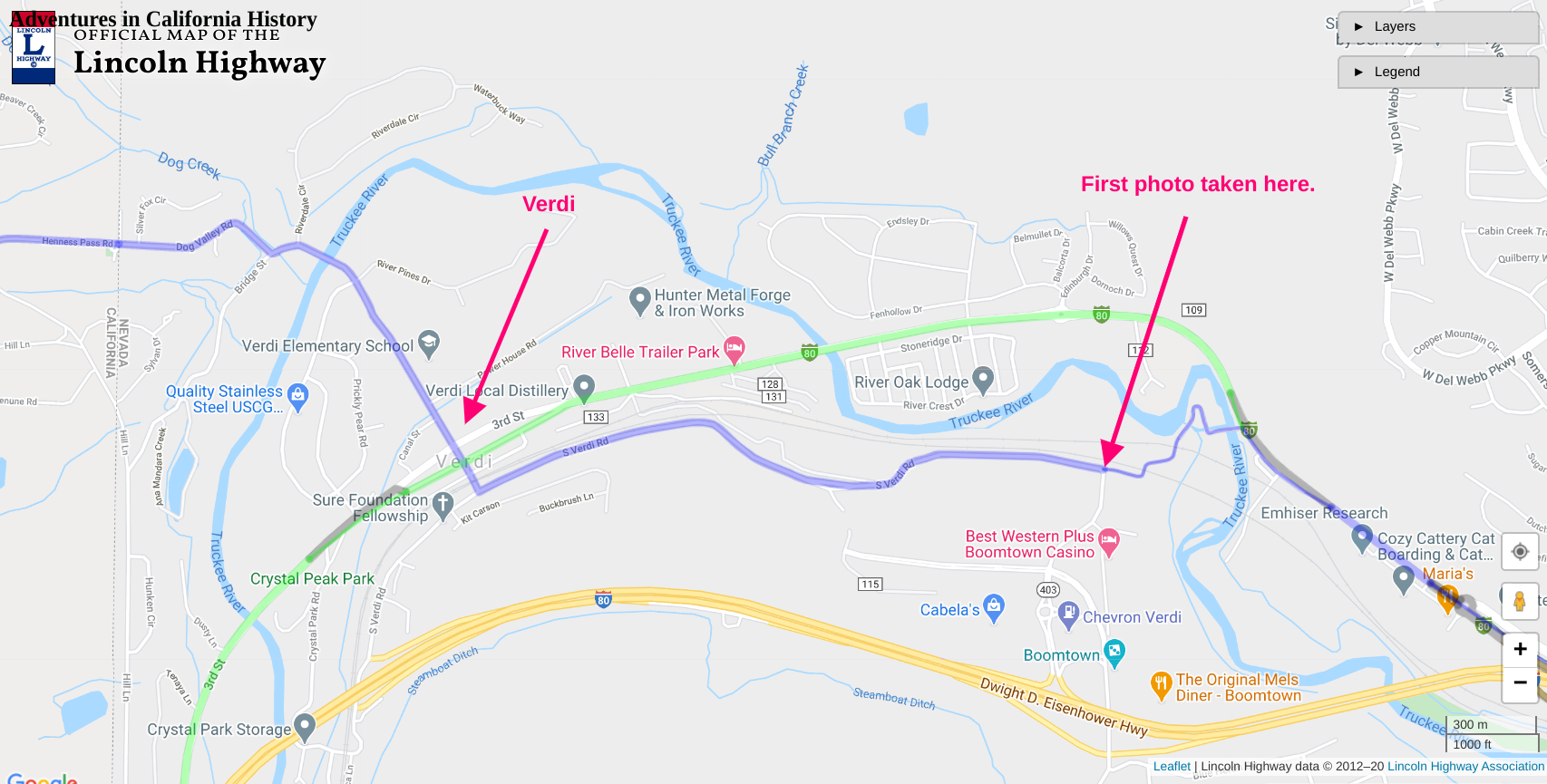
Map of Verdi showing the 1913 Lincoln Highway in blue and the second, 1925 Lincoln, in green.

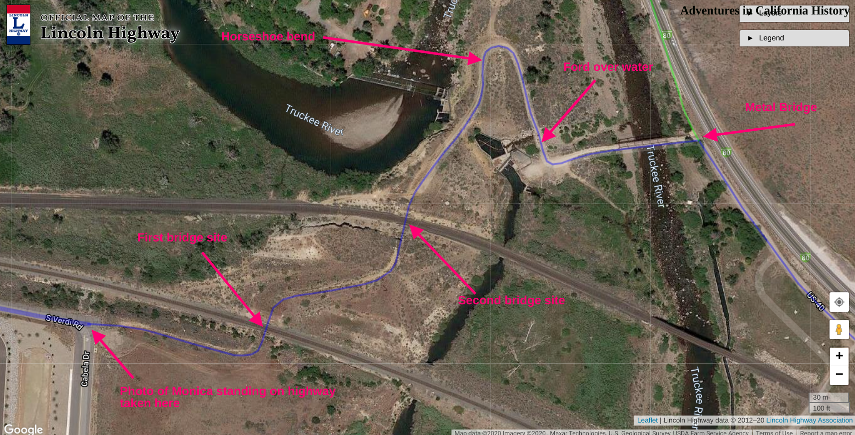
View of the first bridge site crossing the railroad. Check out the old wooden railings.
In the photo above, we can see the Lincoln Highway at the right turning left towards the first wooden bridge site that spanned the first set of railroad tracks. The photo below shows the site of the second bridge over the second set of railroad tracks. We are looking north from the roadbed. You can see the railroad tracks at the bottom. Both of these rail lines are live with trains running on them. Be alert!

Second bridge site along the Lincoln Highway, Verdi, Nevada.

Irrigation canal spillway with the Lincoln Highway.
Once the yesteryear driver crossed the second wooden bridge, they would follow the road around a horseshoe bend and ford an irrigation canal spillway, as seen in the photo above. Was this canal here before of after the Lincoln Highway? We don’t know and will have to do a bit of research to find out. Once the water was crossed, a quick left turn is made, and we head for a metal Lincoln Highway era bridge crossing the Truckee River.

Once we cross the metal bridge, the old road continues for another couple hundred yards and then merges with the second generation 1925 Lincoln Highway. While most of this walk is easy enough, there is a bit of scrambling through bushes and up some banks between the first bridge site and the second bridge site.
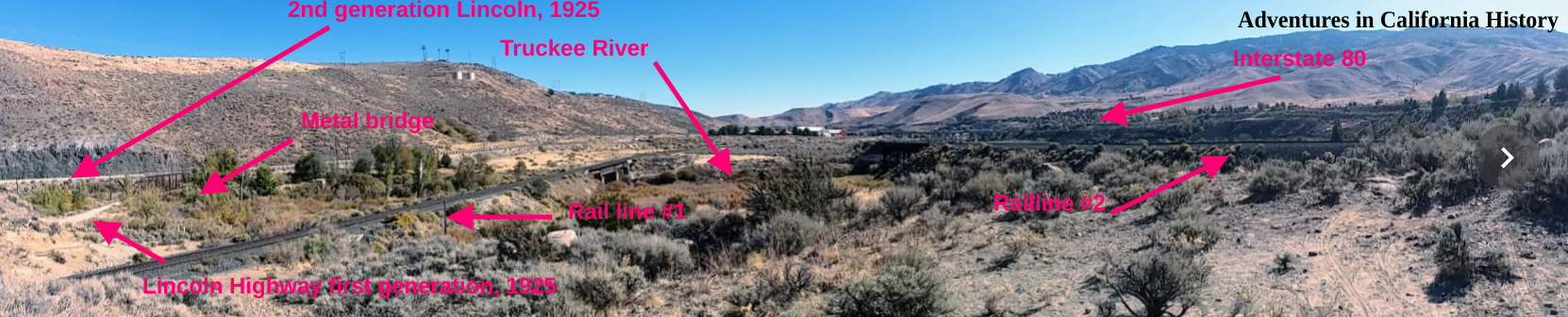
Below is a panorama showing just how many different modes of travel Verdi has seen come its way. We are looking east while standing on the Lincoln Highway. Be sure to click the photo for a larger view.
Click the photo for a larger view!
Below is a map showing the area and the various features we have discussed.
I searched for an image of the wooden bridges across the railroad tracks and came up with very little. However, there is a YouTube video of one of the wooden bridges, which we are told burned down on July 24, 2010, at 6:30 pm, having been struck by lightning. What a shame. Below is a portion of the video showing the old bridge. Heads up, there is music at the beginning if this video which might catch you by surprise. The bridge is 20 seconds into the video, while the music stops at 40 seconds. What a shame we missed seeing these old bridges.